Mascoma River facts for kids
Quick facts for kids Mascoma River |
|
|---|---|

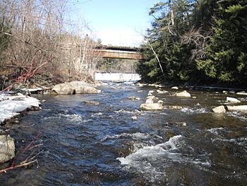
Mascoma River in 2012 at Riverside Park, Lebanon, NH
|
|
| Country | United States |
| State | New Hampshire |
| County | Grafton |
| Towns | Dorchester, Canaan, Enfield, Lebanon |
| Physical characteristics | |
| Main source | Cummins Pond Dorchester 1,525 ft (465 m) 43°46′40″N 72°0′54″W / 43.77778°N 72.01500°W |
| River mouth | Connecticut River Lebanon 330 ft (100 m) 43°38′9″N 72°19′34″W / 43.63583°N 72.32611°W |
| Length | 31.6 mi (50.9 km) |
| Basin features | |
| Tributaries |
|
The Mascoma River is a river in western New Hampshire, United States. It is about 31.6-mile-long (50.9 km). The Mascoma River is a tributary, which means it's a smaller river that flows into a larger one. It joins the Connecticut River, which then flows all the way to Long Island Sound.
The Mascoma River has two main parts. These parts are separated by Mascoma Lake. This lake is located in the towns of Enfield and Lebanon. If you include the lake, the river's total length would be about 2.7 miles (4.3 km) longer.
Contents
Where Does the Mascoma River Start?
The Mascoma River begins at a place called Cummins Pond. This pond is in a very forested area of Dorchester. From there, the river flows south. It passes through the town of Canaan.
Along its journey, the river collects water from several other places. These include Reservoir Pond, Clark Pond, and Canaan Street Lake. It then meets another river called the Indian River.
What Happens Along the River's Path?
After joining the Indian River, the Mascoma River turns west. It gathers more water from streams flowing out of Goose Pond and Crystal Lake. The river then flows through the town of Enfield.
Enfield used to be a busy mill town, using the river's power. Finally, the river reaches Mascoma Lake.
How Does the River End Its Journey?
At the western end of Mascoma Lake, the Mascoma River enters Lebanon. Here, the river drops quickly over rapids. It also passes by several small hydroelectric dams. These dams use the river's moving water to create electricity.
The river continues through the center of Lebanon. It then flows towards West Lebanon. This is where it finally meets the larger Connecticut River.
Fishing and Recreation on the River
Some parts of the Mascoma River are great for fishing. The section right after the Mascoma Lake dam is special. It is only for fly fishing. Other parts of the river are open for all types of fishing.
The New Hampshire Fish and Game Department adds fish to the river. This helps keep the fish population healthy for everyone to enjoy.
How the River Shaped Transportation
For much of its journey, the Mascoma River has been important for travel. The river valley helped decide where roads and railways were built. For example, U.S. Route 4 follows the river's path.
An old state-owned rail line, the Northern Railroad, also ran along the river. Most of this old railway has now been turned into a walking and biking path. It is called the Northern Rail Trail.
Images for kids
 | Madam C. J. Walker |
 | Janet Emerson Bashen |
 | Annie Turnbo Malone |
 | Maggie L. Walker |


