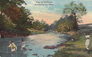
Mill River (Northampton, Massachusetts) facts for kids
The Mill River is a river in Massachusetts. It is about 13.5 miles (21.7 km) long. This river starts in the western hills of Hampshire County. It flows into the Connecticut River. The Mill River and its West Branch drop more than 700 feet (213 meters) in elevation over about 15 miles (24 km). This big drop made it a great place for mills in the past.
Contents
River History
Many mills were built along the Mill River in the early to mid-1800s. They used the river's strong water power. To make sure there was enough water in summer, four reservoirs were built. These were placed in the higher parts of the river's smaller streams.
The Mill River Flood of 1874
In 1865, a group of mill owners decided to build a dam on the Mill River. This dam was north of Williamsburg. One of the owners designed it, but he was not an engineer. Because of this, the dam was not built well. It started leaking as soon as it was filled with water.
On May 16, 1874, the dam broke completely. This was a terrible disaster. It killed 139 people in the towns downstream. The flood destroyed much of the villages of Williamsburg, Skinnerville, and Haydenville. It also destroyed the village of Leeds in Northampton.
The number of deaths could have been even higher. The dam keeper, George Cheney, saw the dam starting to fail. He quickly rode his horse to Williamsburg to warn people. Other riders then took off from Williamsburg. They were able to warn residents in towns further south. Even though it was clear the mill owners were careless, no one was punished in court for this disaster. Today, you can visit the old site of the Williamsburg Reservoir by following a public hiking trail. This flood was reported in newspapers all over the United States at the time.
The Great Flood of 1936
Between March 9 and March 22, 1936, two huge storms hit the eastern United States. They brought very heavy rainfall. Towns and cities from Virginia to Maine experienced widespread flooding. A study done later estimated that 150 to 200 people died because of these floods. The report also said that the damage cost hundreds of thousands of dollars. The 1936 flood, along with another big flood in 1938, led to a major decision. It was decided to change the path of the Mill River away from downtown Northampton.
What Caused the Flood?
The amount of rain from these storms was one of the highest ever recorded. In New England, the ground was still covered with snow from winter. The warmer weather and heavy rain melted this snow. This greatly increased the amount of floodwater.
Along the Connecticut River, communities were hit by two waves of floodwater. The first happened when the Vernon Dam in Vermont broke. This sent a huge wall of water downstream. It caused people in Sunderland, Massachusetts to leave their homes. A second wave happened when large chunks of ice in the river started to break apart. In Northampton, the flooding from the Mill River got worse because the Connecticut River also flooded. The Connecticut River's waters reportedly backed up all the way to the dam at Paradise Pond near Smith College.
How It Affected Local Areas
On March 19, 1936, the Daily Hampshire Gazette newspaper reported on the flood. It said that Northampton and nearby areas faced a second serious flood within a week. Heavy rains were making the Connecticut River and its smaller rivers rise quickly. The Mill River was rising a foot every hour. The Connecticut River flooded large parts of the city and nearby towns.
Later that evening, the Mill River broke past Old South Street. It flooded the area around Maple Street. State police ordered hundreds of families to leave their homes. On Pleasant Street, floodwaters reached as far as the Plaza Theater. This was only two blocks south of Main Street.
The flooding caused many problems. Highways were closed. Train and bus services stopped. The sewer system was affected, along with gas and electric services. The Gazette newspaper, which reported a lot on the disaster, had to move. They set up temporary offices at the nearby Holyoke Transcript. They printed several editions using the Transcript's machines.
Problems with public services and transportation made people worry. They were concerned about diseases from the water and other health issues. There were also worries about food shortages. The Commissioner of Public Safety, Paul G. Kirk, got ready for possible food shortages. Mayor Charles L. Dunn warned that anyone trying to unfairly raise food prices would be punished. On March 21, the Gazette reported that food was being brought by boat through flooded areas.
After people left their homes, protecting empty houses became a problem. To help, Mayor Dunn asked 50 citizens to become special officers. They were to protect homes in the Maple and Pleasant Street areas. This group was given 20 boats to help them. Only residents and people with official reasons were allowed in the flooded areas.
 | DeHart Hubbard |
 | Wilma Rudolph |
 | Jesse Owens |
 | Jackie Joyner-Kersee |
 | Major Taylor |


