
Colebrook, New Hampshire facts for kids
Quick facts for kids
Colebrook, New Hampshire
|
||
|---|---|---|
|
Town
|
||

Main Street
|
||
|
||

Location in Coös County, New Hampshire
|
||
| Country | United States | |
| State | New Hampshire | |
| County | Coös | |
| Incorporated | 1796 | |
| Villages |
|
|
| Area | ||
| • Total | 40.72 sq mi (105.46 km2) | |
| • Land | 40.51 sq mi (104.92 km2) | |
| • Water | 0.21 sq mi (0.54 km2) 0.51% | |
| Elevation | 1,024 ft (312 m) | |
| Population
(2020)
|
||
| • Total | 2,084 | |
| • Density | 52/sq mi (19.9/km2) | |
| Time zone | UTC-5 (Eastern) | |
| • Summer (DST) | UTC-4 (Eastern) | |
| ZIP code |
03576
|
|
| Area code(s) | 603 | |
| FIPS code | 33-13780 | |
| GNIS feature ID | 0871097 | |

Colebrook is a small town in New Hampshire, located in Coös County. It's part of the "Great North Woods Region." The town is next to the Connecticut River on its western side. It's also home to the beautiful Beaver Brook Falls Natural Area.
In 2020, about 2,084 people lived in Colebrook. This was a bit less than the 2,301 people who lived there in 2010. The main part of town, called the Colebrook census-designated place (CDP), had 1,201 residents in 2020. This area is where U.S. Route 3 and New Hampshire Route 26 meet. Other small areas within the town include Kidderville, Upper Kidderville, and Factory Village. Colebrook is also part of the larger Berlin, New Hampshire micropolitan area.

Contents
History of Colebrook
How Colebrook Got Its Name
Colebrook was first given land in 1762 by New Hampshire's Governor, Benning Wentworth. It was first called Dryden, named after an English poet, John Dryden. But the first people who got the land couldn't settle there because it was so far away.
So, in 1770, another Governor, John Wentworth, gave the land again. He renamed it Colebrook Town. This new name honored Sir George Colebrooke, who was a leader of the East India Company. A family named Rosebrook settled there that same year. However, they had to leave because of the American Revolutionary War. More people didn't settle until after the war ended.
Early Days and Growth
By 1790, only 29 people lived in Colebrook. The town officially became "Colebrook" on June 11, 1796. For many years, it was an important legal center for the northern part of Coos County. Today, it still has a branch of the Lancaster Superior Court.
The first main road through town was called River Road. This road is very similar to what is now U.S. Route 3. Early settlers built homes along this road and then on new roads like Titus Hill Road and Pleasant Street. Pleasant Street led to areas like East Colebrook and Kidderville. Another area, "Factory Village," grew around a woolen mill built in 1816.
Around 1800, the first sawmill and gristmill were built. These mills helped process wood and grain. In 1822, a new brick woolen mill in Factory Village made a lot of wool products, like blankets.
Farming and Industry
Colebrook was known for its excellent farming soil. Farmers would load sleds in winter with crops like potash, wheat, and even potato whiskey. They would take these to Portland, Maine, to trade for things they needed.
Colebrook became famous for potatoes. In 1874, it was called the "Potato Capital of New Hampshire." It produced over 120,000 bushels of potatoes each year! Most of these were turned into potato starch at local mills. Some were even used to make "potato whiskey." This industry was very big, with Colebrook producing a large amount of the state's potato starch. However, the potato starch business started to slow down after 1880. Farmers then began to focus more on dairy farming.
The area also had many forests, which made Colebrook a center for lumbering. The first sawmill opened in 1800. Between 1868 and 1915, there were huge "log drives" where logs were floated down rivers. Other businesses like blacksmiths, shoemakers, and tanneries also grew in the 1800s. But when the railroad arrived in 1887, it became easier to get goods from larger suppliers.
Tourism and Hotels
Tourism has been important to Colebrook for a long time. As early as 1804, an inn was built. In the mid-1800s, three large hotels were built. The Colebrook House, which started as a private home, became an inn in the 1840s and is still open today. The Parsons House (built 1862) and the Monadnock House (built 1860s) were also popular. The Parsons House burned down in 1890, and the Monadnock House burned in 1895. A new Monadnock House was built with 70 guest rooms.
A very grand hotel called the Metallak was planned for Colebrook during the "Gilded Age." It was designed to attract tourists who wanted to escape city life. Construction started, but a big windstorm in 1893 destroyed it before it was finished. The plans for this hotel are still saved today.
The famous The Balsams Grand Resort Hotel was built nearby in Dixville Notch in 1874. Its golf course is actually on land in Colebrook. Another hotel, the Hampshire Inn, was popular in the late 1800s and early 1900s.
Geography of Colebrook
Colebrook is a central town in northern Coos County. It's the biggest town by population north of Lancaster, which is the county seat. Roads from Maine, Vermont, and Quebec all meet in the middle of Colebrook.
The town is located along U.S. Route 3. New Hampshire Route 26 also goes through Colebrook, crossing from east to west. New Hampshire Route 145 starts in Colebrook and goes north towards Pittsburg and Canada.
Colebrook covers about 40.9 square miles. Most of this (40.7 square miles) is land, and a small part (0.2 square miles) is water. The highest point in Colebrook is Van Dyck Mountain, which is about 2,760 feet above sea level. To the west, you can see Monadnock Mountain in Lemington, Vermont, which is about 3,148 feet high. Beaver Brook and the Mohawk River flow through Colebrook and into the Connecticut River. Most of the town's water flows into the Connecticut River system.
Climate in Colebrook
| Climate data for Colebrook, NH | |||||||||||||
|---|---|---|---|---|---|---|---|---|---|---|---|---|---|
| Month | Jan | Feb | Mar | Apr | May | Jun | Jul | Aug | Sep | Oct | Nov | Dec | Year |
| Record high °F (°C) | 61 (16) |
63 (17) |
79 (26) |
86 (30) |
90 (32) |
93 (34) |
94 (34) |
95 (35) |
94 (34) |
81 (27) |
71 (22) |
65 (18) |
95 (35) |
| Mean daily maximum °F (°C) | 23.8 (−4.6) |
26.9 (−2.8) |
37.1 (2.8) |
50.0 (10.0) |
64.5 (18.1) |
72.7 (22.6) |
77.3 (25.2) |
74.8 (23.8) |
66.1 (18.9) |
54.2 (12.3) |
40.9 (4.9) |
28.6 (−1.9) |
51.4 (10.8) |
| Mean daily minimum °F (°C) | 0.2 (−17.7) |
1.2 (−17.1) |
14.7 (−9.6) |
28.3 (−2.1) |
39.5 (4.2) |
49.3 (9.6) |
53.7 (12.1) |
51.7 (10.9) |
44.1 (6.7) |
32.5 (0.3) |
23.2 (−4.9) |
8.9 (−12.8) |
28.9 (−1.7) |
| Record low °F (°C) | −40 (−40) |
−42 (−41) |
−29 (−34) |
−8 (−22) |
17 (−8) |
27 (−3) |
31 (−1) |
29 (−2) |
18 (−8) |
7 (−14) |
−13 (−25) |
−38 (−39) |
−42 (−41) |
| Average precipitation inches (mm) | 2.85 (72) |
1.96 (50) |
2.64 (67) |
2.63 (67) |
3.84 (98) |
4.13 (105) |
4.15 (105) |
4.45 (113) |
3.72 (94) |
3.40 (86) |
3.42 (87) |
2.80 (71) |
39.99 (1,015) |
| Average snowfall inches (cm) | 21.2 (54) |
17.8 (45) |
13.8 (35) |
4.9 (12) |
trace | 0 (0) |
0 (0) |
0 (0) |
trace | 0.6 (1.5) |
8.7 (22) |
23.1 (59) |
90.1 (229) |
| Source: NOAA | |||||||||||||
People of Colebrook
Population Changes Over Time
| Historical population | |||
|---|---|---|---|
| Census | Pop. | %± | |
| 1790 | 29 | — | |
| 1800 | 160 | 451.7% | |
| 1810 | 325 | 103.1% | |
| 1820 | 469 | 44.3% | |
| 1830 | 542 | 15.6% | |
| 1840 | 743 | 37.1% | |
| 1850 | 908 | 22.2% | |
| 1860 | 1,118 | 23.1% | |
| 1870 | 1,372 | 22.7% | |
| 1880 | 1,580 | 15.2% | |
| 1890 | 1,736 | 9.9% | |
| 1900 | 1,876 | 8.1% | |
| 1910 | 1,905 | 1.5% | |
| 1920 | 1,811 | −4.9% | |
| 1930 | 1,937 | 7.0% | |
| 1940 | 2,096 | 8.2% | |
| 1950 | 2,116 | 1.0% | |
| 1960 | 2,389 | 12.9% | |
| 1970 | 2,094 | −12.3% | |
| 1980 | 2,459 | 17.4% | |
| 1990 | 2,444 | −0.6% | |
| 2000 | 2,321 | −5.0% | |
| 2010 | 2,301 | −0.9% | |
| 2020 | 2,084 | −9.4% | |
| U.S. Decennial Census | |||
The first census in 1790 showed only 29 people living in Colebrook. The population grew steadily over the years, reaching its highest point in 1980 with 2,459 residents. By 2020, the population was 2,084.
Who Lives in Colebrook?

According to the 2010 census, there were 2,301 people living in Colebrook. Most residents (97.4%) were white. A small number of people were from other racial backgrounds. About 1.2% of the population identified as Hispanic or Latino.
There were 1,073 households in the town. About 24.3% of these households had children under 18. Many households (43.9%) were married couples living together. The average household had 2.14 people.
Looking at age groups, 19.5% of the people were under 18. About 19.6% were 65 years old or older. The average age in Colebrook was 45.8 years.
For the years 2011–2015, the average yearly income for a household was about $45,375. For families, it was about $54,063. The average income per person in the town was $25,383. About 17.3% of the population lived below the poverty line.
Notable People from Colebrook
- Irving W. Drew (1845–1922), a US senator
- Chester B. Jordan (1839–1914), the 48th governor of New Hampshire
- Horace White (1834–1916), a co-owner and editor of the Chicago Tribune newspaper
Places to Visit in Colebrook
- Beaver Brook Falls Wayside
- Colebrook Area Historical Society & Museum, located in the Town Hall building
- Poore Family Homestead Farm Museum
Images for kids
-
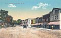
Main Street around 1915
-
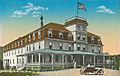
Monadnock House around 1915
-
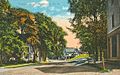
Parsons Street around 1915
-
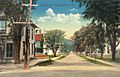
Bridge Street around 1915


See also
 In Spanish: Colebrook (Nuevo Hampshire) para niños
