Lemington, Vermont facts for kids
Quick facts for kids
Lemington, Vermont
|
|
|---|---|
|
Town
|
|
 |
|

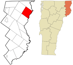
Location in Essex County and the state of Vermont.
|
|

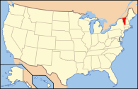
Location of Vermont in the United States
|
|
| Country | United States |
| State | Vermont |
| County | Essex |
| Chartered | 1762 |
| Settled | 1789 |
| Organized | 1796 |
| Area | |
| • Total | 35.5 sq mi (92.0 km2) |
| • Land | 35.4 sq mi (91.6 km2) |
| • Water | 0.2 sq mi (0.4 km2) |
| Elevation | 2,070 ft (631 m) |
| Population
(2020)
|
|
| • Total | 87 |
| • Density | 2/sq mi (0.9/km2) |
| Time zone | UTC-5 (EST) |
| • Summer (DST) | UTC-4 (EDT) |
| ZIP Codes |
05903 (Lemington)
05905 (Guildhall) |
| Area code(s) | 802 |
| FIPS code | 50-39700 |
| GNIS feature ID | 1462133 |
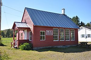
Lemington is a small town located in Essex County, Vermont, in the United States. It's a quiet place, and in 2020, only 87 people lived there. It's considered part of the larger area around Berlin, New Hampshire.
Geography of Lemington
Lemington is in the northeastern part of Essex County. It sits right along the Connecticut River, which forms the border between Vermont and New Hampshire.
The town shares its borders with several other towns in Vermont. To the southwest, it's next to Bloomfield. At its westernmost point, it touches Lewis. To the northwest, you'll find Averill, and to the northeast is Canaan.
Across the Connecticut River, in New Hampshire, are the towns of Colebrook and Columbia, New Hampshire. A road called Vermont Route 102 runs along the eastern edge of Lemington, following the river. There's also a special covered bridge, the Columbia Bridge, that connects Lemington with Columbia, New Hampshire.
Lemington covers about 92 square kilometers (about 35.5 square miles). Most of this area is land, with a small part being water, like rivers. The highest point in town is Monadnock Mountain, which is about 960 meters (3,148 feet) tall. It offers great views of the Connecticut River.
Population and People
The number of people living in Lemington has changed over many years. Here's how the population has grown and shrunk since 1790:
| Historical population | |||
|---|---|---|---|
| Census | Pop. | %± | |
| 1790 | 31 | — | |
| 1800 | 52 | 67.7% | |
| 1810 | 132 | 153.8% | |
| 1820 | 139 | 5.3% | |
| 1830 | 183 | 31.7% | |
| 1840 | 124 | −32.2% | |
| 1850 | 187 | 50.8% | |
| 1860 | 207 | 10.7% | |
| 1870 | 191 | −7.7% | |
| 1880 | 222 | 16.2% | |
| 1890 | 227 | 2.3% | |
| 1900 | 204 | −10.1% | |
| 1910 | 138 | −32.4% | |
| 1920 | 145 | 5.1% | |
| 1930 | 133 | −8.3% | |
| 1940 | 131 | −1.5% | |
| 1950 | 105 | −19.8% | |
| 1960 | 112 | 6.7% | |
| 1970 | 120 | 7.1% | |
| 1980 | 108 | −10.0% | |
| 1990 | 102 | −5.6% | |
| 2000 | 107 | 4.9% | |
| 2010 | 104 | −2.8% | |
| 2020 | 87 | −16.3% | |
| U.S. Decennial Census | |||
In 2000, there were 107 people living in Lemington. Most of the people living there were White. About 22% of the households had children under 18. Many families were married couples living together.
The median age in Lemington in 2000 was 52 years old. This means half the people were younger than 52, and half were older. About 27% of the population was 65 or older.
Famous People from Lemington
- Edward Dow (1820–1894) was an architect who was born in Lemington. An architect is someone who designs buildings.
See also
 In Spanish: Lemington (Vermont) para niños
 | Laphonza Butler |
 | Daisy Bates |
 | Elizabeth Piper Ensley |

