Williams River (Vermont) facts for kids
The Williams River is a river in the state of Vermont, U.S.. It flows for about 27.0-mile (43.5 km) (around 43 kilometers) and eventually joins the larger Connecticut River. The area of land that drains water into the Williams River, called its watershed, covers 117 square miles (about 303 square kilometers). Most of this land (around 80%) is covered by forests, and about 4% is used for farming. The upper parts of the river are home to wild brook trout and brown trout.
Contents
Why is it Called the Williams River?
The Williams River was named after a minister named John Williams from Deerfield, Massachusetts. He is known for giving the first Christian sermon in what would later become Vermont. This happened near where the river meets the Connecticut River on March 5, 1704.
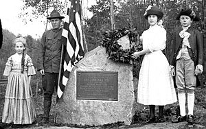
At that time, John Williams and some people from his community were being taken as captives by the French, Mohawk, and Abenaki people. This happened after an event called the Raid on Deerfield. They were being marched from Deerfield, Massachusetts, all the way to Quebec, Canada. A special historical marker was placed near the sermon site in 1912 to remember this event.
Where Does the River Flow?
The Williams River starts in the northern part of a town called Andover. From there, it flows east, passing through a small part of Ludlow before reaching Chester. In Chester, the river changes direction and starts flowing southeast.
The river then travels through a narrow valley, often running close to Vermont Route 103. It continues through rolling hills into the town of Rockingham. Finally, it joins the Connecticut River at a place called Herricks Cove.
River Branches and Brooks
The Williams River has many smaller streams, called tributaries, that flow into it. Some of the main tributaries (starting from the upper part of the river and moving downstream) include Wheaton Brook, Lovejoy Brook, and Bear Brook in Andover and Ludlow.
In Chester, the river is joined by the Middle Branch Williams River, which begins in Windham. This Middle Branch also has its own smaller streams, like Lyman Brook, Andover Branch, and South Branch Williams River. In Rockingham, you'll find other named brooks flowing into the Williams River, such as Wright Brook, Stearns Brook, and Divoll Brook.
Did you know? The lower part of Petty Brook (in Bartonsville) used to be the main path of the Williams River! But a big flood in 1869 changed its course.
Bridges and Waterfalls
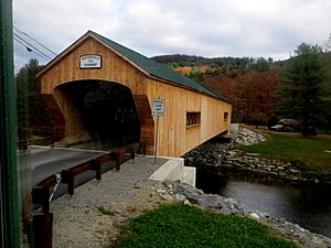
In Rockingham, the Williams River is crossed by two interesting bridges:
- The Bartonsville Covered Bridge was sadly washed away during Hurricane Irene in August 2011. But don't worry, it was rebuilt in 2012 and reopened in January 2013!
- The Worrall Covered Bridge is special because it's the only covered bridge from the 1800s still standing in the town.
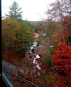
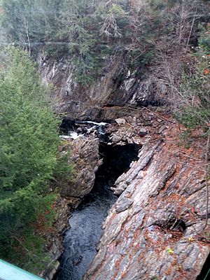
Below these bridges, the river flows over a beautiful spot called Sokoki Falls. This waterfall is named after the local group of the Abenaki people. After the falls, the river continues through a narrow passage known as Brockways Mills Gorge.
Gold in the River?
The Williams River is a popular spot for people who like to search for gold! These "prospectors" can sometimes be seen using pans to look for tiny pieces of placer gold in the riverbed. This happens south of the town of Ludlow, near where a talc mine used to be.
 | Sharif Bey |
 | Hale Woodruff |
 | Richmond Barthé |
 | Purvis Young |


