Park River (Connecticut) facts for kids
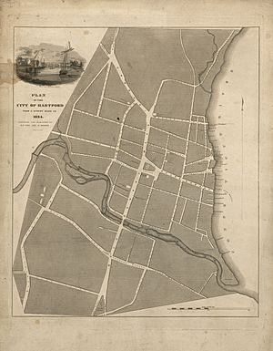
The Park River, also known as the Hog River, is a river that runs through and under the city of Hartford, Connecticut. From the 1940s to the 1980s, the Army Corps of Engineers buried about 2.3 miles of the river. They did this to stop the regular spring floods. These floods were caused by too much surface runoff from the growing city.
Contents
History of the Park River
Long ago, before Europeans arrived, the Suckiaug people lived near the Connecticut and Park rivers. Their name, sucki-auke, meant "black earth," which described the rich soil.
In 1633, Dutch fur traders set up a fort called Fort Goede Hoop. This fort was right where the two rivers met. The Dutch called the Connecticut River the "Great River." They called the Park River the "Little River."
The first English settlers came in 1635. The next year, Reverend Thomas Hooker led his group to start a new town north of the Dutch fort. The first mill in this new town was built on the Little River. Matthew Allyn built it to grind corn. As more factories were built, the Little River became known as the Mill River. This was because so many mills used its water power.
Why the River Was Buried
The lower part of the river often flooded. Big floods in 1936 and 1938 caused a lot of damage. Because of this, the US Army Corps of Engineers started a project in 1940. Their goal was to move the lower part of the river underground.
The first part of the underground tunnel was finished between 1943 and 1949. This section went under Bushnell Park, which is how the river got its current name. More sections were completed after even bigger floods in 1955. These floods happened after two hurricanes, Connie and Diane, hit about a week apart. The entire project was finished in the 1980s. In total, more than 9 miles of the river now flow underground.
North Branch Park River Watershed
A watershed is an area of land where all the water drains into a single river or stream. The North Branch Park River watershed covers about 28.6 square miles. It has a plan from 2010 to help manage its water.
Four main streams flow into the North Branch. These are Beamans Brook, Wash Brook, Filley Brook, and Tumbledown Brook. They come from Bloomfield and parts of West Hartford. These streams meet near the University of Hartford to form the North Branch of the Park River.
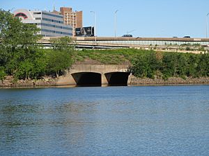
The water then flows through parts of Hartford, like the West End and Blue Hills. It then goes into an underground tunnel north of Farmington Avenue. The North Branch appears above ground again near Pope Park. There, it joins the South Branch before flowing into the Connecticut River through another underground tunnel.
Fish in the North Branch
Many types of fish live in the North Branch watershed. Some are native, meaning they've always been there. Others were brought in by people. Many of these fish are game fish, which means people like to catch them for sport.
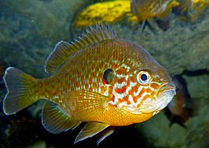
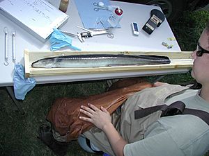
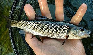
A survey in 2000 found that American Eels, Pumpkinseed fish, and Tessellated darter were the most common. Another survey in 2008 found many Eastern blacknose dace and Longnose dace in the smaller streams. Other fish found here include Largemouth Bass, Fallfish, Common shiner, Common carp, Bluegill, Redbreast sunfish, Rock Bass, White sucker, and Banded killifish.
South Branch Park River Watershed
The South Branch Park River watershed is larger, covering about 39.6 square miles. This part of the river forms where Trout Brook and Piper Brook meet. This meeting point is near New Britain Avenue in the Elmwood area of West Hartford.
The South Branch flows above ground from there to Pope Park. At Pope Park, it joins the North Branch. From there, both branches flow into the Connecticut River through an underground tunnel.
Trout Brook's watershed covers 17.7 square miles. About 66% of West Hartford is within this watershed. Some parts of Trout Brook are not as healthy as they should be.
Piper Brook starts in St. Mary's Cemetery in New Britain. Its watershed is 11.5 square miles, and it also has some unhealthy sections. Bass Brook is another stream in this watershed. It covers 10.4 square miles and starts near Farmington Ave. It flows into Piper Brook near CT Route 9 in New Britain. Other towns in the South Branch watershed include Newington, Farmington, and Wethersfield.
 | Precious Adams |
 | Lauren Anderson |
 | Janet Collins |


