West Hartford, Connecticut facts for kids
Quick facts for kids
West Hartford, Connecticut
|
|||
|---|---|---|---|
| Town of West Hartford | |||
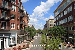
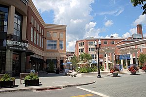
Blue Back Square
|
|||
|
|||
| Nickname(s):
WeHa
|
|||
| Motto(s):
Where City Style Meets Village Charm
|
|||
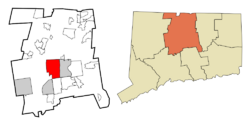 Hartford County and Connecticut Hartford County and Connecticut |
|||
| Country | |||
| U.S. state | |||
| County | Hartford | ||
| Region | Capitol Region | ||
| Settled | 1679 | ||
| Incorporated | May 3, 1854 | ||
| Government | |||
| • Type | Council-manager | ||
| Area | |||
| • Total | 22.3 sq mi (57.7 km2) | ||
| • Land | 21.9 sq mi (56.6 km2) | ||
| • Water | 0.4 sq mi (1.1 km2) | ||
| Elevation | 164 ft (50 m) | ||
| Population
(2020)
|
|||
| • Total | 64,083 | ||
| • Density | 2,876.5/sq mi (1,110.6/km2) | ||
| Time zone | UTC−5 (Eastern) | ||
| • Summer (DST) | UTC−4 (Eastern) | ||
| ZIP Codes |
06107, 06110, 06117, 06119
|
||
| Area code(s) | 860/959 | ||
| FIPS code | 09-82590 | ||
| GNIS feature ID | 0213529 | ||
| Interstates | |||
| U.S. Highways | |||
| State Routes | |||
| Rapid Transit | |||
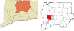
West Hartford is a town in Hartford County, Connecticut, United States. It is about 5 miles (8 km) west of downtown Hartford. The town is part of the Capitol Planning Region. In 2020, about 64,083 people lived there.
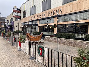
The town has a popular downtown area called "West Hartford Center." People often just call it "The Center." This area is around Farmington Avenue and South/North Main Street. It has been the main shopping area since the late 1600s.
West Hartford became a town in 1854. Before that, it was a part of Hartford, started in 1672. It is home to the University of Hartford and the University of Saint Joseph.
The town hosts fun events that bring in many people. These include the Elizabeth Park Concert Series and the yearly Celebrate West Hartford event. This event has fair rides, food, music, and local businesses.
Contents
History of West Hartford
Archaeological finds show that the Wampanoag people used West Hartford as a winter camp. They fished and hunted along the Connecticut River. This area gave them shelter from cold winds and spring floods.
In 1636, Reverend Thomas Hooker led a group from what is now Cambridge, Massachusetts. They went to the "Great River" and started Hartford, Connecticut. As the colony grew, more land was needed. In 1672, Hartford leaders decided to create a "West Division." This area was between Quaker Lane and Mountain Road. Its northern border was Bloomfield, and the southern was New Britain Avenue. In 1830, the western border was extended to include part of Farmington. The "West Division" was the official name until 1806. Then, the Connecticut General Assembly began calling it "the Society of West Hartford."
Stephen Hosmer is thought to be the first person to settle in West Hartford. In 1679, his father sent him to build a sawmill there. Stephen later moved back to Hartford. But in 1693, his property in West Hartford was listed with a house and sawmill. This property stayed in his family for almost 100 years. You can still see parts of Stephen Hosmer's mill pond and dam today. They are on the western side of North Main Street. This shows where the town's first industry was.
By the time of the American Revolution, the wild land had become farms. A new farming community grew with over 1,000 people and 3,000 sheep. The main building was the parish meeting house. The First Congregational Meeting House was built around 1712. Today, the church is in its fifth building. It stands at the corner of Main Street and Farmington Avenue. This meeting house was important for religious, political, and social life. It helped give the area its name, "The Center."
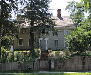
Some wealthy families in the 1790s had workers and slaves. The Sarah Whitman Hooker House is an example of such a home. It still stands on New Britain Avenue. Records show the Hookers owned several slaves. One slave, Bristow, bought his freedom in 1775. He bought it from Thomas Hart Hooker, who was going to fight in the Revolutionary War. Bristow stayed with the family after Hooker died in the war. He became a farming expert. When he died, he left his property to the Hookers' two children. He is the only known African American buried in West Hartford's Old Center Burial Yard. Bristow Middle School in West Hartford is named after him.
Growth of Local Industries
One of the first big industries in West Hartford was pottery and brick making. There is a lot of good clay from Hartford to Berlin. In 1770, Ebenezer Faxon came from Massachusetts. He settled in the Elmwood area of West Hartford. He started a pottery business on South Road (now New Britain Avenue). He used the local clay.
Seth Goodwin helped create a pottery business that lasted a long time. He started his pottery around 1798. For over 100 years, the Goodwin name was known for West Hartford pottery. They made useful items like jugs for local gin. They also made fancy terra cotta designs and fine china. The Goodwin Company employed up to 75 people at its busiest time. The Goodwin Brothers Pottery Company burned down for the third time in 1908 and did not rebuild.
In 1879, Edwin Arnold started the Trout Brook Ice & Feed Company. Ice from Trout Brook, a stream in West Hartford, was cut in winter. It was then stored in ice houses. This ice was used for refrigeration locally. It was also sent to places like New York City.
By the late 1800s, the New York, New Haven & Hartford Railroad ran through Elmwood. Many companies started in this area. These included Whitlock Coil Pipe Company in 1891. Later came Royal Typewriter, Wiremold, Abbot Ball, Colt's Manufacturing, and Uncle Bill's Silver Grippers (which made tweezers). The biggest manufacturer was Pratt & Whitney (now Pratt & Whitney Measurement Systems). In 1940, it built a large factory. During World War II, it had over 7,000 workers. The factory closed in 1991.
Becoming an Independent Town
In 1792, West Hartford residents wanted to become a separate town from Hartford. They asked for permission but were told no. Five years later, they asked again and were denied. In 1854, the Connecticut General Assembly was meeting in New Haven. West Hartford delegates sent a request on March 21. It was signed by 153 residents. They said being connected to Hartford caused "many inconveniences." They felt becoming a separate town would help them.
On April 26, about 100 West Hartford residents argued against separating. After reviewing everything, the General Assembly voted on May 3. West Hartford became an independent town.
However, the debate did not end in 1854. In 1895, wealthy residents from the "East Side" of West Hartford wanted to rejoin Hartford. Other West Hartford residents stopped this idea. Then, in 1923 and 1924, Hartford wanted to take West Hartford back. They called it the "Greater Hartford Plan." Town residents strongly opposed this. The plan was defeated by a vote of 6,137 to 2,100.
The Rise of the Streetcar Suburb
Transportation has greatly changed West Hartford. It went from a quiet area to a modern suburb. In the late 1700s and early 1800s, three turnpikes (toll roads) ran through West Hartford. Along these roads, businesses like taverns, blacksmith shops, and general stores appeared. Early maps show how important these roads were for trade and industry.
Then came the trolleys. In 1845, Fred Brace started a horse-drawn bus service. It ran from his home on Farmington Avenue to downtown Hartford. Even more important were the horse-drawn trolley lines. Later, electric trolleys began running in 1889. They connected Hartford's city center to West Hartford's countryside. Trolley lines made land easier to reach. This allowed professionals and their families to move to areas like Prospect Avenue.
By the 1880s, Hartford's economy was growing fast. Business leaders started building large homes along Prospect Avenue. Prospect Hill became a very fancy address. It was on a ridge with great views of the growing city. Many homes there are on the National Register of Historic Places. This includes the Connecticut Governor's Residence, built in 1908.
Prospect Avenue is next to Elizabeth Park. This park was designed in 1896 by Frederick Law Olmsted. It was named after the wife of Charles M. Pond, who gave the land to Hartford. In 1900, the Hartford Golf Club opened nearby. This made the area even more appealing for suburban living.
In 1895, Wood, Harmon and Company created one of the town's first housing developments. It was called Buena Vista. They advertised its "splendid electric car service" and closeness to Reservoir No. 1.
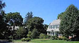
Other developments followed, like "Elmhurst" in Elmwood (1901) and Sunset Farm (1917). One of the most exclusive early developments was West Hill. It was built on land that once belonged to Cornelius Vanderbilt. Horace R. Grant had the idea for West Hill. It was designed by top Hartford architects in the 1920s. West Hill is a great example of a well-planned neighborhood from that time. The homes show Colonial Revival and Tudor Revival styles. It became a National Historic District in 1996.
The Impact of Cars
By the 1920s and 1930s, cars changed West Hartford. The town became easier for middle and working-class people from Hartford to reach. Between 1910 and 1930, West Hartford's population grew from 4,808 to 24,941. After the Great Depression and World War II, many people moved from cities. West Hartford's population jumped from 33,776 in 1940 to 62,382 by 1960. This time saw many new homes and shopping areas built.
In the 1950s, major roads like Albany, Asylum, and Farmington Avenues became important for commuters. This access made West Hartford attractive to middle-class families. During this decade, the town built one new elementary school each year. This was to handle the growing number of students.
In the 1960s, work began on Interstate 84. It was finished in 1969. The highway had a big effect on the community. It cut the town in half. This separated the more industrial Elmwood neighborhood from the rest of West Hartford. The interstate also made the town even more accessible. This led to more growth and changed where people shopped.
Housing continued to be built until the late 1970s. This was especially true in the northern, western, and southwestern parts of town. You can see many large colonial, ranch, and split-level homes there. In 1971, the Bishops Corner shopping area opened. Stores like Lord & Taylor attracted shoppers from all over the region. The Center, with its smaller, local shops, was affected by these new shopping patterns.
Towards the southwest of town is Westfarms Mall. It opened in 1974. It is known for its fancy ceilings and waterfall fountain. The mall is located near I-84 and main roads. It has over 1,300,000 square feet (120,000 m²) of stores and restaurants. It is the third largest indoor mall in Connecticut.
Modern Developments
In 1983, a large robbery happened at a Wells Fargo depot in West Hartford. It was one of the biggest robberies in US history at the time.
Blue Back Square opened in 2007. It is a new type of development in the Center. It combines shops and homes in one large area. The complex has five buildings. It includes 220,000 square feet (20,000 m²) of shops and 120 luxury apartments. There is also office space and a movie theater. Two large parking garages were also built. Blue Back Square is named after Noah Webster's famous spelling book, Blue-Back Speller. This development has greatly changed the Center. It has made West Hartford an even more popular place for dining and shopping.
Geography
West Hartford covers about 22.3 square miles (57.7 km²). About 21.8 square miles (56.6 km²) is land, and 0.4 square miles (1.1 km²) is water.
The west side of West Hartford has the Metacomet Ridge. This is a rocky mountain range that goes from Long Island Sound almost to the Vermont border. Important parts of this ridge in West Hartford include Talcott Mountain. There are also water reservoirs that belong to the Metropolitan District. They manage water and recreation areas there. The Metacomet Trail, which is 51 miles (82 km) long, runs along the ridge. The highest point in town is 778 feet (237 m) above sea level on Talcott Mountain. The Town Hall is at 120 feet (37 m) altitude.
West Hartford is next to and west of Hartford, the state capital. It also borders Bloomfield, Newington, New Britain, Farmington, and Avon. West Hartford is about 100 miles (160 km) southwest of Boston and 120 miles (190 km) northeast of New York City. Interstate 84 goes through West Hartford.
Population and People
| Historical population | |||
|---|---|---|---|
| Census | Pop. | %± | |
| 1850 | 4,411 | — | |
| 1860 | 1,296 | −70.6% | |
| 1870 | 1,533 | 18.3% | |
| 1880 | 1,828 | 19.2% | |
| 1890 | 1,930 | 5.6% | |
| 1900 | 3,186 | 65.1% | |
| 1910 | 4,808 | 50.9% | |
| 1920 | 8,854 | 84.2% | |
| 1930 | 24,941 | 181.7% | |
| 1940 | 33,776 | 35.4% | |
| 1950 | 44,402 | 31.5% | |
| 1960 | 62,382 | 40.5% | |
| 1970 | 68,031 | 9.1% | |
| 1980 | 61,301 | −9.9% | |
| 1990 | 60,110 | −1.9% | |
| 2000 | 63,589 | 5.8% | |
| 2010 | 63,268 | −0.5% | |
| 2020 | 64,083 | 1.3% | |
| U.S. Decennial Census 1850 census is the parish of Hartford. |
|||
In 2010, there were 63,268 people living in West Hartford. There were 25,258 households and 16,139 families. The town had about 2,889 people per square mile (1,115/km²).
Most people in West Hartford are White (79.6%). There are also African American (6.3%), Asian (7.4%), and other races. About 9.8% of the population was Hispanic or Latino.
About half of West Hartford residents (49.85%) reported having a religious belief. Most of these were Roman Catholic (31.74%). Other groups included Presbyterian, Baptist, Methodist, Jewish, and Lutheran.
In 2018, the average household income was $99,280. The average income per person was $54,601. About 6.1% of the population lived below the poverty line.
Economy
Major Employers in West Hartford
Here are the top employers in West Hartford, based on the town's 2023 financial report:
| # | Employer | # of Employees |
|---|---|---|
| 1 | University of Hartford | 2,000–2,999 |
| 2 | Town of West Hartford | 1,100–2,250 |
| 3 | Hartford Healthcare At Home | 500–999 |
| 4 | Hospital at Hebrew Health Care | 500–999 |
| 5 | Triumph Engine Control Systems | 250–499 |
| 6 | Connecticut Veterinary Center | 250–499 |
| 7 | The Cheesecake Factory | 250–499 |
| 8 | Constructive Workshops Inc | 250–499 |
| 9 | Stop & Shop | 200–499 |
| 10 | Hughes Health & Rehabilitation | 100–249 |
Town Services
Transportation
Train Service
West Hartford is a planned stop on the Hartford Line. This is a commuter rail service that runs from New Haven to Springfield. It uses the existing Amtrak train line. There are plans to build a new train station at Flatbush Avenue. However, there is not enough money right now to build the station.
Bus Service
West Hartford has several bus routes run by Connecticut Transit. Buses serve major roads like Albany Avenue, New Britain Avenue, Park Street, and Farmington Avenue.
Bus Rapid Transit
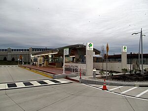
CTfastrak is Connecticut's first bus rapid transit system. It opened in 2015. It has a special lane for buses between Hartford and New Britain. West Hartford has two CTfastrak stations:
- Elmwood: At the corner of New Park Avenue and New Britain Avenue.
- Flatbush Avenue: At the corner of Flatbush Avenue and New Park Avenue.
Emergency Services
Fire Department
The West Hartford fire department has five fire stations. They provide fire protection and emergency medical services. These services include advanced life support.
Utilities
- Electricity: Eversource Energy
- Water: Metropolitan District Commission
- Natural gas: Connecticut Natural Gas
- Telephone, Internet, TV: Frontier Communications
- Cable TV/Internet: Comcast
Education
Public Schools
West Hartford has two public high schools: Conard (the Red Wolves) and Hall (the Hall Titans). There are also 11 elementary schools and three middle schools. The elementary schools are Aiken, Braeburn, Bugbee, Charter Oak, Duffy, Morley, Norfeldt, Smith, Webster Hill, Whiting Lane, and Wolcott. The middle schools are King Philip, Sedgwick, and Bristow Middle School.
Students from Sedgwick Middle School go to Conard High School. Students from King Philip Middle School go to Hall High School. Bristow students return to their original school district for high school.
School Rivalry
In 2020, both Hall and Conard High Schools were ranked among the top 15 schools in Connecticut. They were also in the top 5% nationally by U.S. News. The schools compete closely in academics and especially in sports. The Hall versus Conard sports rivalry started in 1957 with their first football game. This competition and school spirit are still very strong today.
Private Schools
- Saint Thomas the Apostle School
- Saint Timothy Middle School
- Northwest Catholic High School
- St. Brigid-St. Augustine Partnership School
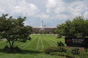
- American School for the Deaf
- Kingswood Oxford School
- Renbrook School
- Hebrew High School of New England
- Solomon Schechter Day School of Greater Hartford
- German School of Connecticut
Colleges and Universities
West Hartford is home to these colleges:
- University of Hartford
- University of Saint Joseph
The University of Connecticut Greater Hartford Campus used to be in West Hartford. It was next to the University of Saint Joseph. But it moved to downtown Hartford in 2017.
Military Presence
The 76th Infantry Division was a unit of the United States Army. It served in World War I, World War II, and the Cold War. In 1946, the 76th Division was brought back as part of the Organized Reserve. Its main office was in West Hartford, Connecticut. Its units were spread across the six New England states. In 1996, the 405th Army Hospital Unit took over the facility on South Quaker Lane.
Media
- The Jewish Ledger: A weekly newspaper.
- West Hartford Life: A monthly newspaper.
- West Hartford News: A weekly newspaper.
- West Hartford Press: A weekly newspaper.
- Radio
- WNWW
- WWUH
- WNPR
- TV
- West Hartford Community Television (WHCTV)
- WVIT
Notable People
Many interesting people have lived in West Hartford:
- Chip Arndt: A gay rights activist and winner of The Amazing Race 4.
- Manute Bol: A famous NBA basketball player.
- Ben Bova: An author who wrote science fiction and non-fiction.
- Tim Brennan: Guitar player and songwriter for Dropkick Murphys.
- Chris Carrabba: Singer–songwriter from Dashboard Confessional.
- Dominick Dunne and John Gregory Dunne: Writers who grew up in West Hartford.
- John Franklin Enders: Won the Nobel Prize for Medicine in 1954.
- Martin Hayes: A six-time All Ireland Fiddle Champion.
- Lemuel Haynes: A clergyman and the first African American to be ordained.
- Katharine Houghton Hepburn: A social activist.
- Grayson Hugh: A singer-songwriter whose songs were in movies like Thelma and Louise.
- Jared Jordan: Drafted by the Los Angeles Clippers in the 2007 NBA Draft.
- Charlie Kaufman: An Academy Award-winning screenwriter for movies like Being John Malkovich.
- Edward Lorenz: A mathematician and meteorologist. He helped create chaos theory and the idea of the "butterfly effect".
- Frank Luntz: A Republican pollster.
- Kenny Mayne: An ESPN personality.
- Joseph Mascolo: An actor known for soap operas.
- Brad Mehldau: A jazz pianist and composer.
- Edward Morley: A scientist known for the Michelson–Morley experiment. Morley Elementary School is named after him.
- John O'Hurley: An actor from Seinfeld and former host of Family Feud.
- Peter Paige: An actor.
- Ryen Russillo: An ESPN personality.
- Michael Schur: The creator of TV shows like Parks and Recreation.
- William Thompson Sedgwick: A professor who was important in shaping U.S. public health.
- Scott Van Pelt: An ESPN personality.
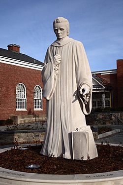
- Noah Webster: A famous writer who created dictionaries and spelling books.
- Korczak Ziolkowski: A sculptor who created the Crazy Horse Memorial in South Dakota.
Places to Visit
- Bishops Corner
- Blue Back Square
- Elizabeth Park
- Elmwood
- Fern Park
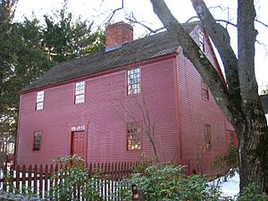
- Noah Webster House
- Park Road
- West Hartford Center
- West Hartford Reservoir
- Westfarms Mall
- Westmoor Park
 |
Avon | Bloomfield |  |
|
| Farmington | Hartford | |||
| New Britain | Newington |
See also
 In Spanish: West Hartford para niños
 | Roy Wilkins |
 | John Lewis |
 | Linda Carol Brown |


