Metacomet Trail facts for kids
Quick facts for kids Metacomet Trail |
|
|---|---|
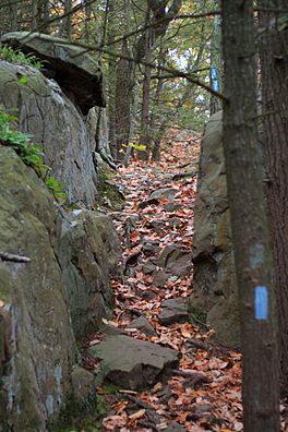
Blue-blazes mark the Metacomet Trail
|
|
| Length | 51 mi (82 km) |
| Location | Hartford County / New Haven County, Connecticut, USA |
| Designation | Part of a National Scenic Trail |
| Use | hiking, snowshoeing, other |
| Highest point | West Peak, 1,024 ft (312 m) |
| Lowest point | Farmington River, 150 ft (46 m) |
| Difficulty | easy, with difficult sections |
| Season | easiest spring to fall |
| Hazards | deer ticks, poison ivy, copperheads (in places) |
The Metacomet Trail is a 62.7-mile long Blue-Blazed hiking trail in central Connecticut. It is known for being rugged and beautiful, even though it's easy to reach from many towns. This trail is part of the new New England National Scenic Trail.
Along the trail, you can find amazing natural and historical spots. These include waterfalls, tall cliffs, forests, swamps, lakes, and farms. You can also visit important historical places and climb to the top of Talcott Mountain and the Hanging Hills. The Connecticut Forest and Park Association helps keep the Metacomet Trail in good shape.
In 2009, the Metacomet Trail became part of a bigger national trail system. President Barack Obama signed a law that made it part of the New England National Scenic Trail. This new national trail also includes the Metacomet, Monadnock, and Mattabesett trails, sometimes called the 3-M or MMM trails.
Contents
Exploring the Metacomet Trail
The Metacomet Trail stretches from the border of Connecticut and Massachusetts south through Hartford and northern New Haven counties. The trail starts near Meriden in the town of Berlin, Connecticut. It ends in Suffield, Connecticut, southwest of Springfield, Massachusetts.
If you keep going north from the Metacomet Trail, you can connect to the 110-mile Metacomet-Monadnock Trail in Massachusetts. From there, the Monadnock-Sunapee Greenway in New Hampshire continues for another 160 miles. To the south, the 50-mile Mattabesett Trail starts where the Metacomet Trail ends in Berlin. It goes south to Totoket Mountain and then northeast to the Connecticut River in Middletown.
Many shorter hiking trails connect with the Metacomet Trail. You'll find these especially around Talcott Mountain, the Hanging Hills, and Ragged Mountain.
Activities on the Trail
The Metacomet Trail is mainly used for hiking and backpacking. People also enjoy picnicking and, in winter, snowshoeing. Some parts of the trail are good for mountain biking and cross-country skiing. Other activities you can do along the trail include hunting, fishing, horseback riding, boating, bouldering, rock climbing, and swimming.
What You'll See on the Trail
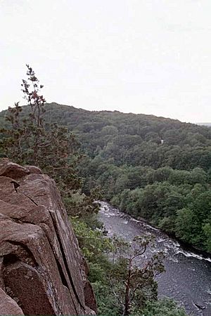
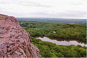
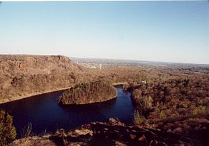
The Metacomet Trail follows the Metacomet Ridge, a line of rocky hills made of "trap rock." This ridge runs from Long Island Sound all the way to the Massachusetts/Vermont border. These hills rise hundreds of feet above the Connecticut River, Farmington River, and Quinnipiac River valleys. They are a major part of central Connecticut's landscape.
As you hike from south to north, the trail goes over several ridges. These include the Hanging Hills, Short Mountain, Ragged Mountain, Bradley Mountain, Pinnacle Rock, Rattlesnake Mountain, Farmington Mountain, Talcott Mountain, Hatchet Hill, Peak Mountain, and West Suffield Mountain. You'll often see steep cliffs with piles of broken rocks called scree at their base. There are many spots with great views. From West Suffield Mountain down to Ragged Mountain, you usually look west. In the Hanging Hills, you can find views in all directions.
The Farmington River cuts through the ridge between Hatchet Hill and Talcott Mountain, forming the Tariffville Gorge.
Towns Along the Trail
The Metacomet Trail goes through these towns: Berlin, Meriden, Southington, New Britain, Plainville, Farmington, West Hartford, Avon, Bloomfield, Simsbury, East Granby, and Suffield, Connecticut.
Nature and Geology of the Trail
The Metacomet Ridge, which the trail follows, was formed about 200 million years ago. It's made of a type of rock called "trap rock," also known as basalt. This rock comes from ancient lava flows. Basalt is dark, but the iron in it turns rusty brown when it touches the air, giving the cliffs a reddish color. Basalt often breaks into cool shapes like octagons and pentagons. You can see huge slopes of broken basalt rocks below many of the cliffs along the trail.
The Metacomet Ridge was created by several huge lava flows, hundreds of feet deep. These happened when North America began to split away from Europe and Africa. Between these lava flows, layers of sediment were deposited, which later turned into sedimentary rock. Over time, these layers of basalt and sedimentary rock tilted upwards. The softer sedimentary layers wore away faster than the hard basalt, leaving the dramatic cliffs and ridges we see today. You can imagine it like a tilted layer cake where some of the frosting has been removed. The sedimentary rock in this area is famous for its fossils, especially dinosaur tracks!
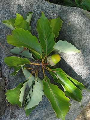
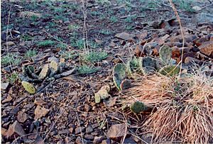
The Metacomet Ridge has unique mini-climates that are rare in New England. On the dry, hot upper ridges, you might find oak savannas with chestnut oak trees and different grasses and ferns. Eastern red cedar trees, which like dry places, grow on the cliff edges. Even prickly pear cactus has been found on the sunny, south-facing slopes of Ragged Mountain!
In cooler, damp areas like narrow ravines, you'll find Eastern hemlock trees. These create shady conditions where plants that prefer cooler climates can grow. The rocky slopes are rich in nutrients and support plants that are unusual for this part of New England. Many ponds and wetlands are found between the trap rock ridges. These areas are important for water storage and provide homes for many plants and animals. Because the Metacomet Ridge has such varied terrain, it is home to several plant and animal species that are rare or endangered in Connecticut.
History and Stories of the Trail
How the Trail Got Its Name
In the late 1800s, people in New England became interested in creating hiking trails. Groups like the Appalachian Mountain Club and the Connecticut Forest and Park Association started building them. Following the success of Vermont's Long Trail in 1918, the Connecticut Forest and Park Association created the 23-mile Quinnipiac Trail in 1928. Soon after, they built the Metacomet Trail. By the end of the 1900s, this group had completed over 700 miles of "blue blaze trails" in Connecticut.
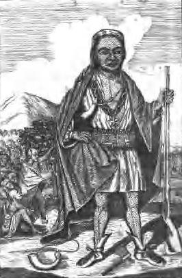
The name "Metacomet" comes from a 17th-century leader of the Wampanoag Tribe in southern New England. He led his people during a conflict known as King Philip's War. People say that Metacomet, who the English colonists called "King Phillip," watched the village of Simsbury burn in 1676 from a cave on Talcott Mountain. This cave is now called King Phillip's Cave and you can reach it from a side trail off the Metacomet Trail.
Historic Places Along the Trail
Old Newgate Prison
Old Newgate Prison, located below Peak Mountain, started as a copper mine in 1705. When mining wasn't profitable, the colony of Connecticut turned it into a prison. It was named after Newgate Prison in London. The first prisoner was sent there in 1773. During the Revolutionary War, people who supported the British were held there. In 1790, it became the first state prison in the United States. After closing as a prison in 1827, it became a tourist attraction. In 1972, Old Newgate Prison was named a National Historic Landmark.
Hubbard Park
Hubbard Park in the Hanging Hills was funded by Walter Hubbard, a local businessman. He gave most of the land for the park to the town of Meriden. He wanted everything in the park to be free for the people of Meriden, with no businesses allowed to make a profit there. Hubbard got help from the famous landscape architect Frederick Law Olmsted to design the park. Finished in 1900, it covers about 1,800 acres of woodlands, streams, cliffs, and flower gardens. Castle Craig, a stone observation tower on East Peak, and Mirror Lake are especially beautiful spots.
Heublein Tower
Heublein Tower is 165 feet tall and sits 1,040 feet above sea level on Talcott Mountain. Gilbert F. Heublein built it in 1914 as a summer home. It was designed to withstand strong winds. In the 1960s, the tower was almost sold for housing development. But thanks to conservation groups and the state of Connecticut, it became part of Talcott Mountain State Park in 1965. The tower is now a museum with old items and furniture. Visitors can climb to the top for amazing 360-degree views of four states.
Hill-Stead Museum
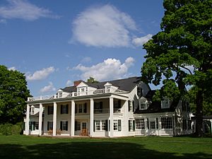
Hill-Stead, now a museum, was built on 250 acres of Farmington Mountain. It was a country estate for a wealthy businessman named Alfred Atmore Pope. His daughter, Theodate Pope Riddle, designed it in 1901. After her parents died, Theodate inherited the house. Before she passed away in 1946, she left Hill-Stead Museum as a memorial to her parents. The museum includes the 33,000-square-foot Pope-Riddle House, an 18th-century farm house, a carriage garage, and other farm buildings. The house is filled with paintings, prints, and art. You can see works by famous artists like Édouard Manet and Claude Monet.
Local Stories and Legends
Will Warren's Den
Will Warren's Den is a cave made of boulders on the west side of Rattlesnake Mountain. It's a historic landmark in Farmington. A sign at the cave says that a man named Warren, after being punished for not going to church, tried to burn down the village of Farmington. He was chased into the mountains, where some Native American women hid him in this cave. No one has ever proven if Will Warren was a real person, so he might be a mix of different people. You can reach the cave from the Metacomet Trail.
The Black Dog of the Hanging Hills
The Hanging Hills are said to be haunted by a ghost known as the "Black Dog of the Hanging Hills." This ghost appears as a small black dog that leaves no footprints and makes no sound. According to local stories, seeing the Black Dog for the first time brings joy. Seeing it a second time brings bad luck. But seeing the Black Dog a third time means you will die. At least six deaths have been blamed on third sightings of the Black Dog.
Hiking the Trail Safely
The Metacomet Trail is marked with blue rectangles. It is kept in good condition and is generally easy to hike, though some parts are rugged and moderately difficult. The trail is never more than a mile or two from a public road. However, cliffs and steep areas can make it harder to access in some spots. There are no places to camp along the trail, and camping is usually not allowed. You can find trail guides from different sources, and the Connecticut Forest and Park Association publishes a complete guidebook.
The weather along the trail is typical for Connecticut. On exposed ridge tops and summits, conditions can be harsher during cold or stormy weather. Lightning can be dangerous on exposed summits during thunderstorms. Snow is common in winter, so you might need snowshoes. Ice can form on exposed ledges, making hiking dangerous without special gear.
Biting insects can be annoying when it's warm. Deer ticks, which can carry Lyme disease, are a possible hazard. The northern copperhead snake, though rare, lives in some parts of the Metacomet Ridge in Connecticut. Poison ivy also grows naturally along the Metacomet Trail in some areas.
Protecting the Trail and Its Environment
The Metacomet Trail goes through public lands like state and town parks, and areas that protect water sources. It also crosses land managed by conservation groups, private land protected by agreements, and private land with permission from owners. Big threats to the trail and its natural beauty include quarrying (digging for rocks) and suburban sprawl (new buildings spreading out).
Volunteers, mostly organized by the Connecticut Forest and Park Association, maintain the trail. Many groups work to protect the landscape and nature along the Metacomet Trail. These include the Connecticut Department of Environmental Protection, the Metropolitan District of Connecticut, and various local land trusts like the Suffield Land Conservancy and the Farmington Land Trust.
In 2000, the Metacomet Trail was studied by the National Park Service to see if it could become part of a new National Scenic Trail. In 2009, it officially became part of the New England National Scenic Trail, which also includes the Mattabesett Trail and Metacomet-Monadnock Trail.
Hiking Challenges and Awards
The Connecticut Forest and Park Association (CFPA) gives out special patches to hikers who complete the entire length of certain trails. If you hike the whole Metacomet Trail, you can get a commemorative patch for a small fee ($1) by contacting the Connecticut Forest and Park Association.
 | Georgia Louise Harris Brown |
 | Julian Abele |
 | Norma Merrick Sklarek |
 | William Sidney Pittman |


