
Newington, Connecticut facts for kids
Quick facts for kids
Newington, Connecticut
|
||
|---|---|---|
| Town of Newington | ||

Main Street
|
||
|
||
 Hartford County and Connecticut Hartford County and Connecticut Capitol Planning Region and Connecticut Capitol Planning Region and Connecticut |
||
| Country | ||
| U.S. state | ||
| County | Hartford | |
| Region | Capitol Region | |
| Incorporated | 1871 | |
| Government | ||
| • Type | Council-manager | |
| Area | ||
| • Total | 13.1 sq mi (34.0 km2) | |
| • Land | 13.1 sq mi (34.0 km2) | |
| • Water | 0 sq mi (0.0 km2) | |
| Elevation | 85 ft (26 m) | |
| Population
(2020)
|
||
| • Total | 30,536 | |
| • Density | 2,326/sq mi (898.1/km2) | |
| Time zone | UTC-5 (Eastern) | |
| • Summer (DST) | UTC-4 (Eastern) | |
| ZIP Code |
06111
|
|
| Area code(s) | 860/959 | |
| FIPS code | 09-52140 | |
| GNIS feature ID | 0213472 | |
| U.S. Highways | ||
| State Routes | ||
| Rapid Transit | ||

Newington is a town in Hartford County, Connecticut, United States. It's part of the Capitol Planning Region. Newington is about 8 miles (13 km) south of downtown Hartford. It's an older town, mostly a place where people live, located in the Greater Hartford area.
As of 2023, about 30,527 people live here. The Connecticut Department of Transportation has its main office in Newington. You can also find Mill Pond Falls here, a small waterfall celebrated every fall with a festival. The American Radio Relay League, which is a group for amateur radio fans, has its headquarters in Newington. Their special call sign is W1AW.
Contents
- Newington's Story: A Look at Its History
- Newington's Geography
- Newington's Population and People
- Arts and Culture in Newington
- Education in Newington
- Newington's Economy: Top Employers
- Getting Around Newington: Transportation
- Safety and Emergency Services
- Famous People from Newington
- Images for kids
- See also
Newington's Story: A Look at Its History
Newington has a long history, almost 375 years old! Even though it didn't officially become a separate town until 1871, people from nearby Wethersfield started living here in 1636. This area was known as "West Farms." It had lots of timber and great pastures for cattle.
In 1721, the farmers living here asked the General Assembly to name their land "Newington." This name meant "the new town in the meadow." The request was approved, but it took another 150 years for Newington to become an official town. So, the town's name is actually older than its official existence!
Growth and Progress in Newington
Newington's town seal has a motto: "growth and progress." The town really started to grow in the late 1700s. In 1798, a road that later became the Berlin Turnpike was approved. This road helped connect Hartford and New Haven and brought many businesses to the area.
In the early 1800s, Newington became even more important. Its central location in Connecticut attracted more people and businesses. Levi Lusk, who fought in the War of 1812, opened one of the first businesses on the Turnpike. It was a tavern, like a restaurant and inn, which led to many more businesses later on.
Railroads came through Newington in the 1830s. This made the town grow even faster, with more homes and businesses. By the second half of the 1800s, Newington had grown so much that it felt very different from its "mother town," Wethersfield.
An 1869 map showed Newington divided into four areas: North, Middle, South, and South-east. Four main roads crossed these areas. These roads later became the Berlin Turnpike, Main Street, Willard Avenue, and Church Street. The town was about four miles long from north to south and three miles wide from east to west.
Becoming an Official Town and the Modern Era
By 1871, Newington had 871 people, 132 homes, and about 130 farms. This was a big increase! When leaders in Wethersfield wouldn't pay for road improvements to help access the railroads, Newington decided to become its own town. This officially happened on July 10, 1871.
Newington's official start happened as new technologies were changing the world. In 1883, John Fish's Store got the town's first telephone. In 1894, a trolley service started, connecting Newington to Hartford and New Britain. The ride to the city took only 20 minutes and cost five cents! This meant people could live in Newington and work in nearby cities. Even though farms were still common, the town was starting to become a suburb.
The trolley helped Newington's population grow. At the start of the 1900s, only about 1,000 people lived here. By 1930, that number reached 4,000. Many people moved to Newington from Hartford and New Britain.
Cars also encouraged more people to move to Newington and led to fewer farms. In the 1930s, even during the Great Depression, Newington's leaders paved dirt roads. Cars and buses replaced the trolley service in 1937.
Modernization in Newington also meant improving social services. In 1898, Virginia Thrall Smith asked town leaders to build a place to care for children who needed help. The town approved, and Smith bought land for what was first called the Home for Incurables. In 1968, it became The Newington Children's Hospital. Other hospitals were also built in Newington in the early 1900s, including Connecticut's first tuberculosis sanitarium in 1911.
By the 1940s, Newington was growing quickly, just like other towns in the state. The Hartford/New Haven Turnpike was renamed the Berlin Turnpike in 1942. It was also made much wider, showing how important this road had become for businesses. Mill Pond, with its 16-foot natural waterfall, remained a popular spot. It's even on the town seal! But by the middle of the century, the Berlin Turnpike, known as "gasoline alley" because of its many gas stations, became the main business area.
Newington's population jumped from 5,449 in 1940 to 9,110 in 1950. This was one of the fastest growth rates in the state. By the late 1900s, some of Newington's factories faced challenges. Companies like the Torrington Company and Loctite moved away in the mid-1990s. The building of Interstate 91 and Interstate 84 also made other towns more attractive for businesses. However, shopping centers, new housing, and the continued success of the Berlin Turnpike helped Newington's economy.
By 2009, Newington's population had grown to 29,701, and it was expected to pass 30,000 by 2013. The town is still mostly residential, but the Berlin Turnpike continues to be a busy commercial area. Over time, smaller businesses on the Turnpike have been replaced by larger chain stores.
Newington's Geography
Newington covers about 34.0 square kilometers (13.1 square miles). It doesn't have much water, just two small ponds in its biggest parks and some small streams.
Newington is surrounded by other towns. To the north is Hartford, the state capital. Moving clockwise from Hartford, Newington also borders Wethersfield, Rocky Hill, Berlin, New Britain, Farmington, and West Hartford. The town is mostly made up of homes, but it also has the Berlin Turnpike, which is a large road with many businesses.
Newington's Population and People
| Historical population | |||
|---|---|---|---|
| Census | Pop. | %± | |
| 1880 | 934 | — | |
| 1890 | 953 | 2.0% | |
| 1900 | 1,041 | 9.2% | |
| 1910 | 1,689 | 62.2% | |
| 1920 | 2,381 | 41.0% | |
| 1930 | 4,572 | 92.0% | |
| 1940 | 5,449 | 19.2% | |
| 1950 | 9,110 | 67.2% | |
| 1960 | 17,664 | 93.9% | |
| 1970 | 26,037 | 47.4% | |
| 1980 | 28,841 | 10.8% | |
| 1990 | 29,208 | 1.3% | |
| 2000 | 29,306 | 0.3% | |
| 2010 | 30,562 | 4.3% | |
| 2020 | 30,536 | −0.1% | |
| U.S. Decennial Census | |||
In 2010, Newington had 30,562 people living in 13,011 households. A household is a group of people living together. About 8,253 of these were families. The town had about 2,310 people per square mile.
Most people in Newington are White (86.5%). There are also Black or African American people (3.5%), Asian people (5.7%), and people from other backgrounds. About 7.6% of the population is Hispanic or Latino.
In terms of age, about 21.9% of the people were under 19. About 18.5% were 65 or older. The average age in Newington was 44 years old.
The median income for a household in Newington was $75,237. This means half of the households earned more than this, and half earned less. For families, the median income was $79,792.
Arts and Culture in Newington
Mill Pond Falls: A Natural Wonder
The town's official seal shows Mill Pond Falls. This waterfall is named after a sawmill that was built there in 1860. The falls are 16 feet (4.9 meters) high and are located in central Newington at Mill Pond Park. It's known as the smallest natural waterfall in the United States!
There's a walking path around Mill Pond that includes a footbridge over the waterfall. You can also find a special area with benches to watch the falls. The park is a popular spot for locals to walk dogs, ice skate, jog, and have picnics. It's open all year round.
Since 2000, the Newington Waterfall Committee has held the Waterfall Festival every September. This festival celebrates the falls and takes place in the center of town. It features over 72 vendors and local music groups. There's also an "Artist's Chalk Walk" where artists of all ages create chalk drawings. In 2010, a "Thankful Tree" was planted at the falls. Residents can write what they are thankful for on tags and hang them on the tree.
The Lucy Robbins Welles Library
The Lucy Robbins Welles Library first opened its doors in 1939. It was updated and made bigger in 1988. It's a great place for reading and learning!
Interesting Places to Visit

Newington has several notable spots:
- The Gen. Martin Kellogg House: This historic house was built in 1808.
- The National Iwo Jima Memorial: This important memorial is located on the border between Newington and New Britain.
- The Newington Junction Historic Districts: These areas have special historical importance.
- The Newington Junction Railroad Depot: This old train station was built in 1870.
- The Willard Homestead (Newington, Connecticut): This very old house was built in 1730.
- The Hiram Percy Maxim Memorial Station (W1AW): This is an amateur radio station located at the American Radio Relay League.
Education in Newington
Newington Public Schools runs the public schools in town. There are seven public schools in Newington.
- Elementary Schools: There are four elementary schools for kindergarten through fourth grade. Children go to the school in their neighborhood. These schools are Elizabeth Green, Anna Reynolds, John Paterson, and Ruth Chaffee.
- Middle Schools: Newington has two middle schools, Martin Kellogg and John Wallace. They teach grades five through eight.
- High School: After middle school, students go to Newington High School for grades nine through twelve.
There is also a private school called Emmanuel Christian Academy (Connecticut), which teaches Kindergarten through Grade 6. The Connecticut Distance Learning Consortium is also located in Newington.
Newington High School's History
Newington High School was founded in the early 1930s. It moved to new buildings in the 1950s and again in the 1970s. The old 1950s high school building was later renovated and is now used as the town hall and police department.
Other Schools in Town
The Japanese School of Greater Hartford holds its weekend classes in the Saint Mary School in Newington. This program helps Japanese children learn about their culture and language.
Newington's Economy: Top Employers
Newington has many businesses that provide jobs. Here are some of the top employers in town, based on a 2023 report:
| # | Employer | # of Employees |
|---|---|---|
| 1 | Hartford Hospital-Newington Campus | 1,481 |
| 2 | Town of Newington | 1,175 |
| 3 | Connecticut Department of Transportation | 1,066 |
| 4 | Data-Mail Inc | 555 |
| 5 | Stew Leonard's | 286 |
| 6 | Newington Rapid Recovery Health Care Center | 257 |
| 7 | Veterans Administration Hospital | 240 |
| 8 | Davidson Specialty Foods, LLC | 231 |
| 9 | Walmart | 216 |
| 10 | Target | 210 |
Getting Around Newington: Transportation
Train Travel

While Amtrak trains don't stop directly in Newington right now, the town center is about 8 miles (13 km) south of Hartford's Union Station. Newington is also planned to be a stop on the Hartford Line. This will be a new train service from New Haven to Springfield. The State of Connecticut has even secured money to fix up the old Newington Junction Railroad Depot, which is a train station located near Willard Avenue. Train service at this spot stopped in 1959, but it might come back!
Bus Rapid Transit (CTfastrak)
In March 2015, CTfastrak opened. This is Connecticut's first bus rapid transit system. It has its own special lanes for buses between Hartford and New Britain, and it has a stop at Newington Junction. The station has two platforms for buses, with extra lanes in the middle for express buses to pass by.
Local Bus Services
Newington is also served by several bus routes run by Connecticut Transit. These include routes 69, 41, 47, and 45. There's also the 907 Newington Express, which provides faster service to downtown Hartford.
Safety and Emergency Services
Newington is kept safe by several groups: the Connecticut State Police, the local Newington Police Department, and the United States Department of Veterans' Affairs Police Department. The local police department has 52 full-time officers. They are also trained as first responders for medical emergencies. This means they can help people right away.
The town has a volunteer ambulance service. This group provides basic medical help and transportation during evenings and all weekend. During other times, American Medical Response provides more advanced medical care.
Newington also has a fire department that is 100% volunteer. It was started in 1917. The fire department is run by an elected board of fire commissioners. They choose the fire marshal, the chief, and all the other officers.
Famous People from Newington
Newington has been home to several well-known individuals:
- Ed Cody (1923–1994): An NFL player for the Green Bay Packers and Chicago Bears.
- Melanie Fontana (born 1986): A singer, composer, and songwriter.
- Richard P. Freeman (1869–1944): A veteran of the Spanish–American War and a US congressman.
- Albert Magnoli (born 1953/1954): A film director, screenwriter, and editor known for movies like Purple Rain.
- John Pezzenti (1952–2007): A wildlife photographer.
- Lindy Remigino (born 1931): A gold medalist in the 1952 Olympics for running.
- Bill Rodgers (born 1947): Attended Newington High School. He won the Boston Marathon four times and the New York City Marathon multiple times.
- Wilber G. Smith (1935–1992): A state senator.
Images for kids
-
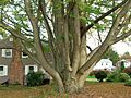
Katsura Tree in Newington
See also
 In Spanish: Newington (Connecticut) para niños
