Canaan (village), Connecticut facts for kids
Quick facts for kids |
|
|
Canaan Village Historic District
|
|

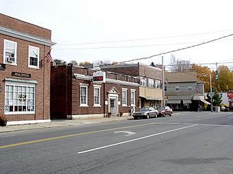
Main Street
|
|
| Location | Roughly bounded by W. Main, Bragg & Orchard Sts. & Granite Ave., North Canaan, Connecticut |
|---|---|
| Area | 93 acres (38 ha) |
| Built | 1872 |
| Architect | Lorrain, E.R. |
| Architectural style | Colonial Revival, Queen Anne, Vernacular Picturesque |
| NRHP reference No. | 90001800 |
| Added to NRHP | December 13, 1990 |
|
Canaan, Connecticut
|
|
|---|---|

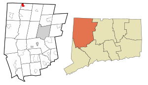
Location in Litchfield County, Connecticut
|
|
| Country | United States |
| Town | North Canaan |
| Area | |
| • Total | 1.75 sq mi (4.52 km2) |
| • Land | 1.75 sq mi (4.52 km2) |
| • Water | 0 sq mi (0.0 km2) |
| Elevation | 679 ft (207 m) |
| Population
(2010)
|
|
| • Total | 1,212 |
| • Density | 695/sq mi (268.4/km2) |
| Time zone | UTC-5 (EST) |
| • Summer (DST) | UTC-4 (EDT) |
| ZIP Code |
06018
|
| Area code(s) | 860 |
| FIPS code | 09-10870 |
| GNIS feature ID | 2378340 |
Canaan is a small village located in the town of North Canaan, in Litchfield County, Connecticut. It's also known as a census-designated place (CDP), which means it's a specific area defined for counting people.
This village was once called Canaan Depot. Today, people often call it Canaan Village to avoid confusing it with the larger town of Canaan located to the south. A special part of the village, called the Canaan Village Historic District, is listed on the National Register of Historic Places. This means it's an important historical area.
In 2010, about 1,212 people lived in Canaan Village. The entire town of North Canaan had a population of 3,315.
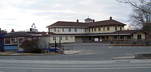
The historic district covers about 93 acres. It includes the main business area and homes that show what the village looked like from the mid-1800s to the early 1900s. Canaan Village grew into an important trading hub because of its railroads. First, the Housatonic Railroad came through, running north and south. Then, the Connecticut Western Railroad arrived, running east and west. These two railroads meeting here made Canaan a key spot for moving goods to different markets. The famous Canaan Union Depot building, built in 1872, served both railroads.
The Canaan Fire Company, which helps keep the community safe, was started in 1911.
Exploring Canaan Village Geography
Canaan Village is in the northwestern part of the town of North Canaan. To the west, across the Housatonic River, is the town of Salisbury. To the north, you'll find the town of Sheffield in Massachusetts.
The Blackberry River, which flows into the Housatonic River, forms the southern edge of the village. The eastern border of Canaan Village follows several roads, including U.S. Route 7 and U.S. Route 44.
The United States Census Bureau says that Canaan Village covers about 4.5 square kilometers (about 1.7 square miles) of land, with no water area.
Who Lives in Canaan Village?
Based on the census from 2000, there were 1,288 people living in Canaan Village. These people lived in 597 households, with 337 of them being families. On average, there were about 289 people per square kilometer.
The population was spread out in terms of age. About 22.5% of the people were under 18 years old. About 20.0% were 65 years old or older. The average age in the village was 40 years.
See also
 In Spanish: Canaan (condado de Litchfield) para niños
 | Delilah Pierce |
 | Gordon Parks |
 | Augusta Savage |
 | Charles Ethan Porter |


