West Cornwall, Connecticut facts for kids
Quick facts for kids
West Cornwall, Connecticut
|
|
|---|---|

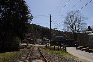
West Cornwall in March 2012
|
|
| Country | |
| State | Connecticut |
| County | Litchfield |
| Town | Cornwall |
| Area | |
| • Total | 4.06 km2 (1.57 sq mi) |
| • Land | 4.06 km2 (1.57 sq mi) |
| • Water | 0.0 km2 (0 sq mi) |
| Elevation | 162 m (531 ft) |
| Time zone | UTC-5 (Eastern (EST)) |
| • Summer (DST) | UTC-4 (EDT) |
| ZIP Code |
06796
|
| Area code(s) | 860/959 |
| FIPS code | 09-82030 |
| GNIS feature ID | 2805985 |
West Cornwall is a small, charming village located in the town of Cornwall, Connecticut. It's not a separate town itself, but a special kind of community called a "census-designated place" (CDP). This means it's an area identified by the U.S. Census Bureau for collecting population data.
Contents
Discover West Cornwall: A Connecticut Village
West Cornwall is an interesting place in Litchfield County, Connecticut. It is known as an unincorporated village. This means it is a community that is part of a larger town, in this case, Cornwall. It does not have its own separate local government.
Where is West Cornwall Located?
This village is on the west side of the town of Cornwall. It sits right next to the Housatonic River. This river forms the natural border between Cornwall and the nearby town of Sharon.
Getting Around West Cornwall
If you visit West Cornwall, you'll notice Connecticut Route 128 running through the village. This road connects to U.S. Route 7 by crossing the Housatonic River into Sharon. These routes help people travel in and out of the area.
West Cornwall as a Census-Designated Place
West Cornwall was officially recognized as a "census-designated place" (CDP) before the 2020 census. This means the U.S. Census Bureau collects specific population and housing information for this area. It helps them understand the communities better.
 | Lonnie Johnson |
 | Granville Woods |
 | Lewis Howard Latimer |
 | James West |


