Montpelier, Vermont facts for kids
Quick facts for kids
Montpelier
|
|||||
|---|---|---|---|---|---|
|
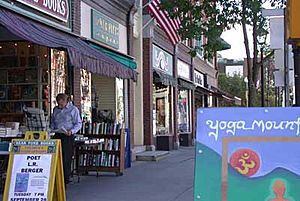
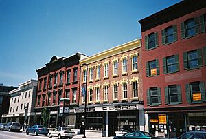
Main Street in 2022
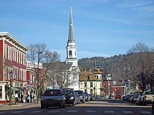
State Street in 2012
Saint Augustine Church
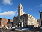
City Hall in 2012
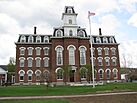
College Hall
|
|||||
|
|||||
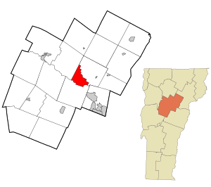
Location in Washington County in Vermont
|
|||||
| Country | |||||
| State | |||||
| County | Washington | ||||
| Region | New England | ||||
| Settled | 1787 | ||||
| Incorporated (village) | 1818 | ||||
| Incorporated (city) | 1895 | ||||
| Named for | Montpellier, France | ||||
| Area | |||||
| • Total | 10.25 sq mi (26.54 km2) | ||||
| • Land | 10.05 sq mi (26.04 km2) | ||||
| • Water | 0.19 sq mi (0.50 km2) | ||||
| Elevation | 522 ft (159 m) | ||||
| Population
(2020)
|
|||||
| • Total | 8,074 | ||||
| • Density | 787.7/sq mi (304.22/km2) | ||||
| Demonym(s) | Montpelierite | ||||
| Time zone | UTC−5 (EST) | ||||
| • Summer (DST) | UTC−4 (EDT) | ||||
| ZIP codes |
05601-05604, 05609, 05620, 05633
|
||||
| Area code(s) | 802 | ||||
| FIPS code | 50-46000 | ||||
| GNIS feature ID | 1461834 | ||||
| Interstates | |||||
| U.S. Highways | |||||
| State Routes | |||||
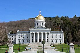
Montpelier is the capital city of Vermont, a state in the United States. It is also the main town of Washington County. Montpelier is home to Vermont's state government. It is the smallest state capital in the U.S. by population.
In 2020, about 8,074 people lived in Montpelier. During the day, the population grows to about 21,000. This is because many people work in the city. The Vermont College of Fine Arts is also located here. The city was named after Montpellier, a city in France.
Montpelier was officially started as a town on August 14, 1781. The first people to settle there permanently arrived in May 1787. The city got its French name because people liked France after its help in the American Revolutionary War. Montpelier was chosen as the state capital in 1805. Citizens helped pay to build the first state house. The city was officially made a city in 1895.
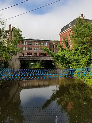
Montpelier is in the middle of Vermont. The Winooski River flows along the south side of the city. Another river, the North Branch, also runs through the city. Flooding can be a problem in Montpelier. Big floods happened in 1927, 1992, and 2023. After a fire in 1875, many buildings were rebuilt with brick to prevent future fires. The state government is a big part of the city's economy. Insurance and tourism are also important.
You can reach Montpelier by Amtrak train. The station is a short distance from downtown. Small private planes can use a nearby airport. For bigger planes, the closest airport is in Burlington.
Contents
History of Montpelier

Early Days and Native Americans
The flat lands near the Winooski River were perfect for growing corn. Native Americans liked living in Montpelier because the valley protected them from winds. This made the area warmer. Many streams met here, which was good for hunting, fishing, and trading. Early settlers found old Native American sites in the area.
Between 1600 and 1800, European settlers started arriving. Sadly, war and sickness greatly reduced the Native American population. But some Native Americans stayed in the area until the mid-1800s.
Founding the Town
Montpelier was officially created on August 14, 1781. The first people to live there permanently arrived in May 1787. Colonel Jacob Davis and General Parley Davis came from Massachusetts. General Davis mapped the land. Colonel Davis cleared trees and built a log house. His family moved in that winter.
Colonel Davis chose the name "Montpelier" after a city in France. People in America liked France because France helped them during the American Revolutionary War. The settlement grew quickly. By 1791, 117 people lived there.
Becoming the Capital
In 1805, Montpelier had 1,200 people. The state government needed a permanent home. Montpelier was chosen because it was in the center of the state and easy to get to. Local residents also gave land and money. A simple State House was built on State Street.
In 1825, the Marquis de Lafayette visited Montpelier. He was a French hero of the Revolutionary War.
Growth and Changes
Montpelier became a center for making things. This grew even more after the Central Vermont Railway opened in 1849. In 1848, the original town was split into two parts: East Montpelier and Montpelier. Later, Montpelier became a village.
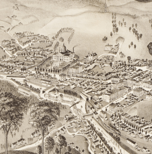
By 1858, the main streets were set up along the rivers. The downtown area looks much the same today. In 1875, a big fire destroyed many buildings downtown.
Montpelier had the first water-powered electricity system in Vermont in 1884. This power was used for streetlights. In 1894, Montpelier officially became a city.
Important Events and Parks
In 1899, "Dewey Day" was held to honor George Dewey. He was a local hero from the Spanish–American War. Also in 1899, Hubbard Park was created. John Erastus Hubbard gave the land to the city. He wanted to keep it wild for future generations. An observation tower was built in the park between 1915 and 1930.
Major Floods in Montpelier
Montpelier has faced several major floods.
- The Great Flood of 1927: Heavy rains in November 1927 caused rivers to overflow. Water rose 13 feet above normal levels. Downtown stores were covered in mud. The damage was huge, but Vermont was praised for its recovery. To help prevent future floods, the Civilian Conservation Corps built the Wrightsville Dam from 1933 to 1935. This created the Wrightsville Reservoir.
- The 1992 Flood: In March 1992, an ice jam in the Winooski River caused another flood. Water levels rose quickly, flooding downtown Montpelier. Many businesses were shut down, and people lost their homes.
- The 2023 Flood: Heavy rains in July 2023 caused more severe flooding. Many homes and downtown businesses were affected. Even the city's fire department and City Hall were damaged.
Geography and Climate
Montpelier is in the north-central part of Vermont. The city center is a flat area. It is surrounded by hills and rocky ledges.
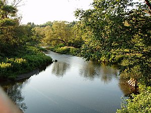
The city covers about 10.3 square miles (26.5 square kilometers). Most of this is land, with a small amount of water. The Winooski River flows along the south side of downtown. Smaller streams also flow through the city.
Montpelier is next to the towns of Middlesex, Berlin, and East Montpelier. It is often linked with the nearby city of Barre. They are sometimes called "the twin cities."
Montpelier's Weather
Montpelier has a humid continental climate. This means it has long, cold, and snowy winters. Springs and autumns are short. Summers are warm and humid.
In winter, temperatures often drop below 0°F (–18°C). Snow is common and stays on the ground for a long time. The average snowfall each year is about 94.2 inches (2.39 meters). Summers are warm, with a few days reaching over 90°F (32°C). The highest temperature ever recorded was 97°F (36°C). The lowest was -34°F (–37°C).
Population and People
| Historical population | |||
|---|---|---|---|
| Census | Pop. | %± | |
| 1800 | 890 | — | |
| 1810 | 1,877 | 110.9% | |
| 1820 | 2,308 | 23.0% | |
| 1830 | 1,193 | −48.3% | |
| 1840 | 3,725 | 212.2% | |
| 1850 | 2,310 | −38.0% | |
| 1860 | 2,411 | 4.4% | |
| 1870 | 3,023 | 25.4% | |
| 1880 | 3,219 | 6.5% | |
| 1890 | 4,160 | 29.2% | |
| 1900 | 6,266 | 50.6% | |
| 1910 | 7,856 | 25.4% | |
| 1920 | 7,125 | −9.3% | |
| 1930 | 7,837 | 10.0% | |
| 1940 | 8,006 | 2.2% | |
| 1950 | 8,559 | 6.9% | |
| 1960 | 8,782 | 2.6% | |
| 1970 | 8,609 | −2.0% | |
| 1980 | 8,241 | −4.3% | |
| 1990 | 8,247 | 0.1% | |
| 2000 | 8,035 | −2.6% | |
| 2010 | 7,855 | −2.2% | |
| 2020 | 8,074 | 2.8% | |
| U.S. Decennial Census | |||
Montpelier is part of a small urban area with Barre. In 2020, Montpelier's population was 8,074. There were about 3,739 households.
About 21.3% of the people were under 18 years old. The average age was 40 years. Most people in Montpelier are White. There are also smaller groups of Black, Asian, and Hispanic people.
Economy and Jobs
The main businesses in Montpelier are state government, higher education, insurance, and tourism.
Key Industries
Since it became the capital in 1805, the state government has been the biggest employer. In the mid-1800s, insurance companies also started in Montpelier.
Most of the businesses downtown are owned by local people. You can find shops selling antiques, books, toys, crafts, and Vermont-themed gifts. Montpelier is unique because it is the only state capital without a Starbucks or a McDonald's.
The Savoy Theater, opened in 1905, shows independent and international films. The annual Green Mountain Film Festival is held here.
Tourism in Montpelier
The Vermont History Museum is a popular place to visit. It is located in The Pavilion.
Arts and Culture
Montpelier has many cultural spots:
- Kellogg-Hubbard Library
- Lost Nation Theater
- Montpelier Theatre Guild
- Vermont History Museum
- Vermont State House
- T. W. Wood Gallery & Arts Center
- Capital City Concerts
A fun local tradition is the Valentine Phantom. Every February 14, downtown shops and buildings are covered with red hearts. This started in the 1990s.
Sports and Recreation
The Vermont Mountaineers baseball team plays at the Montpelier Recreation Field. They are part of the New England Collegiate Baseball League.
The Vermont Super 8 bikepacking route starts at the capitol building each fall.
Parks and Outdoor Fun
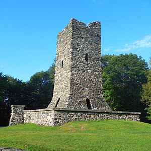
Montpelier has three city nature centers. Hubbard Park is behind the state capitol building. It has trails and an observation tower.
The North Branch River Park is the second-largest park. It has growing mountain biking trails. A pump track is also being built there. The Mill Pond Park offers boat access to the North Branch river. The North Branch Nature Center has 17 acres of protected land. A bridge connects it to the North Branch River Park.
Education in Montpelier
Montpelier has several schools:
- Public Schools:
- Montpelier High School
- Main Street Middle School
- Union Elementary School
- Private School:
- River Rock School (Kindergarten to 8th grade)
- Colleges:
- A campus of the Community College of Vermont
- Union Institute & University (Vermont campus)
- Vermont College of Fine Arts
Media and News
- The Barre Montpelier Times Argus is a daily newspaper for the area.
- The Montpelier Bridge is a paper that comes out twice a month.
- WNNE is a local TV station.
- ORCA Media is a non-profit center that helps with community media.
Transportation
Montpelier is easy to reach because it's near the center of Vermont.
Roads for Driving
Interstate 89 runs through the city. U.S. Route 2 and Vermont Route 12 also meet in Montpelier. These roads connect the city to other parts of Vermont, like Burlington. U.S. Route 302 starts in Montpelier and goes to Barre and other towns.
Train Travel
Amtrak provides daily train service. The station is in nearby Berlin. The "Vermonter" train travels between St. Albans, Vermont, and Washington, D.C.
Bus Services
Greyhound and Megabus have bus stops in Montpelier. The Green Mountain Transit Authority (GMTA) runs local buses. These buses go to Montpelier, Barre, and nearby Waterbury. They also stop at the Vermont State House and the Ben & Jerry's factory.
Airports
Private planes can use the Edward F. Knapp State Airport in Berlin. For commercial flights, the closest airport is Burlington International Airport. It is about 35 miles (56 km) northwest of Montpelier.
Walking and Biking
Montpelier has paths for walking and bicycling. These include the Cross Vermont Trail and the Central Vermont Regional Path. Downtown Montpelier is easy to walk around, with sidewalks and crosswalks.
Notable People
Sister Cities
 Zapopan, Mexico
See also
 In Spanish: Montpelier (Vermont) para niños
 | William Lucy |
 | Charles Hayes |
 | Cleveland Robinson |


