Wrightsville Reservoir facts for kids
Quick facts for kids Wrightsville Reservoir |
|
|---|---|
| Location | Washington County, Vermont |
| Coordinates | 44°19′0″N 72°34′30″W / 44.31667°N 72.57500°W |
| Type | Reservoir |
| Primary inflows | Winooski River North Branch |
| Primary outflows | Winooski River North Branch |
| Basin countries | United States |
| Max. length | 1.75 mi (2.82 km) |
| Max. width | 0.2 mi (0.32 km) |
| Settlements | Montpelier, Vermont, Middlesex, Vermont, East Montpelier, Vermont, Tangletown, Vermont,Wrightsville, Vermont |
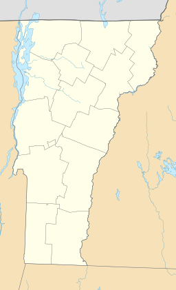
Wrightsville Reservoir is a large man-made lake in Washington County, Vermont. It sits where three towns meet: Montpelier, Middlesex, and East Montpelier. This reservoir is a very popular place for fun activities in the summer. People enjoy swimming, boating, and fishing here.
Even though most of the lake is in Middlesex, it's closer to Montpelier. Most visitors get to it from Vermont Route 12. The reservoir has a popular swimming beach. There's also a disc golf course and a place to launch boats. These spots are all easy to reach from Route 12.
Building the Wrightsville Dam and Reservoir
The Wrightsville Dam was built a long time ago. It was constructed between 1933 and 1935. This project happened after a very big flood in 1927. That flood caused a lot of damage in Montpelier and nearby towns. The Civilian Conservation Corps, a group that helped people find work during tough times, built the dam.
The Village of Wrightsville and Its Move
Building the reservoir meant that the village of Wrightsville had to be moved. The old village was flooded by the new lake. At that time, Wrightsville had at least 30 buildings. The North Branch Cemetery also had to move in 1934. Workers carefully dug up and relocated 651 graves. Some of these graves were from the 1800s.
How the Dam Was Built
The dam was finished in 1935. It was an earthfill dam, meaning it was made mostly of earth and rock. It was 1,525 feet long and 115 feet high. One side of the dam was covered with stone for protection. Inside the dam, there was a concrete tunnel 645 feet long. This tunnel had three pipes. One pipe was closed off. Another pipe sent water to the Wrightsville Hydroelectric Power Plant. The third pipe let water flow into the North Branch of the Winooski River. There was also a special overflow area called a spillway. This spillway was cut through rock, 30 feet below the top of the dam.
Other Dam Projects in Vermont
The Wrightsville Dam was one of only four dam projects built around the same time. These projects happened between 1933 and 1935. The other dams were the East Barre Dam, the Waterbury Reservoir, and the Winooski River Local Protection Project. The total cost for all four projects was about $13.7 million.
Later, from 1956 to 1958, the dam was made even bigger. Its top height was raised by 20 feet. The dam was also made 275 feet longer. This update cost about $1.35 million.
Fun Activities at Wrightsville Reservoir
When the Wrightsville Reservoir was first built, it didn't have any places for recreation. But that changed later!
Early Recreation Areas
In 1964, work began to add three recreational areas around the lake. This project was finished in 1967. The state helped by providing things like fireplaces, picnic tables, and places for drinking water. In 1967, these new areas were given to the Vermont Department of Environmental Conservation to manage.
Shady Rill Recreation Area
One of these areas is the Shady Rill Recreation Area. It's about 1.25 miles north of the dam. You can get there easily from Route 12. Shady Rill has 10 picnic tables and five fireplaces. There's also a picnic shelter and an open field for playing ball. You can find horseshoe pits and an 18-hole disc golf course here too. Martins Brook, also known as Shady Rill Brook, flows nearby, making it a nice spot for picnics by the water.
Wrightsville Reservoir Boat Launch Area
The second area is the Wrightsville Reservoir Boat Launch Area. It's on Route 12, about 0.75 miles north of the dam. This spot has a boat ramp for launching boats. In the winter, people enjoy cross-country skiing and snowmobiling on unmarked trails. Ice fishing is also popular when the lake freezes over.
Wrightsville Beach Recreation Area
The third recreation area built by the Corps was later closed. However, in 1985, a new recreation spot was created. This was part of a project by the Washington Electric Cooperative. This new area is called the Wrightsville Beach Recreation Area. It's on Route 12, about 1.25 miles north of the dam. It's right across from the road to Shady Rill.
Wrightsville Beach has 36 picnic tables and 11 fireplace grills. There's a picnic shelter and a 350-foot swimming beach. You can also hike on a half-mile marked trail. The area has an open field for games, a small playground, and cold showers. You can also find disc golf, horseshoe pits, and a volleyball net. The Wrightsville Beach Recreation District now manages this area. This district includes the towns of Middlesex, Worcester, Montpelier, and East Montpelier.
 | Jessica Watkins |
 | Robert Henry Lawrence Jr. |
 | Mae Jemison |
 | Sian Proctor |
 | Guion Bluford |


