Washington County, Vermont facts for kids
Quick facts for kids
Washington County
|
|
|---|---|

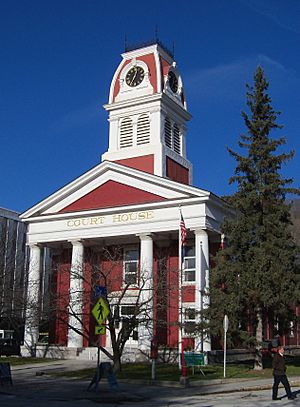
Washington County Courthouse
|
|

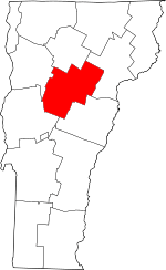
Location within the U.S. state of Vermont
|
|
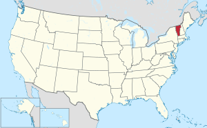
 Vermont's location within the U.S. |
|
| Country | |
| State | |
| Founded | 1811 |
| Named for | George Washington |
| Shire Town | Montpelier |
| Largest city | Barre |
| Area | |
| • Total | 695 sq mi (1,800 km2) |
| • Land | 687 sq mi (1,780 km2) |
| • Water | 8.2 sq mi (21 km2) 1.2%% |
| Population
(2020)
|
|
| • Total | 59,807 |
| • Density | 86/sq mi (33/km2) |
| Time zone | UTC−5 (Eastern) |
| • Summer (DST) | UTC−4 (EDT) |
| Congressional district | At-large |
Washington County is a county in Vermont, a state in the United States. It is named after George Washington, who was the first president of the U.S.
The main town where the county government is located is Montpelier. Montpelier is also the capital city of Vermont. It is the smallest state capital in the United States by population. The biggest city in Washington County is Barre.
In 2020, about 59,807 people lived in Washington County. This makes it the third most populated county in Vermont. However, it is one of the least populated capital counties in the U.S. In 2023, the population was estimated to be around 60,142 people.
Washington County is part of the Barre, Vermont area. In 2010, the middle point of Vermont's population was found in Warren, a town in Washington County.
Contents
History of Washington County
Washington County is one of many counties in Vermont. These counties were created from land that used to belong to New York. This happened on January 15, 1777. On that day, Vermont said it was a separate state from New York.
Before this, different states like Massachusetts, New Hampshire, and New Netherland claimed the land. But the borders were not clear until 1764. That's when King George III set the border between New Hampshire and New York.
The land that became Vermont was given to Albany County by New York. Later, in 1772, Albany County was split. This created Charlotte County. This was the situation until Vermont became independent.
Washington County was first called Jefferson County. It was created in 1810. It was formed from parts of Caledonia County, Chittenden County, and Orange County. The county government started working the next year.
In 1814, its name was changed to Washington County. This happened after the Federalists gained control of Vermont's government. They took over from the Jeffersonians. Vermont traded a lot with British Canada. The state had faced problems because of the Embargo Act of 1807. This act was passed during Thomas Jefferson's time as president.
Geography of Washington County
Washington County covers a total area of about 695 square miles. Most of this area, about 687 square miles, is land. The rest, about 8.2 square miles, is water. This means about 1.2% of the county is water.
Main Roads
 Interstate 89 is a major highway that runs through the county.
Neighboring Counties
Washington County shares borders with several other counties:
- Lamoille County to the north
- Caledonia County to the northeast
- Orange County to the southeast
- Addison County to the southwest
- Chittenden County to the northwest
Protected Natural Areas
Part of the Green Mountain National Forest is located in Washington County. This is a large area of protected land.
Population Information
| Historical population | |||
|---|---|---|---|
| Census | Pop. | %± | |
| 1820 | 14,113 | — | |
| 1830 | 21,378 | 51.5% | |
| 1840 | 23,506 | 10.0% | |
| 1850 | 24,654 | 4.9% | |
| 1860 | 27,612 | 12.0% | |
| 1870 | 26,520 | −4.0% | |
| 1880 | 25,404 | −4.2% | |
| 1890 | 29,606 | 16.5% | |
| 1900 | 36,607 | 23.6% | |
| 1910 | 41,702 | 13.9% | |
| 1920 | 38,921 | −6.7% | |
| 1930 | 41,733 | 7.2% | |
| 1940 | 41,546 | −0.4% | |
| 1950 | 42,870 | 3.2% | |
| 1960 | 42,860 | 0.0% | |
| 1970 | 47,659 | 11.2% | |
| 1980 | 52,393 | 9.9% | |
| 1990 | 54,928 | 4.8% | |
| 2000 | 58,039 | 5.7% | |
| 2010 | 59,534 | 2.6% | |
| 2020 | 59,807 | 0.5% | |
| U.S. Decennial Census 1790–1960 1900–1990 1990–2000 2010–2018 |
|||
2010 Census Details
In 2010, there were 59,534 people living in Washington County. These people lived in 25,027 households. About 15,410 of these were families. The county had about 86 people per square mile.
There were 29,941 homes or housing units. On average, there were about 43.6 housing units per square mile.
About 28.2% of households had children under 18 living with them. About 47.1% were married couples. Around 10.0% had a female head of household with no husband. Many households, 38.4%, were not families. Also, 29.7% of all households were made up of people living alone.
The average household had 2.28 people. The average family had 2.81 people. The average age of people in the county was 42.3 years old.
Elections
Washington County has a history of voting for different political parties in presidential elections.
In 1828, the county voted for National Republican Party candidate John Quincy Adams.
Then, in 1832, the county voted for Democratic Party president Andrew Jackson. The Democrat Martin Van Buren also won the county in 1836.
In 1840, the county voted for Whig Party candidate William Henry Harrison.
In 1844, the county voted for Democratic candidate James K. Polk. Another Democrat, Lewis Cass, won the county in 1848.
In 1852, Whig Party candidate Winfield Scott won the county.
From John C. Frémont in 1856 to Richard Nixon in 1960, the Republican Party won every presidential election in Washington County for 104 years.
In 1964, the county voted for Democratic Party president Lyndon B. Johnson.
After 1964, the county went back to voting for Republican candidates. This streak started with Richard Nixon in 1968. It ended with George H. W. Bush in 1988. George H. W. Bush was the last Republican presidential candidate to win the county.
In 1992, the county voted for Bill Clinton. Since then, Washington County has voted for Democratic candidates in every presidential election.
| Year | Republican | Democratic | Third party | |||
|---|---|---|---|---|---|---|
| No. | % | No. | % | No. | % | |
| 2024 | 9,327 | 26.37% | 24,527 | 69.35% | 1,515 | 4.28% |
| 2020 | 8,928 | 25.29% | 25,191 | 71.35% | 1,188 | 3.36% |
| 2016 | 7,993 | 25.71% | 18,594 | 59.81% | 4,499 | 14.47% |
| 2012 | 8,093 | 27.61% | 20,351 | 69.44% | 863 | 2.94% |
| 2008 | 9,129 | 28.35% | 22,324 | 69.33% | 747 | 2.32% |
| 2004 | 11,461 | 36.44% | 19,177 | 60.98% | 810 | 2.58% |
| 2000 | 11,448 | 38.48% | 15,281 | 51.37% | 3,020 | 10.15% |
| 1996 | 7,750 | 29.94% | 14,267 | 55.12% | 3,867 | 14.94% |
| 1992 | 9,424 | 32.12% | 13,452 | 45.85% | 6,462 | 22.03% |
| 1988 | 13,253 | 50.40% | 12,690 | 48.26% | 351 | 1.33% |
| 1984 | 13,706 | 54.48% | 11,163 | 44.37% | 289 | 1.15% |
| 1980 | 9,714 | 41.96% | 9,559 | 41.29% | 3,878 | 16.75% |
| 1976 | 10,919 | 53.90% | 8,764 | 43.26% | 576 | 2.84% |
| 1972 | 12,421 | 61.58% | 7,596 | 37.66% | 152 | 0.75% |
| 1968 | 9,387 | 52.62% | 7,826 | 43.87% | 626 | 3.51% |
| 1964 | 5,750 | 32.37% | 12,002 | 67.57% | 11 | 0.06% |
| 1960 | 10,458 | 59.49% | 7,116 | 40.48% | 4 | 0.02% |
| 1956 | 11,351 | 71.50% | 4,520 | 28.47% | 5 | 0.03% |
| 1952 | 11,979 | 72.59% | 4,460 | 27.03% | 64 | 0.39% |
| 1948 | 7,720 | 59.92% | 4,839 | 37.56% | 324 | 2.51% |
| 1944 | 7,162 | 55.47% | 5,749 | 44.53% | 0 | 0.00% |
| 1940 | 8,426 | 52.00% | 7,727 | 47.69% | 50 | 0.31% |
| 1936 | 8,351 | 50.64% | 8,073 | 48.96% | 66 | 0.40% |
| 1932 | 8,393 | 57.72% | 5,777 | 39.73% | 370 | 2.54% |
| 1928 | 9,891 | 68.91% | 4,408 | 30.71% | 54 | 0.38% |
| 1924 | 8,525 | 74.30% | 1,715 | 14.95% | 1,234 | 10.75% |
| 1920 | 6,418 | 75.76% | 1,953 | 23.06% | 100 | 1.18% |
| 1916 | 4,216 | 57.11% | 2,732 | 37.01% | 434 | 5.88% |
| 1912 | 2,797 | 41.26% | 1,743 | 25.71% | 2,239 | 33.03% |
| 1908 | 3,823 | 67.86% | 1,610 | 28.58% | 201 | 3.57% |
| 1904 | 3,807 | 72.07% | 1,247 | 23.61% | 228 | 4.32% |
| 1900 | 3,819 | 68.94% | 1,622 | 29.28% | 99 | 1.79% |
| 1896 | 4,476 | 73.10% | 1,396 | 22.80% | 251 | 4.10% |
| 1892 | 3,134 | 60.28% | 1,940 | 37.31% | 125 | 2.40% |
| 1888 | 3,715 | 64.70% | 1,892 | 32.95% | 135 | 2.35% |
| 1884 | 3,129 | 60.00% | 1,812 | 34.75% | 274 | 5.25% |
| 1880 | 3,611 | 62.67% | 1,927 | 33.44% | 224 | 3.89% |
Communities in Washington County
Washington County has several different types of communities.
Cities
- Barre
- Montpelier (This is the county seat, where the main government offices are.)
Towns
Village
Census-Designated Places (CDPs)
These are areas that the U.S. Census Bureau defines for gathering population data.
Other Unincorporated Communities
These are smaller places that are not officially cities, towns, or villages.
- Adamant
- East Calais
- East Montpelier Center
- East Roxbury
- Irasville
- North Montpelier
- Putnamville
- Riverton
- South Northfield
- South Woodbury
Education
Washington County has several school districts. These districts manage the public schools in the area.
- Barre Supervisory Union
- Caledonia Central Supervisory Union
- Central Vermont Supervisory Union
- Harwood Unified School District
- Montpelier-Roxbury Supervisory Union
- Orleans Southwest Supervisory Union
- Washington Central Supervisory Union
See also
 In Spanish: Condado de Washington (Vermont) para niños
 | James Van Der Zee |
 | Alma Thomas |
 | Ellis Wilson |
 | Margaret Taylor-Burroughs |

