East Montpelier (CDP), Vermont facts for kids
Quick facts for kids
East Montpelier, Vermont
|
|
|---|---|

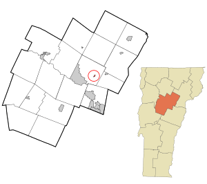
Location in Washington County and the state of Vermont
|
|
| Country | United States |
| State | Vermont |
| County | Washington |
| Area | |
| • Total | 0.10 sq mi (0.25 km2) |
| • Land | 0.09 sq mi (0.24 km2) |
| • Water | 0.004 sq mi (0.01 km2) |
| Elevation | 728 ft (222 m) |
| Population
(2010)
|
|
| • Total | 80 |
| • Density | 830/sq mi (320/km2) |
| Time zone | UTC-5 (Eastern (EST)) |
| • Summer (DST) | UTC-4 (EDT) |
| ZIP code |
05651
|
| Area code(s) | 802 |
| FIPS code | 50-21850 |
East Montpelier is a small village in Washington County, Vermont. It is part of the larger town of East Montpelier. In 2010, about 80 people lived in this village. It's known as a census-designated place (CDP). This means it's a special area defined by the government for counting people.
Where is East Montpelier Located?
East Montpelier village is in the state of Vermont, in the United States. It covers a very small area, about 0.25 square kilometers (0.1 square miles). Most of this area is land, with a tiny bit of water.
How to Get There
You can find East Montpelier along U.S. Route 2. It's about 7 miles (11 km) east of Montpelier. Montpelier is the capital city of Vermont. East Montpelier is also 31 miles (50 km) west of St. Johnsbury.
Another road, Vermont Route 14, also goes through the village. This road leads north to Hardwick and south to Barre.
Natural Features
The village of East Montpelier is located on the north side of the Winooski River. This river is an important natural feature in the area.
See also
 In Spanish: East Montpelier (condado de Washington) para niños
 | Georgia Louise Harris Brown |
 | Julian Abele |
 | Norma Merrick Sklarek |
 | William Sidney Pittman |

