Woodbury, Vermont facts for kids
Quick facts for kids
Woodbury, Vermont
|
|
|---|---|

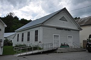
Woodbury Town Hall
|
|

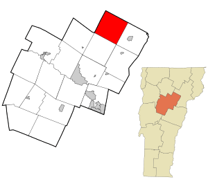
Location in Washington County and the state of Vermont
|
|
| Country | United States |
| State | Vermont |
| County | Washington |
| Communities |
|
| Area | |
| • Total | 39.1 sq mi (101.3 km2) |
| • Land | 37.5 sq mi (97.1 km2) |
| • Water | 1.6 sq mi (4.1 km2) |
| Elevation | 1,470 ft (448 m) |
| Population
(2020)
|
|
| • Total | 928 |
| • Density | 23.727/sq mi (9.161/km2) |
| Time zone | UTC-5 (Eastern (EST)) |
| • Summer (DST) | UTC-4 (EDT) |
| ZIP Codes | |
| Area code(s) | 802 |
| FIPS code | 50-85525 |
| GNIS feature ID | 1462270 |
Woodbury is a small town located in Washington County, Vermont, in the United States. In 2020, about 928 people lived there.
Contents
History of Woodbury
Woodbury was officially created and settled in the late 1700s. After the American Civil War, people found that they could make money by digging up granite. Granite is a very hard stone.
To move the heavy stone, the Hardwick and Woodbury Railroad was built. This train line took the granite from the quarries in Woodbury to workshops in nearby Hardwick. From Hardwick, the granite could be sent to other places by train.
Over time, the business of finishing granite in Woodbury became less popular. However, granite is still dug up in the town today. A type of granite called "Woodbury Gray" is still sold.
Did you know? The 2024 video game Fears to Fathom: Woodbury Getaway is set in this town!
Woodbury's Geography
Woodbury covers a total area of about 101.3 square kilometers (39.1 square miles). Most of this area, about 97.1 square kilometers (37.5 square miles), is land. The rest, about 4.1 square kilometers (1.6 square miles), is water. This means about 4% of the town's area is covered by water.
Population Changes in Woodbury
| Historical population | |||
|---|---|---|---|
| Census | Pop. | %± | |
| 1800 | 23 | — | |
| 1810 | 254 | 1,004.3% | |
| 1820 | 432 | 70.1% | |
| 1830 | 824 | 90.7% | |
| 1840 | 1,092 | 32.5% | |
| 1850 | 1,070 | −2.0% | |
| 1860 | 999 | −6.6% | |
| 1870 | 902 | −9.7% | |
| 1880 | 856 | −5.1% | |
| 1890 | 810 | −5.4% | |
| 1900 | 862 | 6.4% | |
| 1910 | 824 | −4.4% | |
| 1920 | 686 | −16.7% | |
| 1930 | 529 | −22.9% | |
| 1940 | 463 | −12.5% | |
| 1950 | 449 | −3.0% | |
| 1960 | 317 | −29.4% | |
| 1970 | 399 | 25.9% | |
| 1980 | 573 | 43.6% | |
| 1990 | 766 | 33.7% | |
| 2000 | 809 | 5.6% | |
| 2010 | 906 | 12.0% | |
| 2020 | 928 | 2.4% | |
| U.S. Decennial Census | |||
The population of Woodbury has changed a lot over the years. In 1800, only 23 people lived there. The number grew to over 1,000 by 1840. Then, it slowly went down for many years. By 1960, only 317 people lived in Woodbury. Since then, the population has grown again. In 2020, 928 people called Woodbury home.
In the year 2000, there were 809 people living in Woodbury. About 23.6% of the people were under 18 years old. The median age was 40 years old. This means half the people were younger than 40 and half were older.
Famous People from Woodbury
Some notable people have connections to Woodbury:
- Seymour Ainsworth: A businessman who was important in Saratoga Springs, New York. He was also a member of the New York State Assembly. He was born in Woodbury.
- Charles H. Heath: He served as the President pro tempore of the Vermont Senate.
- Charles Webster Leonard: A businessman who worked in Vermont, Massachusetts, and New York City. He was an executive at the Woodbury Granite Company.
- Bob Smith: A Major League Baseball pitcher. He was born in Woodbury.
See also
 In Spanish: Woodbury (Vermont) para niños
 | James B. Knighten |
 | Azellia White |
 | Willa Brown |


