Addison County, Vermont facts for kids
Quick facts for kids
Addison County
|
|
|---|---|
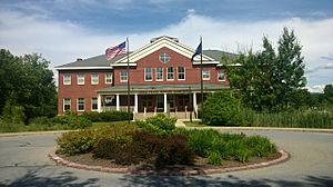
Addison County courthouse in Middlebury
|
|
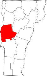
Location within the U.S. state of Vermont
|
|
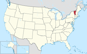 Vermont's location within the U.S. |
|
| Country | |
| State | |
| Founded | 1785 |
| Named for | Joseph Addison |
| Shire Town | Middlebury |
| Largest town | Middlebury |
| Area | |
| • Total | 808 sq mi (2,090 km2) |
| • Land | 766 sq mi (1,980 km2) |
| • Water | 41 sq mi (110 km2) 5.1%% |
| Population
(2020)
|
|
| • Total | 37,363 |
| • Density | 46.241/sq mi (17.854/km2) |
| Time zone | UTC−5 (Eastern) |
| • Summer (DST) | UTC−4 (EDT) |
| Congressional district | At-large |
Addison County is a county located in the state of Vermont. In 2020, about 37,363 people lived there. Its main town, also called the county seat, is Middlebury. The county is named after Joseph Addison, a famous English writer.
Contents
History of Addison County
Early Settlers and French Influence
Before Europeans arrived, the Iroquois people lived in this area. In 1609, Europeans began to explore the region. French settlers from Crown Point, New York, started moving across Lake Champlain. By 1730, some families had settled at Chimney Point. A year later, in 1731, Fort Frederic was built nearby.
British Arrival and American Independence
In 1759, a British general named General Amherst took control of the area. More British settlers then moved in. A very important event for American independence was the Battle of Bennington. It happened on August 16, 1777, and helped the Americans fight against the British.
Forming the County and Early Economy
Addison County was officially created on October 18, 1785. At this time, Vermont was its own republic. In 1791, Vermont joined the United States.
At first, farmers in the county mainly grew wheat. But in the 1820s, they started raising sheep instead. The Champlain Canal opened in 1823. This canal made it easier for ships to travel from the Hudson River. By 1840, Addison County was producing more wool than any other county in the United States!
Population Growth
When Vermont became part of the U.S. in 1791, about 9,267 people lived in Addison County. By 1830, the population had grown a lot, reaching 26,503 people.
Geography of Addison County
Addison County covers about 808 square miles. Most of this is land (766 square miles), and 41 square miles (about 5.1%) is water. It is the third-largest county in Vermont by total area.
The county is in the western part of Vermont. It is almost in the middle of the state from north to south. The main river here is Otter Creek. It flows through the county from the south to the north.
Neighboring Counties
Addison County shares borders with these other counties:
- Chittenden County - to the north
- Washington County - to the northeast
- Orange County - to the east
- Windsor County - to the southeast
- Rutland County - to the south
- Washington County, New York - to the southwest
- Essex County, New York - to the west
Protected Natural Areas
Part of the Green Mountain National Forest is located in Addison County. This is a special area protected for nature and recreation.
Population Information
| Historical population | |||
|---|---|---|---|
| Census | Pop. | %± | |
| 1790 | 6,420 | — | |
| 1800 | 13,417 | 109.0% | |
| 1810 | 19,998 | 49.0% | |
| 1820 | 20,469 | 2.4% | |
| 1830 | 24,940 | 21.8% | |
| 1840 | 23,583 | −5.4% | |
| 1850 | 26,549 | 12.6% | |
| 1860 | 24,010 | −9.6% | |
| 1870 | 23,484 | −2.2% | |
| 1880 | 24,173 | 2.9% | |
| 1890 | 22,277 | −7.8% | |
| 1900 | 21,912 | −1.6% | |
| 1910 | 20,010 | −8.7% | |
| 1920 | 18,666 | −6.7% | |
| 1930 | 17,952 | −3.8% | |
| 1940 | 17,944 | 0.0% | |
| 1950 | 19,442 | 8.3% | |
| 1960 | 20,076 | 3.3% | |
| 1970 | 24,266 | 20.9% | |
| 1980 | 29,406 | 21.2% | |
| 1990 | 32,953 | 12.1% | |
| 2000 | 35,974 | 9.2% | |
| 2010 | 36,821 | 2.4% | |
| 2020 | 37,363 | 1.5% | |
| U.S. Decennial Census 1790–1960 1900–1990 1990–2000 2010–2018 |
|||
In 2010, there were 36,821 people living in Addison County. There were about 14,084 households. The average age of people in the county was 41.3 years old.
Education in Addison County
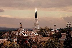
Addison County has several high schools:
- Vergennes Union High School in Vergennes
- Mt. Abraham Union High School in Bristol
- Middlebury Union High School in Middlebury
- Middlebury Union Middle School in Middlebury
The county is also home to two colleges: Middlebury College and the Community College of Vermont. Both are located in Middlebury.
Transportation
Air Travel
The Middlebury State Airport is used for private planes in Addison County. For bigger commercial flights, people can go to Burlington International Airport to the north or Rutland Southern Vermont Regional Airport to the south.
Public Transportation
Public bus service in Addison County is run by Tri-Valley Transit (formerly ACTR). There are many bus routes around Middlebury. These connect to towns like Vergennes, New Haven, and Bristol. There is also seasonal service to Middlebury Snow Bowl. Commuter buses go to Burlington and Rutland.
Tri-Valley Transit also has a Dial-A-Ride System. This system helps people who might need special transportation. Volunteer drivers help provide these rides. You can find more information at www.actr-vt.org.
Train Service
Amtrak's Ethan Allen Express train stops at two stations in Addison County: Middlebury and Ferrisburgh–Vergennes. This train travels to major cities like Burlington, Rutland, Albany, and New York City. This train service started in July 2022. It is the first regular passenger train route in the county since 1953.
Major Highways
Communities in Addison County
City
Towns
Census-designated places
These are specific areas within towns that are recognized for census purposes:
- Bristol
- East Middlebury
- Lincoln
- Middlebury
- New Haven
- South Lincoln
Other Unincorporated Communities
These are smaller communities that are not officially cities or towns:
See also
 In Spanish: Condado de Addison para niños
 | Precious Adams |
 | Lauren Anderson |
 | Janet Collins |


