Bristol (CDP), Vermont facts for kids
Quick facts for kids
Bristol (CDP), Vermont
|
|
|---|---|

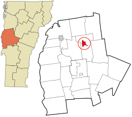
Location in Addison County and the state of Vermont.
|
|
| Country | United States |
| State | Vermont |
| County | Addison |
| Town | Bristol |
| Area | |
| • Total | 2.15 sq mi (5.58 km2) |
| • Land | 2.13 sq mi (5.51 km2) |
| • Water | 0.03 sq mi (0.07 km2) |
| Elevation | 571 ft (174 m) |
| Population
(2020)
|
|
| • Total | 1,936 |
| • Density | 898.6/sq mi (347.0/km2) |
| Time zone | UTC-5 (Eastern (EST)) |
| • Summer (DST) | UTC-4 (EDT) |
| ZIP code |
05443
|
| Area code(s) | 802 |
| FIPS code | 50-08950 |
| GNIS feature ID | 1460661 |
Bristol is a small community located in Addison County, Vermont, in the United States. It is the main part of the larger town of Bristol. This area is known as a census-designated place (CDP), which means it's a specific area identified by the U.S. Census Bureau for statistical purposes.
In 2020, about 1,936 people lived in Bristol CDP. This is out of a total of 3,782 people who live in the entire town of Bristol.
Contents
Exploring Bristol's Location and Landscape
Bristol CDP is found in the northwest part of the town of Bristol. It sits on the north side of the New Haven River. This river flows out of the Green Mountains, which are located to the east.
Key Roads and Travel Routes
Vermont Route 17 goes right through Bristol. If you head west on this road for about 5 miles (8 kilometers), you'll reach U.S. Route 7 at New Haven Junction. If you travel east on Route 17, it crosses the Green Mountains through a place called Appalachian Gap. This journey is about 20 miles (32 kilometers) long and leads to Waitsfield.
Vermont Route 116 also runs through Bristol, sharing some of its path with VT 17. Route 116 goes north for about 8 miles (13 kilometers) to Starksboro. If you go south on Route 116, it's about 12 miles (19 kilometers) to East Middlebury.
Size of Bristol CDP
The United States Census Bureau reports that Bristol CDP covers a total area of about 2.15 square miles (5.58 square kilometers). Most of this area, about 2.13 square miles (5.51 square kilometers), is land. A small part, about 0.03 square miles (0.07 square kilometers), is water. This means about 1.24% of Bristol CDP is covered by water.
See also
 In Spanish: Bristol (condado de Addison) para niños
 | Emma Amos |
 | Edward Mitchell Bannister |
 | Larry D. Alexander |
 | Ernie Barnes |

