Orange County, Vermont facts for kids
Quick facts for kids
Orange County
|
|
|---|---|

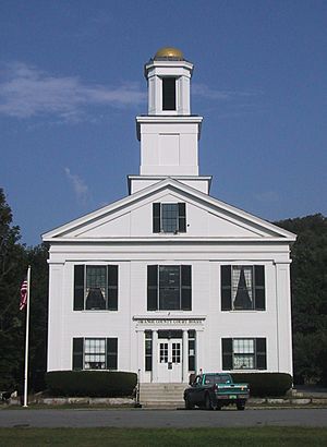
Orange County Superior Court in Chelsea
|
|

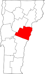
Location within the U.S. state of Vermont
|
|
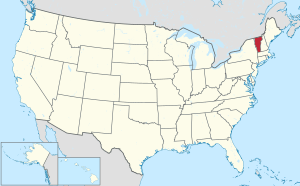
 Vermont's location within the U.S. |
|
| Country | |
| State | |
| Founded | 1781 |
| Named for | William of Orange (William III of England) |
| Shire Town | Chelsea |
| Largest town | Randolph |
| Area | |
| • Total | 692 sq mi (1,790 km2) |
| • Land | 687 sq mi (1,780 km2) |
| • Water | 5.2 sq mi (13 km2) 0.8%% |
| Population
(2020)
|
|
| • Total | 29,277 |
| Time zone | UTC−5 (Eastern) |
| • Summer (DST) | UTC−4 (EDT) |
| Congressional district | At-large |
Orange County is a place in the state of Vermont, USA. It is a type of local government area called a county. In 2020, about 29,277 people lived here. The main town, or county seat, is Chelsea. Orange County was created on February 2, 1781. It was one of the first counties in Vermont.
Contents
Exploring Orange County's Geography
Orange County covers about 692 square miles. Most of this area, 687 square miles, is land. The remaining 5.2 square miles, which is less than 1%, is water. This county is located near the center of Vermont.
Roads and Travel in Orange County
Even though Orange County has many hills, several important roads cross through it. Two major interstate highways serve the county. Interstate 89 runs north and south through the western part. Interstate 91 runs north and south along the eastern edge, near the New Hampshire border.
Besides the interstates, two U.S. Routes also enter Orange County. U.S. Route 5 runs north and south, similar to I-91, along the eastern side. U.S. Route 302 goes east and west along the northern border with Caledonia County.
Several Vermont state routes are also found here. Vermont Route 12, Vermont Route 14, Vermont Route 25, and Vermont Route 110 all run north and south. Vermont Route 66 and Vermont Route 113 are east and west routes.
Neighboring Counties of Orange County
Orange County shares its borders with several other counties:
- Caledonia County to the northeast
- Grafton County, New Hampshire to the east
- Windsor County to the southwest
- Addison County to the west
- Washington County to the northwest
Understanding Orange County's Population
| Historical population | |||
|---|---|---|---|
| Census | Pop. | %± | |
| 1790 | 10,526 | — | |
| 1800 | 18,238 | 73.3% | |
| 1810 | 25,247 | 38.4% | |
| 1820 | 24,681 | −2.2% | |
| 1830 | 27,285 | 10.6% | |
| 1840 | 27,873 | 2.2% | |
| 1850 | 27,296 | −2.1% | |
| 1860 | 25,455 | −6.7% | |
| 1870 | 23,090 | −9.3% | |
| 1880 | 23,525 | 1.9% | |
| 1890 | 19,575 | −16.8% | |
| 1900 | 19,313 | −1.3% | |
| 1910 | 18,703 | −3.2% | |
| 1920 | 17,279 | −7.6% | |
| 1930 | 16,694 | −3.4% | |
| 1940 | 17,048 | 2.1% | |
| 1950 | 17,027 | −0.1% | |
| 1960 | 16,014 | −5.9% | |
| 1970 | 17,676 | 10.4% | |
| 1980 | 22,739 | 28.6% | |
| 1990 | 26,149 | 15.0% | |
| 2000 | 28,226 | 7.9% | |
| 2010 | 28,936 | 2.5% | |
| 2020 | 29,277 | 1.2% | |
| U.S. Decennial Census 1790–1960 1900–1990 1990–2000 2010–2018 |
|||
Population Details from 2010
In 2010, Orange County had 28,936 people living in 11,887 households. About 7,865 of these were families. The population density was about 42 people per square mile. There were also 14,845 housing units.
Most people in the county (97.0%) were white. Other groups included Asian (0.5%), Black or African American (0.4%), and American Indian (0.3%). About 1.0% of the population was of Hispanic or Latino origin.
The largest ancestry groups were English (22.4%), Irish (16.5%), and French (14.7%). German (10.4%), "American" (7.3%), French Canadian (7.1%), Italian (6.5%), and Scottish (6.5%) ancestries were also common.
About 28.3% of households had children under 18. Over half (51.9%) were married couples living together. The average household had 2.37 people, and the average family had 2.83 people. The median age in the county was 43.8 years.
The median income for a household was $52,079. For families, it was $61,221. About 10.0% of the population lived below the poverty line. This included 13.2% of those under 18 and 7.2% of those aged 65 or older.
How Orange County is Governed
Like all counties in Vermont, Orange County has a small local government. Most of the government's work is handled at the state level. The county government mainly deals with legal and court matters. There are no special "county taxes" that people pay.
Representatives in the Vermont Senate
Towns in Orange County are part of four different Vermont Senate Districts. These districts send representatives to the Vermont Senate.
The Orange Senate district covers most of Orange County. It is represented by Mark A. MacDonald.
The Washington Senate district includes the towns of Braintree and Orange. It also covers all of Washington County and the town of Stowe. This district is represented by Ann Cummings, Andrew Perchlik, and Anne Watson.
The Windsor Senate district includes the town of Thetford in Orange County. It also covers most of Windsor County. Its representatives are Alison Clarkson, Dick McCormack, and Rebecca White.
The Caledonia Senate district includes the town of Newbury in Orange County. It also covers most of Caledonia County. This district is represented by Jane Kitchel.
Political History of Orange County
Orange County has a long history of voting in presidential elections. In 1828, the county voted for John Quincy Adams. In 1832, it chose William Wirt.
From 1836 to 1852, the county mostly voted for candidates from the Whig Party.
Then, from 1856 to 1960, the Republican Party had a very long winning streak in Orange County. This lasted for 104 years! The only exception was in 1912, when the county voted for former president Theodore Roosevelt, who was running for the Progressive Party.
In 1964, Lyndon B. Johnson, a Democrat, won the county. He was the first Democratic presidential candidate to win Orange County, and also the first to win the entire state of Vermont.
After 1964, the county went back to voting Republican for another 20 years. This streak started with Richard Nixon in 1968 and ended with George H. W. Bush in 1988.
Bill Clinton won Orange County in both the 1992 and 1996 presidential elections.
In 2000, George W. Bush won Orange County. This was the last time a Republican presidential candidate won the county.
Since John Kerry won the county in 2004, Orange County has voted for Democratic candidates in every presidential election.
Education in Orange County
Orange County has four main school districts, called supervisory unions:
- Orange East Supervisory Union
- Orange North Supervisory Union
- Orange Southwest Supervisory Union
- Orange Windsor Supervisory Union
Some towns, like Fairlee, Vershire, and West Fairlee, are part of the Rivendell Interstate School District.
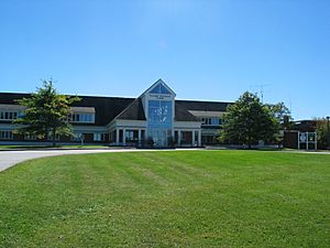
The town of Randolph is also home to a college campus. This is Vermont State University Randolph. It was known as Vermont Technical College until July 2023.
Orange North Supervisory Union Schools
This school union includes:
- Orange Center School
- Washington Village School
- Williamstown Elementary School
- Williamstown Middle High School
Fun and Recreation
Allis State Park is located in the town of Brookfield. It offers a hiking trail, a picnic area, a fire tower, and a small campground for visitors to enjoy.
Towns and Communities
Orange County has several towns and smaller communities:
Towns
- Bradford
- Braintree
- Brookfield
- Chelsea (the main town, located in the center)
- Corinth
- Fairlee
- Newbury
- Orange
- Randolph (the town with the most people in Orange County)
- Strafford
- Thetford
- Topsham
- Tunbridge
- Vershire
- Washington
- West Fairlee
- Williamstown
Villages
- Newbury
- West Newbury
- Wells River
- Union Village
Census-designated places
These are areas that the U.S. Census Bureau defines for gathering population data:
Unincorporated community
More to Explore
See also
 In Spanish: Condado de Orange (Vermont) para niños
 | William L. Dawson |
 | W. E. B. Du Bois |
 | Harry Belafonte |


