Lake Champlain facts for kids
Quick facts for kids Lake Champlain |
|
|---|---|
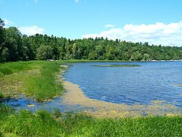
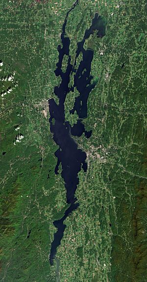
Photo of Lake Champlain taken in August of 2007
|
|
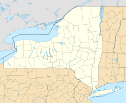
| Location | New York/Vermont in the United States; and Quebec in Canada |
| Coordinates | 44°32′N 73°20′W / 44.53°N 73.33°W |
| Native name | |
| Primary inflows | Otter Creek, Winooski River, Missisquoi River, Poultney River, Lamoille River, Ausable River, Chazy River, Boquet River, Saranac River, La Chute River |
| Primary outflows | Richelieu River |
| Catchment area | 21,326 km2 (8,234 sq mi) |
| Basin countries | Canada, United States |
| Max. length | 172 km (107 mi) |
| Max. width | 23 km (14 mi) |
| Surface area | 1,331 km2 (514 sq mi) |
| Average depth | 19.5 m (64 ft) |
| Max. depth | 122 m (400 ft) |
| Water volume | 25.8 km3 (6.2 cu mi) |
| Residence time | 3.3 years |
| Shore length1 | 945 km (587 mi) |
| Surface elevation | 95 to 100 ft (29 to 30 m) |
| Islands | 80 (Grand Isle, North Hero, Isle La Motte, see list) |
| Settlements | Burlington, Vermont; Plattsburgh, New York |
| 1 Shore length is not a well-defined measure. | |
Lake Champlain is a large, natural freshwater lake in North America. It lies mostly between the US states of New York and Vermont. A small part of the lake also reaches north into Quebec, Canada.
The New York side of the lake is part of the Adirondack Park. This area offers many fun outdoor activities. The cities of Plattsburgh, New York, and Burlington, Vermont, are important towns on the lake's shores. The lake has many islands, including Grand Isle, Isle La Motte, and North Hero.
Lake Champlain is sometimes called "The Sixth Great Lake." This is because it connects to the St. Lawrence Seaway through the Richelieu River. It also connects to the Hudson River using the Champlain Canal.
Contents
- Exploring Lake Champlain's Geography
- Lake Champlain's Rich History
- Protecting Lake Champlain's Environment
- Lake Champlain's Natural Life
- Getting Around Lake Champlain
- Places Around Lake Champlain
- Public Safety on Lake Champlain
- See also
Exploring Lake Champlain's Geography
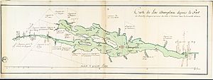
Lake Champlain is part of a huge land system called the Great Appalachian Valley. This valley stretches from Quebec, Canada, all the way to Alabama in the US. Lake Champlain is one of the largest lakes in the United States. It covers about 1,269 square kilometers (490 square miles). The lake is 172 kilometers (107 miles) long and 23 kilometers (14 miles) wide at its widest point. It can be as deep as 122 meters (400 feet).
How Water Flows in Lake Champlain
Lake Champlain is located in a valley between the Green Mountains of Vermont and the Adirondack Mountains of New York. Water flows into the lake from these mountains. The lake then drains northward into the Richelieu River. This river eventually flows into the St. Lawrence River in Quebec.
Many people, about 250,000, get their drinking water from Lake Champlain. Several rivers feed into the lake from Vermont, New York, and Quebec. The lake is also connected to the Hudson River by the Champlain Canal.
Parts of the lake freeze every winter. Sometimes, the entire lake freezes over. In summer, the water temperature can reach about 21°C (70°F).
Lake Champlain's Rich History
For a long time, Lake Champlain has been a natural border between different groups of people. It was a frontier between the Abenaki and Mohawk tribes. The Abenaki name for the lake is Pitawbagok, meaning "middle lake." The Mohawk name, Kaniatarakwà:ronte, means "a bulged lake." It was an important path to the lands of the Iroquois Confederacy.
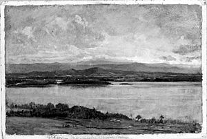
The lake was named after Samuel de Champlain, a French explorer. He saw the lake in July 1609. In the 1700s and 1800s, the lake was very important for trade and military travel.
Lake Champlain During the Revolutionary War
During colonial times, Lake Champlain was a key travel route. It was easier to travel by boat or sled on the lake than on rough, muddy roads. The lake connected the Saint Lawrence River and Hudson River valleys.
Forts were built at Ticonderoga and Crown Point to control who could pass on the lake. These forts saw important battles during the American Revolutionary War.
Early Battles and Control of the Lake
At the start of the Revolutionary War, British forces held the Champlain Valley. But American rebels quickly saw how important it was to control Lake Champlain. The British forts at Ticonderoga and Crown Point had many cannons and were not well-guarded.
In May 1775, just after the Battles of Lexington and Concord, American forces moved to capture these forts. Ethan Allen and his Green Mountain Boys, along with Benedict Arnold, took control of Fort Ticonderoga and Crown Point. This gave the Americans valuable cannons and control of the lake.
Controlling Lake Champlain was vital. It offered a direct path for Americans to invade British Canada. If the British controlled it, they could have split the American colonies.
The Failed Invasion of Quebec
After taking the forts, the Americans planned to attack British Canada. In the winter of 1775–1776, American forces tried to capture Quebec. Brigadier General Richard Montgomery led one army up the Champlain Valley. Benedict Arnold led another through the Maine wilderness.
The American attack on Quebec failed. The soldiers faced harsh winter weather and lacked supplies. Many also got smallpox. In May 1776, British reinforcements arrived, forcing the Americans to retreat back down the Champlain Valley.
Building Fleets and the Battle of Valcour Island
Both sides knew they needed to control the lake. In the summer of 1776, the British and Americans built their naval fleets on Lake Champlain. By October, the Americans had 16 ships, led by General Benedict Arnold. The British had a strong fleet with experienced sailors.
On October 11, 1776, the two fleets met near Valcour Island on Lake Champlain. The Americans fought bravely, but their fleet was heavily damaged. Arnold cleverly led his ships past the British lines under the cover of night.
The British chased the Americans and caught them on October 13. Arnold ordered his men to run their ships aground and escape by land. The Americans lost control of the lake, but their fight had delayed the British invasion. This delay was very important. It gave the Continental Army time to get stronger and win a major victory at Saratoga the next year.
Burgoyne's Campaign and American Victory
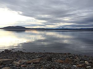
In 1777, British General John Burgoyne led 8,000 troops down Lake Champlain from Canada. His goal was to divide the New England colonies. Burgoyne's army took Fort Ticonderoga in July.
However, on October 7, 1777, American General Horatio Gates defeated Burgoyne's army at the Second Battle of Freeman's Farm. Ten days later, Burgoyne surrendered at Saratoga. This American victory was a turning point in the war. It convinced France to become an ally of the American army.
Life After the Revolutionary War
After the war ended in 1783, Americans quickly settled the Champlain Valley. Many people moved from other New England colonies. They built homes, inns, and businesses. For example, Salmon Dutton, a settler from Vermont, worked as a surveyor and owned a toll road. His home showed the typical life in the area.
Another example is Major General Hezekiah Barnes. He settled in Charlotte, Vermont, in 1787. He worked as a road surveyor and opened an inn and trading post. These stories show how important Lake Champlain was for trade and travel after the war.
The War of 1812 and Fort Blunder
During the War of 1812, British and American forces fought the Battle of Plattsburgh on Lake Champlain on September 11, 1814. The American victory here stopped the last British invasion of the northern states. This win helped the US in peace talks.
After this war, the U.S. Army started building a fort at the northern end of Lake Champlain. It was meant to protect against attacks from Canada. But there was a mistake: the fort was being built on the Canadian side of the border! People called it "Fort Blunder" because of this error. Construction stopped, and locals used the materials for their own buildings.
In 1842, the border was moved north to include "Fort Blunder" in the US. A new, stronger fort, Fort Montgomery, was built there. Parts of it still stand today.
Modern Times on Lake Champlain
In the early 1800s, the Champlain Canal was built. This connected Lake Champlain to the Hudson River. It allowed boats to travel from New York City all the way to Montreal and other parts of Canada.
In 1909, 65,000 people celebrated 300 years since Samuel de Champlain discovered the lake. Important guests, including President William Howard Taft, attended.
In 1929, the first bridge across the lake was opened. It connected Crown Point, New York, to Chimney Point, Vermont. This bridge was used until 2009 when it was found to be unsafe. A new Lake Champlain Bridge opened in 2011.
In 1998, Lake Champlain was briefly called the nation's sixth Great Lake. This was because President Bill Clinton signed a bill that included it. This status would have given the states around it more money for research. But after some debate, the "Great Lake" status was removed. However, universities in New York and Vermont still get funds to study the lake.
"Champ," the Lake Champlain Monster
In 1609, Samuel de Champlain wrote about seeing a strange creature in the lake. He described it as 1.5 meters (5 feet) long, with silver-gray scales and sharp teeth. Native Americans also told stories of similar monsters. This mysterious creature is believed to be the origin of the "Lake Champlain monster" legend.
Champ has become a popular symbol. Sports teams and mascots are named after it, like the Vermont Lake Monsters baseball team. Some people think Champ might be a large sturgeon, a group of diving birds, or even floating logs.
Protecting Lake Champlain's Environment
Lake Champlain is a beautiful and important natural resource. A plan to protect it from pollution was created in 1996. Quebec joined this plan in 2003. The main goals are to reduce pollution, keep the water safe for people, and control harmful non-native species.
One big problem is too much phosphorus in the lake. This comes from farm runoff and city areas. Too much phosphorus causes algae blooms, especially in Missisquoi Bay. These blooms can be harmful. Vermont and Quebec have agreed to reduce their phosphorus pollution.
Even with these concerns, Lake Champlain is safe for swimming, fishing, and boating. It's known for its great fishing, especially for salmon and bass. About 81 types of fish live in the lake. Over 300 kinds of birds use the lake for their homes or during their migrations.
Many groups and government agencies are working to monitor and improve the lake's health. These include the Conservation Law Foundation and the Lake Champlain Basin Program. Farmers are also using new methods to reduce pollution, which is helping the lake.
Scientists are also working to control lampreys in the lake. Lampreys are native fish, but their population has grown too much. They can harm other fish like lake trout and salmon.
Lake Champlain's Natural Life
In 2010, there were many cormorants on the lake. They are now seen as a nuisance because they eat so many fish. Officials are trying to reduce their numbers. Cormorants almost disappeared from the lake in the 1940s and 1950s due to the use of DDT, a harmful chemical.
Ring-billed gulls are also considered a nuisance. Efforts are being made to bring back other birds, like black-crowned night herons and great blue herons, which were also affected by DDT.
In 1989, UNESCO named the area around Lake Champlain a Champlain-Adirondack Biosphere Reserve. This means it's a special place for nature and people to live together.
Getting Around Lake Champlain
Crossing the Lake by Road
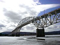
There are three main roads that cross Lake Champlain:
- The Lake Champlain Bridge connects Chimney Point, Vermont, with Crown Point, New York. The old bridge was closed in 2009 because it was unsafe. A new bridge was built quickly and opened in November 2011.
- US 2 crosses the northern part of the lake. It connects Rouses Point, New York, to Grand Isle County, Vermont, and then continues south.
- New York State Route 22 crosses the southern part of the lake, connecting Whitehall, NY and Dresden, Washington County, New York.
Crossing the Lake by Ferry
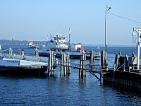
Ferries also help people cross the wider parts of the lake. The Lake Champlain Transportation Company operates ferries at:
- Charlotte, Vermont, to Essex, New York (sometimes closed in winter).
- Grand Isle, Vermont, to Cumberland Head, New York (runs year-round, even breaking ice).
The most southern ferry connects Ticonderoga, New York, with Shoreham, Vermont.
Crossing the Lake by Railroad
Four major railroad crossings were built over the lake. Today, only one is still used.
- An old "floating" rail bridge from Larabees Point, Vermont, to Ticonderoga, New York, was abandoned in 1918. Trains sometimes fell into the lake!
- The Island Line Causeway in Vermont was a long path made of rock. Trains used it from 1901 to 1961. Now, this causeway is a popular path for cyclists, runners, and fishers.
- Another rail bridge between Alburgh, Vermont and Rouses Point, New York, was removed in 1964.
- The rail bridge between Swanton and Alburgh, Vermont, is still used by the New England Central Railroad.
Waterways and Canals
Lake Champlain is part of a larger system of waterways. It connects to the Erie Canal through the Champlain Canal. This connection opened in 1823. It also connects to the St. Lawrence River via the Richelieu River. The Chambly Canal helps boats get around rapids on the Richelieu River.
Together, these waterways are part of the Lakes to Locks Passage. The lake is also part of the 1,190-kilometer (740-mile) Northern Forest Canoe Trail. This trail starts in New York and ends in Maine.
Places Around Lake Champlain
Major Cities on the Lake
Burlington, Vermont is the biggest city on Lake Champlain, with about 44,743 people (2020). The next largest cities are Plattsburgh, New York, and South Burlington, Vermont.
Islands of Lake Champlain
Lake Champlain has about 80 islands. Three of these islands make up four entire towns in Vermont. The largest islands include:
- South Hero Island (which includes the towns of Grand Isle and South Hero, Vermont)
- North Hero Island (home to the town of North Hero, Vermont)
- Isle La Motte (where the town of Isle La Motte, Vermont is located)
- Valcour Island, New York
- Juniper Island
- Three Sisters
- Four Brothers
- Savage Island
- Burton Island (a State Park)
- Cloak Island
- Garden Island (also called Gunboat Island)
- Crab Island
- Dameas Island
- Hen Island
- Butler's Island
- Carleton's Prize
- Young Island
- Providence Island
- Stave Island
- Sunset Island
Lighthouses on the Lake
Several lighthouses stand on Lake Champlain:
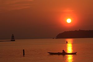
- Bluff Point Lighthouse, on Valcour Island, was built in 1871. It had a full-time lightkeeper until 1930.
- Cumberland Head Light is an old stone lighthouse that is now privately owned.
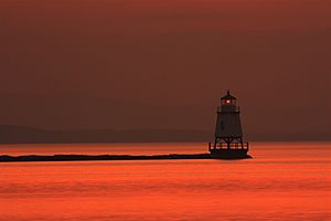
- Isle La Motte Light is on the northern end of the island. It used to be red but has faded to pink.
- Juniper Island Light is a cast-iron lighthouse from 1846. It is now privately owned.
- There is also a privately owned, historic lighthouse on Point Au Roche.
- Split Rock Lighthouse is near Essex, New York. It is close to a natural border that once divided the Mohawk and Algonquin tribes.
Parks Around Lake Champlain
Many parks are found in the Lake Champlain area, in both New York and Vermont.
In New York, you can visit Point Au Roche State Park. It has hiking trails, cross-country skiing, and a public beach. Ausable Point Campground is also in the Adirondack Park. Cumberland Bay State Park offers camping, a beach, and sports fields.
In Vermont, there are parks like Sand Bar State Park in Milton. It has a long sand beach, swimming, and boat rentals. Grand Isle State Park has camping, a nature walk, and a play area. Button Bay State Park in Ferrisburgh offers campsites and a swimming pool. Burlington's Waterfront Park is a popular spot in the city.
Public Safety on Lake Champlain
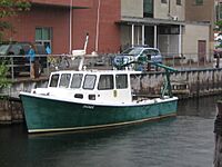
The Coast Guard Station Burlington helps keep people safe on the American side of the lake. They do search and rescue, law enforcement, and ice rescue all year round. Other groups that help include the U.S. Border Patrol, Royal Canadian Mounted Police, Vermont State Police, and New York State Police.
See also
 In Spanish: Lago Champlain para niños
 | Percy Lavon Julian |
 | Katherine Johnson |
 | George Washington Carver |
 | Annie Easley |


