Whitehall, New York facts for kids
Quick facts for kids
Whitehall
|
|
|---|---|

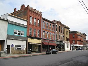
Main Street Historic District
|
|
| Nickname(s):
The Smallest Town In New York
|
|

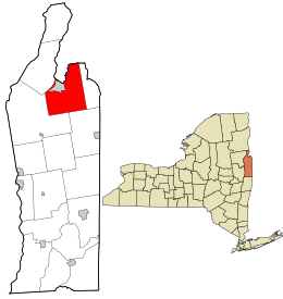
Location in Washington County and the state of New York.
|
|
| Country | United States |
| State | New York |
| County | Washington |
| Area | |
| • Total | 58.82 sq mi (152.35 km2) |
| • Land | 57.16 sq mi (148.04 km2) |
| • Water | 1.66 sq mi (4.31 km2) |
| Population
(2020)
|
|
| • Total | 4,023 |
| • Density | 69.07/sq mi (26.67/km2) |
| Area code(s) | 518 |
| FIPS code | 36-115-81633 |
Whitehall is a town in Washington County, New York, United States. It is part of the Glens Falls Metropolitan Statistical Area. In 2020, about 4,023 people lived here.
The Town of Whitehall also has a village inside it, which is also called Whitehall.
Contents
History of Whitehall
In the late 1600s, this area was a place where English and French colonies would prepare for attacks against each other. Whitehall was first called "Skenesborough" in 1759. It was settled by a British officer named Philip Skene. He later went back to Britain and was declared an enemy by New York State.
During the French and Indian War, Whitehall was one of two main paths connecting the British and French colonies.
Whitehall and the American Revolution
During the American Revolution, American soldiers captured the village of Skenesborough in 1774. Benedict Arnold, working for Philip Schuyler, built a group of ships here. These ships were used to fight British forces at Valcour Island. Because of this, many people say Whitehall is the birthplace of the U.S. Navy.
After the battle, the American ships that were left came back here. They were then sunk on purpose so the enemy couldn't get them. The next year, John Burgoyne led his soldiers through this area on their way to the Battle of Saratoga. After the war, the town's name was changed to Whitehall.
Later History
During the War of 1812, ships were built here again to fight British forces on Lake Champlain. This led to the Battle of Plattsburgh. In 1823, the Champlain Canal was finished, connecting to Whitehall. This canal helped move goods and people.
The Rensselaer and Saratoga Railroad reached Whitehall in 1848. This made travel and trade even easier. In the second half of the 1800s, the silk industry became very important in the town.
Because of its role in the American Revolution, the New York State government officially declared Whitehall the birthplace of the United States Navy in 1960.
Geography of Whitehall

Whitehall covers about 58.8 square miles. Most of this area, about 57.6 square miles, is land. The rest, about 1.1 square miles, is water.
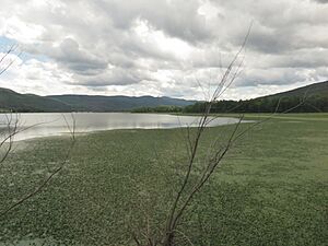
The northern border of the town is also the border with Vermont. The Champlain Canal runs through the western part of Whitehall. The South Bay of Lake Champlain forms part of the town's western edge.
Two main roads, U. S. Route 4 and NY Route 22, go through Whitehall from north to south. US-4 turns east at Whitehall village, while NY-22 turns west towards the Town of Dresden.
Climate
| Climate data for Whitehall, New York (1991–2020 normals, extremes 1937–present) | |||||||||||||
|---|---|---|---|---|---|---|---|---|---|---|---|---|---|
| Month | Jan | Feb | Mar | Apr | May | Jun | Jul | Aug | Sep | Oct | Nov | Dec | Year |
| Record high °F (°C) | 64 (18) |
67 (19) |
84 (29) |
94 (34) |
94 (34) |
102 (39) |
103 (39) |
101 (38) |
99 (37) |
87 (31) |
79 (26) |
68 (20) |
103 (39) |
| Mean daily maximum °F (°C) | 30.3 (−0.9) |
34.0 (1.1) |
43.1 (6.2) |
57.9 (14.4) |
71.0 (21.7) |
79.1 (26.2) |
83.5 (28.6) |
81.7 (27.6) |
73.9 (23.3) |
60.7 (15.9) |
47.2 (8.4) |
35.5 (1.9) |
58.2 (14.6) |
| Daily mean °F (°C) | 21.2 (−6.0) |
23.2 (−4.9) |
32.8 (0.4) |
46.6 (8.1) |
59.1 (15.1) |
67.8 (19.9) |
72.4 (22.4) |
70.8 (21.6) |
62.8 (17.1) |
50.7 (10.4) |
38.9 (3.8) |
28.0 (−2.2) |
47.9 (8.8) |
| Mean daily minimum °F (°C) | 12.1 (−11.1) |
12.5 (−10.8) |
22.4 (−5.3) |
35.2 (1.8) |
47.2 (8.4) |
56.5 (13.6) |
61.3 (16.3) |
59.9 (15.5) |
51.8 (11.0) |
40.7 (4.8) |
30.7 (−0.7) |
20.5 (−6.4) |
37.6 (3.1) |
| Record low °F (°C) | −36 (−38) |
−38 (−39) |
−27 (−33) |
7 (−14) |
18 (−8) |
31 (−1) |
43 (6) |
37 (3) |
26 (−3) |
8 (−13) |
−2 (−19) |
−28 (−33) |
−38 (−39) |
| Average precipitation inches (mm) | 3.00 (76) |
2.57 (65) |
2.99 (76) |
3.30 (84) |
3.33 (85) |
4.37 (111) |
4.36 (111) |
4.45 (113) |
3.58 (91) |
4.05 (103) |
2.98 (76) |
3.57 (91) |
42.55 (1,081) |
| Average precipitation days (≥ 0.01 in) | 11.3 | 8.4 | 10.4 | 10.9 | 13.8 | 12.3 | 11.9 | 11.0 | 9.7 | 12.7 | 10.7 | 11.5 | 134.6 |
| Source: NOAA | |||||||||||||
Neighboring Towns
 |
Dresden | West Haven, Vermont | Fair Haven, Vermont |  |
| Fort Ann | Hampton | |||
| Fort Ann | Fort Ann | Granville |
People of Whitehall
| Historical population | |||
|---|---|---|---|
| Census | Pop. | %± | |
| 1820 | 2,341 | — | |
| 1830 | 2,888 | 23.4% | |
| 1840 | 3,813 | 32.0% | |
| 1850 | 4,726 | 23.9% | |
| 1860 | 4,862 | 2.9% | |
| 1870 | 4,464 | −8.2% | |
| 1880 | 5,347 | 19.8% | |
| 1890 | 5,402 | 1.0% | |
| 1900 | 5,295 | −2.0% | |
| 1910 | 5,869 | 10.8% | |
| 1920 | 6,008 | 2.4% | |
| 1930 | 5,975 | −0.5% | |
| 1940 | 5,670 | −5.1% | |
| 1950 | 5,256 | −7.3% | |
| 1960 | 4,757 | −9.5% | |
| 1970 | 4,794 | 0.8% | |
| 1980 | 4,427 | −7.7% | |
| 1990 | 4,409 | −0.4% | |
| 2000 | 4,035 | −8.5% | |
| 2010 | 4,042 | 0.2% | |
| 2020 | 4,023 | −0.5% | |
| U.S. Decennial Census | |||
In 2000, there were 4,035 people living in Whitehall. There were 1,611 households, which are groups of people living together. About 31.5% of these households had children under 18.
The population was spread out by age. About 25.7% of the people were under 18 years old. About 15.8% were 65 years or older. The average age in the town was 38 years.
Places in Whitehall
Communities
- East Bay Wildlife Management Area – This is a special area for nature and animals, located northeast of Whitehall village.
- East Whitehall – A small community near the eastern border of the town. The historic Home Farm here was added to the National Register of Historic Places in 2008.
- Grays Corner – Another small community southeast of Whitehall village.
- Whitehall – This is the main village of Whitehall. You can find it where NY-22 and US-4 roads meet in the northern part of the town.
Natural Locations
- Brown Pond – A lake in the southeastern part of Whitehall.
- Castle Creek – A small river that flows into the Mettawee River.
- Death Rock – A high point (elevation) north of West Mountain.
- Dolph Pond – A lake in the southwestern part of Whitehall.
- Mettawee River – A stream that flows into the Champlain Canal.
- Mud Brook – A stream that flows into the Champlain Canal, south of Whitehall village.
- Ore Bed Hill – A high point northeast of Grays Corner.
- Ravine – A series of rising areas along the east side of Skene Mountain.
- Tub Mountain – A high point southwest of Grays Corner.
- Warner Hill – A high point north of Whitehall village.
- West Mountain – A high point near South Bay.
- Wood Creek – A creek that helps form the path of the Champlain Canal.
Famous People from Whitehall
- Robert Bartholomew – A person who studies society and health, and also a journalist.
- Codie Bascue – An Olympic bobsledder who competed for Team USA in the 2018 Winter Olympics.
- William Wallace Smith Bliss – A United States Army officer and a mathematician, who was born in Whitehall.
- Henry G. Burleigh – A person who represented New York in the United States government.
- Joseph H. Potter – A judge for the New York State Supreme Court. He also built the original "castle" known as Skene Manor.
- William P. Potter – A high-ranking officer (rear admiral) in the U.S. Navy.
- Solomon L. Spink – A person who represented the Dakota Territory in the United States government from 1869 to 1871.
See also
 In Spanish: Whitehall (Nueva York) para niños
 | Stephanie Wilson |
 | Charles Bolden |
 | Ronald McNair |
 | Frederick D. Gregory |

