Lakes to Locks Passage facts for kids
Quick facts for kids
Lakes to Locks Passage |
|
|---|---|
| Route du Richelieu (Quebec segment) | |
| Route information | |
| Existed | 2002 (US); 2012 (Quebec)–present |
| Highway route | |
| South end | Waterford, New York |
| North end | Sorel-Tracy, Quebec |
| Waterway route | |
| South end | Cohoes, New York |
| North end | Sorel-Tracy, Quebec |
The Lakes to Locks Passage in the United States and the Route du Richelieu in Canada are like special roads and waterways that take you on a beautiful journey. They connect places in northeastern New York (USA) and southern Quebec (Canada).
This passage links important waterways like the upper Hudson River, Champlain Canal, Lake George, and Lake Champlain. This network was once North America's first "super-highway," connecting upstate New York with Quebec.
The goal of the Lakes to Locks Passage is to make this whole area a single, amazing place to visit. The US part is a recognized New York State Scenic Byway, a National Scenic Byway, and even an All-American Road. This means it's one of the best scenic routes in the country! The Canadian part is a special tourist route recognized by the Quebec Ministry of Tourism.
Contents
Exploring the Lakes to Locks Passage
This special route stretches from just north of Albany in New York to the border near Rouses Point. It includes both roads for driving and waterways for boats. The waterway part continues north into Canada to connect with the St. Lawrence River.
Along the way, you can still see the strong influence of French, English, and Dutch settlers in the towns, waterfalls, and lake harbors. Many communities are called "Waypoint Communities" and are ready to welcome visitors. Local museums and attractions serve as "Heritage Centers," offering lots to learn. Almost every community has tours you can do by driving, biking, or walking.
The Highway Route
The Lakes to Locks Passage road starts where U.S. Route 4 and New York State Route 32 meet in Waterford, about 10 miles (16 km) north of Albany. It ends where US 11 and NY 9B meet in Rouses Point, right next to the Canada-US border.
The main roads that make up this route are:
- US 4 from Waterford to Whitehall.
- NY 22 from Whitehall to Keeseville.
- US 9 from Keeseville to Chazy.
- NY 9B from Chazy to Rouses Point.
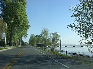
There are also scenic lakeside roads on Point Au Roche and Cumberland Head.
You can cross the border between Rouses Point, New York, and Lacolle, Quebec. This allows travelers to continue their journey from the Lakes to Locks Passage into the Route du Richelieu.
From Lacolle, the Route du Richelieu goes north to Lacolle village, then turns east on Route 202. It then splits into two paths along both sides of the Richelieu River until it reaches the St. Lawrence River in Sorel-Tracy.
- The western path follows the west bank of the Richelieu River. It passes through towns like Saint-Jean-sur-Richelieu, Chambly, and Beloeil. This path mostly uses Route 223, but it also goes through the historic centers of Vieux-Saint-Jean and Chambly.
- The eastern path crosses the Jean-Jacques-Bertrand Bridge. It then follows Routes 225 and 133 through towns like Henryville, Richelieu, and Mont-Saint-Hilaire. Much of this eastern path is called the chemin des Patriotes, named for the Richelieu valley's role in the Lower Canada Rebellion of 1837-38.
Bridges in Saint-Jean-sur-Richelieu, between Chambly and Richelieu, and between Beloeil and Mont-Saint-Hilaire, let you drive between the two paths. Both paths meet again at the end, at the Sorel‑Tracy Heritage Interpretation Centre, right on the bank of the Saint Lawrence River.
The Waterway Route
The waterway route starts at the Erie Canal (on the Mohawk River) in Cohoes, about 9 miles (14 km) north of Albany. It goes all the way to the St. Lawrence River at Sorel-Tracy, Quebec, about 40 miles (64 km) northeast of Montreal. This waterway was North America's first connected water route, and it helped shape both the United States and Canada.
It offers access to over 225 miles (362 km) of amazing historic, natural, cultural, and fun places. These include the Champlain Canal, upper Hudson River, Lake George, and Lake Champlain in New York. In Quebec, it includes the Chambly Canal and the Richelieu River.
Here's how the waterway flows:
- The Champlain Canal goes from Cohoes to Whitehall. It has 11 locks, which are like water elevators for boats.
- Lake Champlain and the Richelieu River connect from Whitehall, New York, to Saint-Jean-sur-Richelieu, Quebec.
- The Chambly Canal helps boats get around rapids on the Richelieu River, from Saint-Jean-sur-Richelieu to Chambly. It has 9 locks.
- The Richelieu River continues from Chambly to Sorel-Tracy.
Cool Places to Visit
There are many interesting spots along the Lakes to Locks Passage and Route du Richelieu.
In Quebec along Route du Richelieu
- Fort Chambly: A historic fort in Chambly.
- Honoré Mercier museum: Learn about history in Sainte-Anne-de-Sabrevois.
- Fort Lennox: Another historic fort on an island in Saint-Paul-de-l'île-aux-noix.
- Chambly Canal: A historic canal great for boating and walking.
- Maison des Gouverneurs: A heritage center in Sorel-Tracy.
- Gault Nature Reserve: A beautiful natural area on Mont Saint-Hilaire.
In New York State along Lakes to Locks Passage
- Fort Ticonderoga: A famous historic fort.
- North Star Underground Railroad Museum: Learn about the Underground Railroad.
- Ausable Chasm: A stunning gorge with waterfalls and trails.
History of the Passages
In 1992, New York State named the Champlain Trail a New York State Scenic Byway. This recognized its beautiful scenery, history, culture, nature, and fun activities around Lake Champlain. In 2000, communities around Lake Champlain in New York and Vermont worked together on a plan for the Champlain Trail. At the same time, communities along the Champlain Canal in New York also made a plan for the Champlain Canal Byway.
In May 2000, the New York State Scenic Byways Advisory Board (NYSSBAB) saw how well these groups had planned. They decided to combine the Champlain Canal Byway and the Champlain Trail into one big organization. This led to the creation of the Lakes to Locks Passage.
The Lakes to Locks Passage was recognized as an All-American Road by the United States Department of Transportation in 2002. This was because of its important history and many recreational opportunities. As an All-American Road, it's one of a special group of roads that the government promotes as a "premier destination" for tourists from all over the world.
The Lakes to Locks Passage, Inc. is a non-profit group that manages the byway. They work to help people appreciate, recognize, and take care of the natural, cultural, and historic treasures along the Hudson River, Champlain Canal, Lake George, and Lake Champlain.
In 2005, at a meeting between Quebec and New York, the Lakes to Locks Passage Inc. and a group from Quebec called the Regional Conference of Elected Officers (CRÉ) signed an agreement. They decided to work together to promote the region and create suggested routes for travelers between Quebec and New York.
In Quebec, people had been talking about a tourist route along the Richelieu River since the mid-1990s. The Route du Richelieu was officially announced by the CRÉ in March 2010, after getting approval from the Quebec Ministry of Tourism in 2009. The CRÉ and Tourisme Montérégie officially opened the route in July 2012.
 | James Van Der Zee |
 | Alma Thomas |
 | Ellis Wilson |
 | Margaret Taylor-Burroughs |


