Mont Saint-Hilaire facts for kids
Quick facts for kids Mont Saint-HilaireWigwômadenizibo |
|
|---|---|
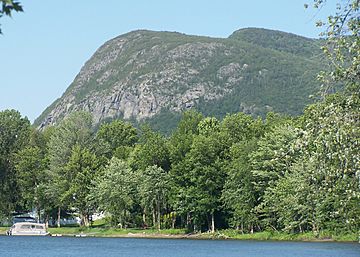
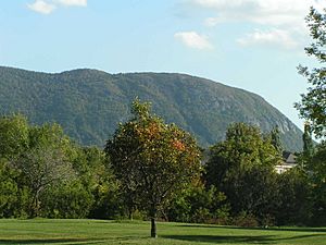
Mont Saint-Hilaire (Dieppe and Rocky summits) seen from Otterburn Park
|
|
| Highest point | |
| Elevation | 414 m (1,358 ft) |
| Geography | |
| Location | Mont-Saint-Hilaire, Quebec, Canada |
| Parent range | Monteregian Hills |
| Topo map | NTS 031H/11 |
| Geology | |
| Age of rock | Early Cretaceous |
| Mountain type | Intrusive stock |
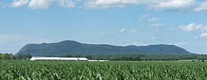
Mont Saint-Hilaire (also called Mount Saint-Hilaire) is a special hill in southern Quebec, Canada. Its Abenaki name is Wigwômadenizibo, which means "little house-shaped mountain." This mountain is about 414 metres (1,358 feet) high. It stands out from the flat land around it.
Mont Saint-Hilaire is located about 30 kilometres (19 miles) east of Montreal. It is also just east of the Richelieu River. Nearby towns include Mont-Saint-Hilaire, Saint-Jean-Baptiste, Otterburn Park, Beloeil, and McMasterville.
This mountain is part of the Monteregian Hills. It is a very important natural area. It is one of the last places with old forests from the Saint-Lawrence valley. Because of this, it is a special protected area called a biosphere reserve.
Most of the mountain belongs to McGill University. They call it the Gault Nature Reserve. This reserve is like a third campus for the university. The western part of the mountain is open to visitors for hiking and cross-country skiing. This area is called the Milieu Naturel (natural area). But the eastern part, called the Milieu de Conservation (preservation area), is closed to the public.
For a long time, people thought Mont Saint-Hilaire was the highest mountain in Quebec. This was because it stands out so much from the flat land. However, at 414 metres, it is not the highest. Quebec has much taller mountains, like Mount Caubvick.
Mont Saint-Hilaire has many different animals and plants. It also has rare minerals. Some of these minerals were first found here. Others are only found in this area. There is a quarry on the mountain's north-eastern side where some minerals are dug up. The soil here is also great for growing apple trees. Many people visit the mountain's apple orchards every year.
Contents
What is the Geography of Mont Saint-Hilaire?
The mountain rises 414 metres (1,358 feet) above sea level. This means it is about 400 metres (1,312 feet) taller than the plains around it. Mont Saint-Hilaire has several peaks. These peaks surround a central lake called Lac Hertel (Lake Hertel).
Most of the well-known peaks are in the western part of the mountain. This is the part that is open to visitors. Some of these peaks are:
- Pain de Sucre (Sugar Loaf), which is 414 metres (1,358 feet) high.
- Sunrise, which is 405 metres (1,329 feet) high.
- Rocky, which is 403 metres (1,322 feet) high.
- Sommet Dieppe (Dieppe Summit), which is 371 metres (1,217 feet) high.
- Burnt Hill, which is 320 metres (1,050 feet) high.
The peaks on the eastern side of the mountain are not well known. This area is closed to the public. Most maps do not even show these peaks clearly. Only a few names are known, like East Hill and Lake Hill. These peaks range from 277 to 392 metres (909 to 1,286 feet) high.
What are the Cliffs of Mont Saint-Hilaire?
One of the most famous parts of the mountain is its cliffs. They are known as the falaise dieppe or falaise de Dieppe (Dieppe cliffs). These cliffs are part of the Dieppe summit. They are nearly 175 metres (574 feet) high.
Some famous parts of the cliffs include the 60-metre (197-foot) high Tour rouge (Red tower). There are also two large slabs of rock. These are the Dalle noire (Black slab) and Dalle Verte (Green slab). They stand at a steep 75-degree angle.
The cliffs have a special ecosystem. They are home to lichens and cedar trees. Some of these cedar trees might be as old as 500 years. The cliffs also host the mountain's peregrine falcons. Rock climbing used to happen here, but it harmed the ecosystem. It was also dangerous for the climbers. A white cross on the cliff remembers a boy scout who died there in 1941.
What is Lac Hertel?
Lac Hertel is a lake at the centre of the mountain. It sits in a bowl-shaped area formed by glaciers. The lake covers about 0.3 square kilometres (0.12 square miles). It is about 9 metres (30 feet) deep at its deepest point.
Three streams flow into the lake. A fourth stream flows out of the lake towards the Richelieu River. Lac Hertel is a backup source of drinking water for the area. Because of this, swimming, fishing, and boating are not allowed in the lake.
Some people used to think Lac Hertel was an old volcano crater. But it was actually formed by glaciers carving out the land. It is not a volcanic crater at all.
How was Mont Saint-Hilaire Formed?
Mont Saint-Hilaire is one of the Monteregian Hills. These are a group of mountains in southern Quebec. They were formed when hot, melted rock (magma) pushed up from deep inside the Earth. This happened between 133 and 120 million years ago, during the Cretaceous Period.
Over millions of years, the softer rocks around these magma intrusions wore away. This left the harder rocks of Mont Saint-Hilaire standing tall. This is why it looks like a hill rising from a flat plain.
What Minerals are Found at Mont Saint-Hilaire?
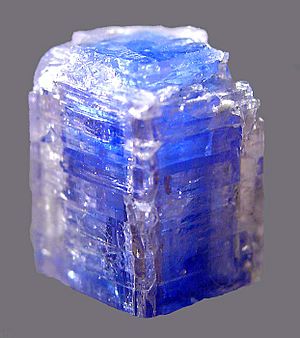
Mont Saint-Hilaire is famous for its many rare and unusual minerals. Scientists have found over 366 different types of minerals here. For 50 of these minerals, Mont Saint-Hilaire is the place where they were first discovered.
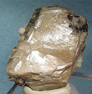
Some minerals found here include Annite, which is very rich in iron. Another mineral called Siderophyllite is also found here in large crystals. The mountain's rocks are also home to minerals like nepheline syenite, diorite, and monzonite.
What is the Ecology of Mont Saint-Hilaire?
Mont Saint-Hilaire is very important for nature. It has some of the last remaining ancient forests of the Gulf of St. Lawrence lowland forests. Because of this, it was named a provincial biosphere reserve in 1978. It also became a federal Migratory Bird Sanctuary in 1960.
The area is home to many different plants and animals. There are 21 plant species that are considered "at risk." Two plant species are even "endangered" under current laws. This shows how important it is to protect this special place.
What is the History of Mont Saint-Hilaire?
The Algonquin First Nations knew Mont Saint-Hilaire well. They used the Pain-de-Sucre peak as a lookout point. From there, they could see the whole Richelieu River valley. The mountain is in the traditional land of the Abenaki people. They call it Wigwômadenizibo, meaning "little house-shaped mountain."
The first European to visit the area was Samuel de Champlain. He explored the Richelieu River in 1603 and 1609. During his second trip, he discovered the mountain.
What is the Gault Reserve?
In 1913, a man named Andrew Hamilton Gault bought the mountain. He wanted to protect its wild nature. He even planned to build a large house there for his retirement. Construction started in 1957. But Gault lived in the house for only three weeks before he passed away.
Gault left the mountain to McGill University, where he had studied. The university then turned it into the "Gault Reserve." This reserve helps protect the mountain's natural beauty.
In 1960, the mountain became a migratory bird sanctuary. In 1970, it was split into two parts: a preservation area (closed to the public) and an area open to visitors. The open area became managed by the Centre de Conservation de la Nature (Nature Conservation Centre) in 1972. In 1978, Mont Saint-Hilaire became Canada's first world biosphere reserve. This was because it held the last parts of the old forests in the Saint-Lawrence Valley.
What are the Different Names of Mont Saint-Hilaire?
The mountain has had many names over time. In the modern Abenaki language, it is called Wigwômadenizibo. This means "the small house-shaped mountain." The nearby Mount Yamaska is called Wigwômadenek, meaning "Wigwam-shaped mountain."
When Samuel de Champlain first saw the mountain, he named it Mont Fort. This could mean "Fort Mountain" or "Mount Strong."
Later, in the 1600s, it was sometimes called Mont Chambly. This was because of the town of Chambly to the south. After 1697, it became known as Mont Rouville. This name came from the Hertel de Rouville family, who owned the land.
When the Campbell family took over, the mountain was called Mont Beloeil. This name came from the town of Beloeil across the Richelieu River. But by the early 1900s, the name Mont Saint-Hilaire became popular. This name came from the parish of Mont-Saint-Hilaire at the foot of the mountain. Even so, people from Beloeil and Mont-Saint-Hilaire argued about the name for many years.
How is Mont Saint-Hilaire Important in Culture?
Mont Saint-Hilaire has a unique shape. Because of this, it has always been important in the culture of the nearby region. It is a major local symbol. Its shape appears in the logos of many towns, like Beloeil, McMasterville, Mont-Saint-Hilaire, and Otterburn Park.
Mont Saint-Hilaire in Art
Many artists have painted Mont Saint-Hilaire. The first was an English painter named John Bainbrigge. He made three watercolour paintings of the mountain around 1838. Later, the mountain appeared in a painting by Cornelius Krieghoff.
Three famous artists are especially linked to the mountain. They were born or lived in Mont-Saint-Hilaire. These are Ozias Leduc (born 1864), his student Paul-Émile Borduas (born 1905), and Jordi Bonet (who moved there in 1969). Leduc is known for his many paintings of the mountain, like L'Heure Mauve. Borduas and Bonet also found inspiration from the mountain in their art.
Mont Saint-Hilaire in Religion
Some evidence suggests that Mont Saint-Hilaire was a sacred place for the Algonquin natives. They may have held special ceremonies there.
The Catholic Church also became important on the mountain. In 1841, a large wooden cross was built on top of the mountain. It was over 30 metres (98 feet) high. There was a chapel at its base. Visitors could even climb inside the hollow cross to the top. A path with stations of the cross led up the mountain. A storm destroyed the cross in 1846. A stone chapel replaced it in 1871, but it burned down in 1876.
Mont Saint-Hilaire in Legends
Many old stories and legends are told about Mont Saint-Hilaire. Local artists and historians have written down some of these tales. However, many oral traditions are now lost.
The legends often feature three fairies. They were said to live in a cave in the cliff for centuries. They later left the mountain and gave up their immortality to marry humans. Other legends talk about the devil. They say there are two paths to hell on the mountain. One place is called les Portes de fer (the Iron gates). These are two large stone slabs found close together on the mountain's slopes.
Lac Hertel is also part of several legends. Some say it has no bottom. Others claim it is connected by underground tunnels to Lake Champlain. One story says the lake formed because the devil tricked early settlers into not going to church.
Another legend is about unusual ice on the northern cliff. A horse-shaped ice formation stays there until late spring. The legend says the spirit of a farmer's horse warns farmers not to plant their crops until this ice melts.
Mont Saint-Hilaire and Mysterious Events
Since the late 1900s, some people believe Mont Saint-Hilaire is a place of unusual activity. The towns around the mountain have reported many UFO sightings. Some groups claim Mont Saint-Hilaire is a main spot for UFO observations in southern Quebec.
On May 22-23, 1981, hundreds of people came to the mountain. They believed UFOs would visit that night. Rain limited what they saw, but some people still reported sightings. Some also believe Mont Saint-Hilaire is an entrance to a hollow earth, where people live inside the planet.
The many unusual minerals and crystals at Mont Saint-Hilaire also interest people who follow the New Age movement and conspiracy theories. They believe the mountain's unique features affect local magnetism and have special powers.
See also
 In Spanish: Monte Saint-Hilaire para niños
 | Sharif Bey |
 | Hale Woodruff |
 | Richmond Barthé |
 | Purvis Young |


