The Northern Forest Canoe Trail (NFCT) is a super long water path for canoes and kayaks! It stretches for about 1,190 kilometers (740 miles) across the northeastern United States and into Canada. This amazing trail starts in Old Forge, New York, in the Adirondacks. It then winds its way all the way to Fort Kent, Maine. Along the way, the trail also passes through Vermont, Quebec (in Canada), and New Hampshire. The Northern Forest Canoe Trail officially opened on June 3, 2006.
Exploring the Northern Forest Canoe Trail
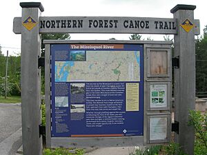
Northern Forest Canoe Trail (NFCT) sign
Imagine a water version of the famous Appalachian Trail! The Northern Forest Canoe Trail is a lot like that. Both are very long trails. Most people use them for short trips, like a day out or an overnight adventure. If someone wants to paddle the entire trail, they usually do it in smaller parts over time.
One big difference from the Appalachian Trail is how the NFCT gets access to places. For campsites and spots where you carry your boat (called "portages"), the NFCT works with landowners to get permission. This is different from buying the land for protection. Also, some parts of the trail need a lot of paddling skill to complete safely.
The trail is split into 13 different sections. Each section has its own maps and information. These sections include:
- Adirondack Country (West, Central, and East) in New York
- Islands and Farms Region in Vermont
- Upper Missisquoi Valley in Vermont and Quebec
- Northeast Kingdom in Quebec and Vermont
- Great North Woods in New Hampshire
- Rangeley Lakes Region in Maine
- Flagstaff Region in Maine
- Greater Jackman Region in Maine
- Moosehead/Penobscot Region in Maine
- Allagash Region (South and North) in Maine
You'll find "trail towns" along the way, like Old Forge, Richford, Vermont, the Errol-Berlin area in New Hampshire, and Rangeley, Maine. In Maine, much of the trail goes through the wild North Maine Woods area.
The trail covers 58 lakes and ponds, 22 rivers and streams. It also has 63 "carries" or portages, which are places where you have to carry your canoe or kayak over land. These portages add up to about 90 kilometers (53 miles). On some parts of the trail, you'll see special yellow diamond signs with blue letters. These signs mark portage trails, campsites, and places to get on or off the water.
The American Canoe Association has given the NFCT a special recommendation as a great water trail.
Spencer Pond and Moosehead Lake, Maine, from Little Spencer Mountain
Rivers and Lakes Along the Trail
The Northern Forest Canoe Trail takes paddlers through many beautiful bodies of water. Here are some of the main ones in each state and province:
New York (147 miles)
Vermont & Québec (174 miles)
New Hampshire (72 miles)
Maine (374 miles)
Amazing Paddlers: Completing the Whole Trail
As of 2016, 95 people have paddled the entire Northern Forest Canoe Trail in one long trip! These are called "through-paddlers." Also, six other people have completed the whole trail by doing it in several shorter trips over time.
The first people to officially through-paddle the trail after it opened were Nicole Grohoski and Thomas Perkins from Ellsworth, Maine. They finished their journey in about 45 days in 2006. Someone named Donnie Mullen actually paddled the trail before it officially opened in 2000. He took about 55 days, but he didn't have all the helpful signs and maps that are available now. The fastest trip was in 2012 by Elspeth Ronnander, Erik Peih, and Emily Johnson. They completed the trail in an incredible 21 days, 3 hours, and 45 minutes!
Books About the Trail
If you're interested in learning more about the Northern Forest Canoe Trail, here are some books you can check out:
- "Paddling the Northern Forest Canoe Trail" by Sam Brakeley – This book tells the story of his own trip paddling the entire trail in 2009.
- "The Northern Forest Canoe Trail Through-Paddler's Companion" by Katina Daanen – This is a guide book for paddling the 1,190-kilometer (740-mile) water trail from New York to Maine.
- "Paddling Through Time - The Story of the Northern Forest Canoe Trail", Northern Forest Canoe Trail, 2006. ISBN: 9780978669706, 64 pages.
43°42′45″N 74°58′10″W / 43.71260°N 74.96945°W / 43.71260; -74.96945 (Old Forge, New York) 43°45′03″N 74°47′41″W / 43.75075°N 74.79485°W / 43.75075; -74.79485 (Inlet, New York) 43°48′38″N 74°39′25″W / 43.81065°N 74.65695°W / 43.81065; -74.65695 (Raquette Lake, New York) 43°53′11″N 74°35′09″W / 43.88645°N 74.58575°W / 43.88645; -74.58575 (Woods, New York) 43°55′30″N 74°28′40″W / 43.92500°N 74.47790°W / 43.92500; -74.47790 (Long Lake (SW)) 43°58′28″N 74°25′34″W / 43.97455°N 74.42605°W / 43.97455; -74.42605 (Long Lake, New York) 44°05′14″N 74°19′03″W / 44.08720°N 74.31750°W / 44.08720; -74.31750 (Long Lake (NE)) 44°11′58″N 74°19′08″W / 44.19945°N 74.31890°W / 44.19945; -74.31890 (Raquette River) 44°13′47″N 74°18′55″W / 44.22975°N 74.31520°W / 44.22975; -74.31520 (Indian Carry) 44°15′11″N 74°17′36″W / 44.25315°N 74.29340°W / 44.25315; -74.29340 (Bartlett Carry) 44°17′19″N 74°11′02″W / 44.28855°N 74.18390°W / 44.28855; -74.18390 (Lower Saranac Lake) 44°19′28″N 74°07′55″W / 44.32435°N 74.13200°W / 44.32435; -74.13200 (Saranac Lake, New York) 44°23′51″N 74°04′23″W / 44.39760°N 74.07305°W / 44.39760; -74.07305 (Saranac River) 44°26′15″N 73°58′20″W / 44.43760°N 73.97220°W / 44.43760; -73.97220 (Franklin Falls, New York) 44°30′28″N 73°54′54″W / 44.50765°N 73.91500°W / 44.50765; -73.91500 (Union Falls, New York) 44°35′46″N 73°50′15″W / 44.59600°N 73.83760°W / 44.59600; -73.83760 (Clayburg, New York) 44°37′40″N 73°45′37″W / 44.62780°N 73.76030°W / 44.62780; -73.76030 (Saranac, New York dam) 44°41′14″N 73°40′01″W / 44.68730°N 73.66705°W / 44.68730; -73.66705 (Elsinore, New York) 44°41′59″N 73°26′51″W / 44.69960°N 73.44740°W / 44.69960; -73.44740 (Plattsburgh, New York) 44°45′56″N 73°17′21″W / 44.76550°N 73.28930°W / 44.76550; -73.28930 (Lake Champlain) 45°00′19″N 73°09′36″W / 45.00530°N 73.16000°W / 45.00530; -73.16000 (Missiquoi Bay) 44°56′03″N 73°02′52″W / 44.93420°N 73.04770°W / 44.93420; -73.04770 (Highgate Falls, Vermont) 44°54′06″N 72°57′05″W / 44.90170°N 72.95150°W / 44.90170; -72.95150 (Sheldon Junction, Vermont) 44°54′06″N 72°48′28″W / 44.90180°N 72.80770°W / 44.90180; -72.80770 (Enosburg Falls, Vermont) 44°59′48″N 72°40′19″W / 44.99670°N 72.67200°W / 44.99670; -72.67200 (Richford, Vermont) 45°00′43″N 72°35′17″W / 45.01200°N 72.58800°W / 45.01200; -72.58800 (U.S.–Canada border) 45°01′37″N 72°25′48″W / 45.02690°N 72.42990°W / 45.02690; -72.42990 (Highwater, Québec) 45°04′22″N 72°23′14″W / 45.07280°N 72.38725°W / 45.07280; -72.38725 (Potton, Québec) 45°05′30″N 72°17′41″W / 45.09180°N 72.29470°W / 45.09180; -72.29470 (Perkins Landing, Québec) 44°56′16″N 72°12′20″W / 44.93790°N 72.20550°W / 44.93790; -72.20550 (Newport, Vermont) 44°56′01″N 72°10′38″W / 44.93360°N 72.17710°W / 44.93360; -72.17710 (Lake Clyde dam) 44°56′11″N 72°07′08″W / 44.93630°N 72.11900°W / 44.93630; -72.11900 (Lake Salem (NW)) 44°53′57″N 72°03′36″W / 44.89930°N 72.06000°W / 44.89930; -72.06000 (West Charleston, Vermont) 44°50′14″N 71°59′26″W / 44.83730°N 71.99050°W / 44.83730; -71.99050 (East Charleston, Vermont) 44°48′47″N 71°52′52″W / 44.81300°N 71.88110°W / 44.81300; -71.88110 (Island Pond, Vermont) 44°47′47″N 71°50′22″W / 44.79633°N 71.83935°W / 44.79633; -71.83935 (Brighton State Park) 44°46′17″N 71°44′31″W / 44.77140°N 71.74200°W / 44.77140; -71.74200 (Wenlock, Vermont) 44°45′05″N 71°38′01″W / 44.75140°N 71.63350°W / 44.75140; -71.63350 (Bloomfield, Vermont) 44°39′07″N 71°33′44″W / 44.65200°N 71.56235°W / 44.65200; -71.56235 (Stratford, New Hampshire) 44°35′20″N 71°32′05″W / 44.58900°N 71.53480°W / 44.58900; -71.53480 (Groveton, New Hampshire) 44°37′15″N 71°23′00″W / 44.62070°N 71.38321°W / 44.62070; -71.38321 (Percy, New Hampshire) 44°35′41″N 71°18′05″W / 44.59460°N 71.30130°W / 44.59460; -71.30130 (West Milan, New Hampshire) 44°36′55″N 71°14′07″W / 44.61520°N 71.23520°W / 44.61520; -71.23520 (Androscoggin River) 44°42′53″N 71°10′25″W / 44.71460°N 71.17350°W / 44.71460; -71.17350 (Minsfield Pond Road) 44°46′42″N 71°07′54″W / 44.77820°N 71.13180°W / 44.77820; -71.13180 (Errol, New Hampshire) 44°47′10″N 70°59′10″W / 44.78600°N 70.98600°W / 44.78600; -70.98600 (Rapid River) 44°46′36″N 70°55′12″W / 44.77660°N 70.91990°W / 44.77660; -70.91990 (Lower Richardson Lake) 44°52′41″N 70°52′05″W / 44.87800°N 70.86800°W / 44.87800; -70.86800 (Upper Richardson Lake) 44°57′42″N 70°47′43″W / 44.96180°N 70.79530°W / 44.96180; -70.79530 (Mooselookmeguntic, Maine) 44°57′54″N 70°46′05″W / 44.96490°N 70.76800°W / 44.96490; -70.76800 (Oquossoc, Maine) 44°57′55″N 70°38′47″W / 44.96540°N 70.64640°W / 44.96540; -70.64640 (Rangeley, Maine) 45°00′16″N 70°34′34″W / 45.00440°N 70.57600°W / 45.00440; -70.57600 (Dallas, Maine) 45°04′00″N 70°34′35″W / 45.06680°N 70.57640°W / 45.06680; -70.57640 (Langtown Mill, Maine) 45°09′08″N 70°26′47″W / 45.15220°N 70.44650°W / 45.15220; -70.44650 (Stratton, Maine) 45°13′19″N 70°12′07″W / 45.22200°N 70.20200°W / 45.22200; -70.20200 (Flagstaff Lake, Maine) 45°17′49″N 70°13′18″W / 45.29700°N 70.22180°W / 45.29700; -70.22180 (Grand Falls) 45°25′52″N 70°17′31″W / 45.43100°N 70.29190°W / 45.43100; -70.29190 (Spencer Lake) 45°29′42″N 70°17′18″W / 45.49500°N 70.28840°W / 45.49500; -70.28840 (Whipple Pond) 45°31′13″N 70°17′45″W / 45.52030°N 70.29580°W / 45.52030; -70.29580 (Spencer Rips) 45°38′12″N 70°15′44″W / 45.63660°N 70.26220°W / 45.63660; -70.26220 (Jackman, Maine) 45°37′04″N 69°58′03″W / 45.61790°N 69.96740°W / 45.61790; -69.96740 (Demo Road) 45°38′03″N 69°55′30″W / 45.63410°N 69.92500°W / 45.63410; -69.92500 (Little Brassua Lake) 45°40′56″N 69°45′55″W / 45.68220°N 69.76530°W / 45.68220; -69.76530 (Rockwood, Maine) 45°50′46″N 69°41′17″W / 45.84600°N 69.68800°W / 45.84600; -69.68800 (Moosehead Lake) 45°53′39″N 69°36′37″W / 45.89430°N 69.61030°W / 45.89430; -69.61030 (Northeast Carry) 45°59′26″N 69°31′24″W / 45.99060°N 69.52330°W / 45.99060; -69.52330 (Smith Halfway House) 46°04′12″N 69°25′10″W / 46.07000°N 69.41950°W / 46.07000; -69.41950 (Chesuncook Lake) 46°18′55″N 69°22′44″W / 46.31520°N 69.37890°W / 46.31520; -69.37890 (Chamberlain Lake) 46°29′34″N 69°17′17″W / 46.49270°N 69.28800°W / 46.49270; -69.28800 (Churchill Depot, Maine) 46°36′53″N 69°23′33″W / 46.61480°N 69.39240°W / 46.61480; -69.39240 (The Thoroughfare) 46°45′47″N 69°18′19″W / 46.76310°N 69.30530°W / 46.76310; -69.30530 (Henderson Brook) 46°57′05″N 69°11′41″W / 46.95150°N 69.19460°W / 46.95150; -69.19460 (Michaud Farm) 47°05′00″N 69°02′44″W / 47.08320°N 69.04560°W / 47.08320; -69.04560 (Allagash, Maine) 47°10′27″N 68°53′56″W / 47.17430°N 68.89880°W / 47.17430; -68.89880 (St. Francis, Maine) 47°13′30″N 68°45′07″W / 47.22500°N 68.75200°W / 47.22500; -68.75200 (Wheelock, Maine) 47°15′14″N 68°35′46″W / 47.25400°N 68.59600°W / 47.25400; -68.59600 (Fort Kent, Maine)


