Allagash River facts for kids
Quick facts for kids Allagash River |
|
|---|---|
 |
|
| Country | United States |
| State | Maine |
| Region | New England |
| Physical characteristics | |
| Main source | Churchill Lake 930 ft (280 m) 46°29′33″N 69°17′17″W / 46.49250°N 69.28806°W |
| River mouth | Saint John River 591 ft (180 m) 47°05′8″N 69°02′38″W / 47.08556°N 69.04389°W |
| Length | 65 mi (105 km) |
| Basin features | |
| Basin size | 1,479 sq mi (3,830 km2) |
| Type: | Wild |
| Designated: | July 19, 1970 |
| Part of: | Allagash Wilderness Waterway |
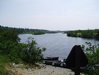
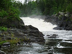
The Allagash River is a beautiful river in northern Maine, United States. It is about 65 miles (105 km) long. This river flows through a wild and scenic area. This area is known as the Maine North Woods. The name "Allagash" comes from the Abenaki language. It means "bark stream." The Allagash River is a popular place for canoe trips.
Contents
Where Does the Allagash River Start and End?
The Allagash River begins at Churchill Lake. This lake is in northern Piscataquis County. In the past, other lakes like Allagash, Chamberlain, and Telos also flowed into it. But in the 1840s, dams were built. These dams changed the water flow. They sent water to the East Branch of the Penobscot River. This helped to move logs south to the coast.
Today, some water from Chamberlain Lake still flows into Eagle Lake. From there, it joins the Allagash River. If you include this part, the river is about 86 miles (138 km) long. The Allagash River flows generally northeast. It passes through a series of natural lakes. Finally, it joins the Saint John River near Allagash, Maine. This is close to the border with New Brunswick, Canada.
Exploring the Allagash: A Journey Through History
The Allagash River has always been a special place. Its wild nature makes it perfect for canoe trips. In 1857, a famous writer named Henry David Thoreau explored the river. He traveled with his friend Edward S. Hoar. Their guide was Joseph Polis, a member of the Penobscot Tribe.
They paddled all the way to the river's source, Heron Lake. Thoreau wrote about his adventure. His story, "The Allegash and East Branch," was published later. It was part of his book The Maine Woods (1864). His writings helped people appreciate the beauty of this wilderness.
Protecting the Allagash River
People in Maine wanted to keep the Allagash River wild. In 1966, they voted to protect it. They approved money to keep the river's "wilderness character." Much of the river became the Allagash Wilderness Waterway.
In 1970, the river joined the National Wild and Scenic River program. This program protects special rivers in the U.S. Even though "wild" rivers are usually free-flowing, the old wooden Churchill Dam was kept. It was important for historical reasons.
Later, in the 1990s, the dam started to fail. Maine citizens decided to replace it with a concrete one. This was done to protect nearby recreation areas. Some environmental groups were concerned about this. They worried about new roads and docks. These changes could bring more people to the river.
Much of the land around the Allagash Wilderness Waterway is private. It is owned by the Seven Islands Land Company. This company manages about 1 million acres (4,000 km²) of forest. They help keep the area natural.
River Flow and Water Levels
The United States government keeps track of the Allagash River's flow. They have a special measuring station. It is about 3 miles (5 km) from where the river meets the Saint John River. At this point, the river's watershed covers about 1,479 square miles (3,831 km²).
The river's average flow is about 1,967 cubic feet per second (55.7 m³/s). This is like the amount of water in a large swimming pool every second. The highest flow recorded was 40,900 cubic feet per second (1,158 m³/s). The lowest was 87 cubic feet per second (2.5 m³/s). The river flows fastest in spring. This is when snow melts. It flows slowest in the fall.
 | Aurelia Browder |
 | Nannie Helen Burroughs |
 | Michelle Alexander |


