Penobscot River facts for kids
Quick facts for kids Penobscot River |
|
|---|---|
The Penobscot River watershed
|
|
| Country | United States |
| Physical characteristics | |
| Main source | Maine |
| River mouth | Penobscot Bay sea level 44°26′N 68°50′W / 44.44°N 68.83°W |
| Length | 109 miles (175 km) |
| Basin features | |
| Basin size | 8,610 sq mi (22,300 km2) |
| Tributaries | |
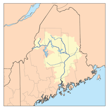
The Penobscot River is a long river in the U.S. state of Maine. It stretches about 109 miles (175 km) by itself. If you include its West Branch and South Branch, the river system becomes 264 miles (425 km) long. This makes it the longest river that is completely inside Maine. Its drainage basin, which is the area of land that collects water for the river, covers about 8,610 square miles (22,300 km²).
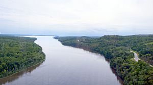
The Penobscot River starts from four different branches in lakes in north-central Maine. These branches generally flow east. The West Branch and East Branch meet near Medway. From there, the Penobscot River flows south for 109 miles. It passes by the city of Bangor, where large ships can travel on it. A smaller stream called Kenduskeag Stream also joins the river in Bangor. Finally, the Penobscot River flows into the Atlantic Ocean at Penobscot Bay. The river is home to the Penobscot people, who live on Indian Island.
Contents
History of the Penobscot River
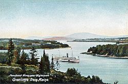
The Penobscot River has a rich history, playing an important role for both Native Americans and European settlers.
Early Explorations and Norumbega
Some historians believe the Penobscot region is the famous "Norumbega" that early explorers wrote about. Jean Allefonsce, a French explorer, described a rich city or region called Norumbega. While some argued about its exact location, many now agree it was likely the Penobscot area.
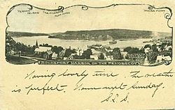
The Penobscot River was an important pathway for trade into Maine from the Atlantic coast. Ocean-going ships could travel far upstream to Bangor. Many cities and towns grew along the river's mouth and banks. These include Rockland, Belfast, Brewer, and Bangor.
Further upstream, the river became a key route for moving wooden logs and pulpwood. These were floated down from inland forests to sawmills and paper mills. These mills used the river's water power to operate. Towns like Howland, Veazie, and Millinocket developed because of these industries.
French and British Settlements
The first European to explore the river was Estêvão Gomes from Portugal in 1524. Later, in 1605, the Frenchman Samuel de Champlain explored it. French Jesuit priests soon arrived and became missionaries to the Penobscot people, converting them to Catholicism.
The French built a settlement called Pentagouet, now known as Castine, where the river meets Penobscot Bay. The Penobscot people also made a permanent home on Indian Island, near Old Town, Maine. This was close to the Catholic mission. For many years, these were likely the only permanent settlements. However, the Penobscot people used the entire river and bay for hunting and had other seasonal villages.
In 1669, the Mohawk tribe attacked the Penobscot people, causing much damage. Later, during Father Rale's War, English settlers from Massachusetts also raided the Penobscot villages. In 1759, the Pownall Expedition, led by Governor Thomas Pownall, built Fort Pownall. This marked the start of English control over the Penobscot River valley.
The first permanent English settler was Joshua Treat. He built a log house and sawmill in what is now Frankfort. More settlers from Massachusetts and New Hampshire moved upriver. Eventually, the Penobscot people were mainly limited to Indian Island, which is their reservation today.
American Revolution and Modern Times
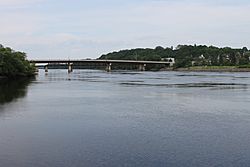
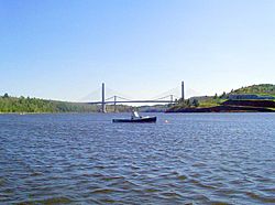
During the American Revolutionary War, the river and bay were the site of the Penobscot Expedition in 1779. An American fleet was destroyed trying to take Maine back from the British. In the War of 1812, the British invaded Maine again and attacked Bangor. To prevent future attacks, the U.S. government built Fort Knox in 1844. This large granite fort is still a major landmark on the river.
In the 1800s, the river was used to transport logs from Maine's forests. These logs were cut into lumber at mills near Old Town and Orono. Ships then carried the lumber from Bangor. Later in the century, people also harvested ice from the river to sell in cities.
In the 1900s, papermaking became very important. Large wood pulp and paper mills were built along the river. These mills created a chemical called dioxins as a byproduct. This substance was released into the river from several mills. The Penobscot people, who relied on fish from the river, were greatly affected. Rebecca Sockbeson, a Penobscot, shared that her people were getting sick from the river.
To help the river recover, the Penobscot River Restoration Project began in the 21st century. Several dams were changed or removed. The Great Works Dam was torn down in 2012, and the Veazie Dam in 2013. A fish ladder was added at Milford Dam, and a fish bypass at Howland Dam. These efforts have helped increase the number of fish, like Atlantic Salmon and Shad, in the river.
In 2006, the Penobscot Narrows Bridge was built. This impressive bridge is 2,120 feet (646 m) long and cost $85 million. It has an observatory open to the public, 420 feet (128 m) above the river. It's one of only four bridge observatories in the world.
Angling and Recreation
The Penobscot River is a popular spot for fishing, including fly fishing. The West Branch is famous for its landlocked salmon. The East Branch is known for its smallmouth bass. In 2008, the river was opened for catch and release fly fishing for Atlantic salmon.
The West Branch of the river has many deep pools and slate ledges, making it great for fishing from the shore or by canoe. The Ripogenus Dam near Chesuncook Lake helps keep the water levels good for the large landlocked salmon. This part of the river has heavy rapids, deep runs, and large pools. Baxter State Park is also nearby.
Some parts of the river have very strong rapids, making it exciting for whitewater rafting. Until 1971, the West Branch was used by the Great Northern Paper Company to float logs to its mill. After that, the company built the Golden Road (Maine) to transport logs by truck. This road runs alongside the river and is now also used by people visiting the Penobscot.
Fishermen often see different insects hatching on the river. Mayflies usually hatch from May to June. Caddisflies also hatch around this time and can continue into the fall. Stoneflies hatch throughout the fishing season. Fishermen on the West Branch often need to use different fishing techniques.
Penobscot River in Popular Culture
The Penobscot River has appeared in several books and movies:
- Henry David Thoreau wrote about his trip up the Penobscot in 1846 to climb Mount Katahdin in his book Ktaadn.
- Author Stephen King placed his fictional town of Derry, Maine on the Penobscot.
- The river is featured in the film adaptation of the Tom Clancy novel The Hunt for Red October. It's where a Soviet submarine is hidden.
- Part of the Annie Proulx novel Barkskins takes place in Penobscot Bay.
- In Margaret Atwood's The Testaments, characters Baby Nicole and Aunt Victoria escape to Canada on the Penobscot River.
See also
 In Spanish: Río Penobscot para niños
 | Janet Taylor Pickett |
 | Synthia Saint James |
 | Howardena Pindell |
 | Faith Ringgold |


