
Penobscot Indian Island Reservation facts for kids
Quick facts for kids
Indian Island
Álənαpe Mə́nəhan
|
||
|---|---|---|
| Penobscot Indian Island Reservation | ||
.jpg) |
||
|
||
 |
||
| Tribe | Penobscot | |
| Country | United States | |
| State | Maine | |
| County | Penobscot | |
| Government | ||
| • Type | Tribal Council | |
| Area | ||
| • Total | 57.0 km2 (22.0 sq mi) | |
| • Land | 19.5 km2 (7.5 sq mi) | |
| • Water | 37.4 km2 (14.4 sq mi) 65.7% | |
| Elevation | 44 m (145 ft) | |
| Population
(2020)
|
||
| • Total | 758 | |
| • Density | 13.298/km2 (34.45/sq mi) | |
| Time zone | EST | |
| Website | https://www.penobscotnation.org | |

| Historical population | |||
|---|---|---|---|
| Census | Pop. | %± | |
| 1900 | 269 | — | |
| 1910 | 320 | 19.0% | |
| 1950 | 323 | — | |
| 1960 | 383 | 18.6% | |
| 1970 | 317 | −17.2% | |
| 1980 | 458 | 44.5% | |
| 1990 | 476 | 3.9% | |
| 2000 | 562 | 18.1% | |
| 2010 | 610 | 8.5% | |
| 2020 | 758 | 24.3% | |
| U.S. Decennial Census | |||
The Penobscot Indian Island Reservation (in Abenaki, Álənαpe Mə́nəhan) is a special area of land. It is home to the Penobscot Tribe of Maine. This tribe is officially recognized by the United States government.
The reservation is located in Penobscot County, Maine, United States. It is very close to Old Town. In 2020, about 758 people lived here. The reservation stretches for many miles along the Penobscot River. It goes through 15 towns and two unorganized areas. The main part is Indian Island, near Old Town and Milford. It extends north towards East Millinocket. A small, empty part of the reservation is in Aroostook County. This part is used for hunting and gathering.
Contents
History of the Penobscot People
The Penobscot people have lived in this area for a very long time. Their land was between what is now Old Town and Bangor. They still live on their tribal land on the Penobscot Indian Island Reservation.
The first European to visit this place was probably Estêvão Gomes in 1524. He was from Portugal and worked for Spain. Later, in 1605, the French explorer Samuel de Champlain arrived. He was searching for a legendary city called Norumbega. French missionaries also came to live among the Penobscot people.
For many years, France and Britain fought over this valley. After Britain won the Seven Years' War in the 1750s, England gained control. This area was one of the last northern parts to become part of New England. A very important Penobscot chief during this time was Madockawando.
Conflicts and Treaties
There were often disagreements between New England and Acadia (French territory). English settlers from Massachusetts moved into Acadia. To protect their land, France set up Catholic missions. These were in three main native villages. One was on the Kennebec River, one on the Penobscot River, and one on the Saint John River.
In response, five Native American tribes in Acadia formed the Wabanaki Confederacy. This was a group that worked with New France. Their goal was to stop New England from expanding.
King William's War and Raids
During King William's War, there were several attacks. Father Louis-Pierre Thury lived near the Penobscot people. He became very influential. In 1689, he joined a raid that destroyed Pemaquid. He also took part in an attack on York, Maine, in 1692. This event was called the Candlemas Massacre.
In 1692, Benjamin Church led a group of 450 men. They attacked the Penobscot village as a way to get back at them. Father Thury worked to keep the Abenaki people on the French side. He was also involved in attacks on Oyster Bay in New Hampshire. He was present when Pemaquid was captured in 1696.
Chief Madockawando and other Penobscot warriors fought in many battles. They were at the Battle of Fort Loyal in 1690. They also took part in the Raid on Wells in 1692. Madockawando died during the war in 1697.
Father Rale's War and Village Destruction
During Father Rale's War, Father Lauverjat was at the mission. In 1722, he led 500-600 Native Americans. They surrounded Fort St. Georges in Thomaston for twelve days. They burned buildings and killed cattle. Five New Englanders died, and seven were captured. The New Englanders killed twenty Maliseet and Penobscot warriors.
In 1723, Colonel Thomas Westbrook led 230 men to the Penobscot River. They traveled about 32 miles upstream to the Penobscot village. They found a large fort with 14-foot walls. Inside were 23 wigwams and a large chapel. The village was empty, so the soldiers burned it down.
Starting in 1775, the Penobscot people began to lose their ancestral lands. This happened through treaty negotiations. By 1820, when Maine became a state, they had given up almost all their land. The tribe was left with only their main village on an island. Settlers called it "Indian Old Town." Later, a white settlement called Old Town grew across the river. The Penobscot village became known as "Indian Island." It is still the home of the officially recognized Penobscot Nation.
Exploring Indian Island Today
The reservation has a small museum where you can learn about Penobscot history. For many years, Penobscot High Stakes Bingo was a popular place. It was one of the first Native American gambling businesses in the country. It operated from 1973 until 2015.
Famous People from Indian Island
Many notable people have come from the Penobscot Indian Island Reservation:
- Louis Francis "Chief" Sockalexis was a Major League Baseball player. He played for the Cleveland Spiders from 1897 to 1899. He is buried at St. Anne Church Cemetery.
- Michael Pehrson
- Sherri Mitchell, an author and attorney.
- ssipsis, a writer who grew up on the reservation.
- June Sapiel, an activist.
- Molly Spotted Elk, a dancer, actress, and writer.
- Maulian Bryant, a Tribal Ambassador.
- Morgan Talty, a writer.
Geography of the Reservation
The Penobscot Indian Island Reservation covers about 57.0 square kilometers (22.0 square miles). About 19.5 square kilometers (7.5 square miles) of this is land. The rest, about 37.4 square kilometers (14.4 square miles), is water. This means a large part of the reservation is made up of water, about 65.70%.
Understanding the Population
| Languages (2000) | Percent |
|---|---|
| Spoke English at home | 92.71% |
| Spoke Abenaki at home | 7.29% |
In 2000, there were 562 people living on the reservation. Most people (84.88%) identified as Native American. About 14.59% identified as White. A small number (0.53%) were from two or more races. Also, 0.53% of the population was Hispanic or Latino.
The population includes people of all ages. About 33.3% were under 18 years old. About 9.6% were 65 years or older. The average age was 32 years old.
Indian Island in Books
The 1825 novel Brother Jonathan by John Neal has a part set on Indian Island. This happens during the American Revolutionary War. The main character in the book is part Penobscot and part English. The novel describes the island as "the last encampment of the Penobscot Red men."
Images for kids
-
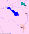
Indian Island shown in green
-
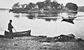
Indian Island, 1919

.jpg)
