Aroostook County, Maine facts for kids
Quick facts for kids
Aroostook County
|
|||
|---|---|---|---|
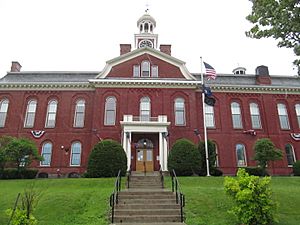
Aroostook County Courthouse
|
|||
|
|||
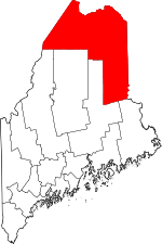
Location within the U.S. state of Maine
|
|||
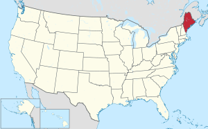 Maine's location within the U.S. |
|||
| Country | |||
| State | |||
| Founded | May 1, 1839 | ||
| Named for | Miꞌkmaq word meaning "beautiful water" | ||
| Seat | Houlton | ||
| Largest city | Presque Isle | ||
| Area | |||
| • Total | 6,828 sq mi (17,680 km2) | ||
| • Land | 6,671 sq mi (17,280 km2) | ||
| • Water | 156 sq mi (400 km2) 2.3% | ||
| Population
(2020)
|
|||
| • Total | 67,105 | ||
| • Density | 9.8279/sq mi (3.79458/km2) | ||
| Time zone | UTC−5 (Eastern) | ||
| • Summer (DST) | UTC−4 (EDT) | ||
| Congressional district | 2nd | ||
Aroostook County is a large county in the state of Maine, located right along the border with Canada. In 2020, about 67,105 people lived here. The main office for the county government is in Houlton, but there are also offices in Caribou and Fort Kent.
People in Maine often call it "The County". It is the biggest county in Maine by total area. It's also the second-largest county east of the Mississippi River in the entire United States. With over 6,800 square miles (17,600 square kilometers) of land, it is bigger than some smaller U.S. states! Aroostook County is the northernmost county in Maine. Its northernmost village, Estcourt Station, is the most northern community in the New England region.
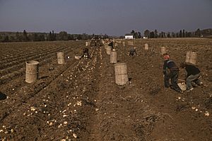
Aroostook County is famous for growing potatoes. It is also becoming a place where a lot of wind power is generated. Many people in the northern part of the county, especially in the Saint John Valley, speak both English and Acadian French. This is because of the strong Acadian culture and history in the area. The original people of this land, the Wolastoqiyik, still live here as the Houlton Band of Maliseet Indians.
Contents
What Does "Aroostook" Mean?
The name Aroostook comes from the Wolastokwey (or Maliseet) language. It means "beautiful river" and refers to the Saint John River.
Aroostook County's History
Aroostook County is part of what was originally called Wolastokuk, the land of the Wolastoqiyik (or Maliseet) Nation. This nation was part of a larger group called the Wabanaki Confederacy. This group of nations came together during the time when Europeans were settling in North America.
Early Settlers and Border Disputes
In the past, this area was not very populated. People, including Native Americans and Acadians, moved here to escape conflicts or find new homes. Many Acadians and Wolastoqewiyik found safety in Canada. However, some communities, like the Houlton Band of Maliseet Indians, stayed in what became the United States.
Aroostook County was officially created in 1839. It was formed from parts of Penobscot and Washington counties. Over the years, its borders changed a few times until they became what they are today.
Part of Aroostook County was involved in a disagreement over land called the "Aroostook War". This dispute was later resolved peacefully by a treaty.
The Underground Railroad
Aroostook County was also a stop on the Underground Railroad. This was a secret network that helped people seeking freedom from slavery travel to Canada. The Friends Quaker Church near Fort Fairfield was often one of the last safe places before reaching Canada.
Military Presence and Modern Events
During the Cold War, military spending was important to Aroostook County's economy. Loring Air Force Base was built in Limestone, Maine. It was a very important base for the U.S. Air Force because of its location close to Europe. The base closed in 1994.
In 2014, Aroostook County helped host the Acadian World Congress. This was a big event that celebrated Acadian culture and heritage. It included fun activities like a parade and a giant tug of war across the Saint John River with neighboring Canadian counties.
Geography of Aroostook County
Aroostook County covers a huge area of 6,828 square miles (17,684 square kilometers). Most of this is land, with a small part being water. It is Maine's largest county by area, about the same size as the states of Connecticut and Rhode Island combined! The highest point in the county is Peaked Mountain, which is 2,230 feet (680 meters) tall.
Neighboring Areas
Aroostook County shares borders with several other counties in Maine and provinces in Canada:
- Washington County – to the southeast
- Penobscot County – to the south
- Piscataquis County – to the south
- Somerset County – to the southwest
- Montmagny Regional County Municipality, Quebec – to the west (Canada)
- L'Islet Regional County Municipality, Quebec – to the west (Canada)
- Kamouraska Regional County Municipality, Quebec – to the northwest (Canada)
- Témiscouata Regional County Municipality, Quebec – to the north (Canada)
- Madawaska County, New Brunswick – to the northeast (Canada)
- Victoria County, New Brunswick – to the east (Canada)
- Carleton County, New Brunswick – to the east (Canada)
- York County, New Brunswick – to the southeast (Canada)
Parks and Protected Areas
Aroostook County is home to some beautiful natural areas:
Main Roads
Several important highways run through Aroostook County, connecting its communities:
 I-95
I-95 US 1
US 1 US 1A
US 1A US 2
US 2 US 2A
US 2A SR 10
SR 10 SR 11
SR 11 SR 89
SR 89 SR 161
 SR 164
 SR 171
People of Aroostook County
| Historical population | |||
|---|---|---|---|
| Census | Pop. | %± | |
| 1840 | 9,413 | — | |
| 1850 | 12,529 | 33.1% | |
| 1860 | 22,479 | 79.4% | |
| 1870 | 29,609 | 31.7% | |
| 1880 | 41,700 | 40.8% | |
| 1890 | 49,589 | 18.9% | |
| 1900 | 60,744 | 22.5% | |
| 1910 | 74,664 | 22.9% | |
| 1920 | 81,728 | 9.5% | |
| 1930 | 87,843 | 7.5% | |
| 1940 | 94,436 | 7.5% | |
| 1950 | 96,039 | 1.7% | |
| 1960 | 106,064 | 10.4% | |
| 1970 | 92,463 | −12.8% | |
| 1980 | 91,331 | −1.2% | |
| 1990 | 86,936 | −4.8% | |
| 2000 | 73,938 | −15.0% | |
| 2010 | 71,870 | −2.8% | |
| 2020 | 67,105 | −6.6% | |
| 2023 (est.) | 67,351 | −6.3% | |
| U.S. Decennial Census 1790–1960 1900–1990 1990–2000 2010–2016 |
|||
In 2010, about 71,870 people lived in Aroostook County. The population density was about 10.8 people per square mile. Many people in the county have French, English, or Irish backgrounds. About 18% of the population reported speaking French at home in 2010.
Communities in Aroostook County
Aroostook County has several types of communities:
Cities
Incorporated Towns
- Allagash
- Amity
- Ashland
- Blaine
- Bridgewater
- Castle Hill
- Caswell
- Chapman
- Crystal
- Dyer Brook
- Eagle Lake
- Easton
- Fort Fairfield
- Fort Kent
- Frenchville
- Grand Isle
- Hamlin
- Hammond
- Haynesville
- Hersey
- Hodgdon
- Houlton
- Island Falls
- Limestone
- Linneus
- Littleton
- Ludlow
- Madawaska
- Mapleton
- Mars Hill
- Masardis
- Merrill
- Monticello
- New Canada
- New Limerick
- New Sweden
- Oakfield
- Orient
- Perham
- Portage Lake
- Saint Agatha
- Saint Francis
- Sherman
- Smyrna
- Stockholm
- Van Buren
- Wade
- Wallagrass
- Washburn
- Westfield
- Westmanland
- Weston
- Woodland
Plantations
Census-Designated Places (CDPs)
Unincorporated Communities within Towns
- California
- Clayton Lake
- Crouseville
- Daigle
- Estcourt Station
- Fort Kent Mills
- Portage
- Saint David
- Sinclair
- Smyrna Mills
- Wytopitlock
Unorganized Territories
Indian Reservations
- Aroostook Band of Mi'kmaq Indians Reservation, located in Presque Isle
- Houlton Band of Maliseet Indians Reservation, located in Houlton
See also
 In Spanish: Condado de Aroostook para niños
 | Kyle Baker |
 | Joseph Yoakum |
 | Laura Wheeler Waring |
 | Henry Ossawa Tanner |


