Crouseville, Maine facts for kids
Quick facts for kids
Crouseville, Maine
|
|
|---|---|
|
Unincorporated village
|
|
| Country | United States |
| State | Maine |
| County | Aroostook |
| Town | Washburn |
| Elevation | 449 ft (137 m) |
| Time zone | UTC-5 (Eastern (EST)) |
| • Summer (DST) | UTC-4 (EDT) |
| ZIP code |
04738
|
| GNIS feature ID | 564587 |
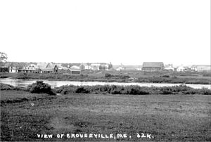
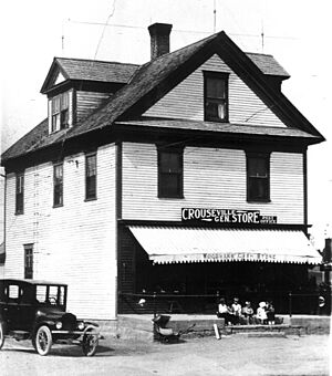
Crouseville is a small village in the state of Maine, USA. It's part of a larger town called Washburn, located in Aroostook County. This village is not a separate city or town, but rather a community within Washburn.
Contents
History of Crouseville
Long ago, in 1800, the area that is now Crouseville didn't have a name. In 1826, a surveyor named Joseph Norris mapped it. Back then, it was just known as "Township 13, Range 3."
Early Settlers and Borders
The people who first settled along the Aroostook River weren't sure if they were living in New Brunswick (a British colony at the time) or the United States. To help claim the land, the United States created Aroostook County in 1839.
In 1842, the Webster-Ashburton Treaty officially made this area part of the United States. Even after this, some townships in Maine were still managed by Massachusetts, which was Maine's "mother state."
Naming the Village
The area around Crouseville was called "Salmon Brook Township." In the winter of 1844-1845, it became known as the "Plantation of Salmon Brook." Until about 1852, the Crouseville area was specifically called "East Salmon Brook."
In 1850, a family named Crouse moved to the area from New Brunswick. Gould and Hepzibah Crouse, along with their children, settled much of the land.
In 1861, the nearby village of Salmon Brook officially became the town of Washburn. After this, "East Salmon Brook" was often called "East Washburn." Finally, in 1897, the community was officially named Crouseville. It was named after the pioneering Crouse family and their descendants who helped build the area.
Cemeteries
Crouseville has a few cemeteries where early settlers and residents are buried.
- Crouseville Pioneer Cemetery: The first known burial here was Duncan Christie, who drowned in 1857.
- Crouseville Cemetery: The first known burial in this cemetery was Marshall Crouse in 1876.
- Hillside Grove Cemetery: This cemetery was established around 1995.
Geography and Climate
Crouseville is located at an elevation of 449 feet (about 137 meters) above sea level. The village is right next to the Aroostook River. There are also three islands in the river nearby: Crouse Island, Churchill Island, and Bull Island. A part of the river called Rum Rapids flows near Churchill Island.
Climate in Crouseville
Crouseville experiences big changes in temperature throughout the year. Summers are warm to hot and can be humid. Winters are cold, sometimes very cold. This type of weather is known as a humid continental climate.
Fun Activities
Crouseville and the surrounding Aroostook County offer many outdoor activities.
Snowmobiling
Aroostook County has a huge snowmobile trail system, stretching 1600 miles! This system, called the Northeast Snowmobile Trail (NEST), goes right through Crouseville. It connects with an even larger system that links Maine, New Hampshire, Vermont, and the Canadian Province of Quebec. This means you can ride your snowmobile for a very long distance!
Skiing
If you enjoy skiing, there are places nearby for both downhill and cross-country skiing. You can find facilities at the 10th Mountain Ski Center, Nordic Heritage Ski Center, Big Rock Alpine Skiway, and Quoggy Jo Community Alpine Area.
Education
Crouseville is part of Maine School Administrative District 45. For higher education, the University of Maine at Presque Isle and Northern Maine Community College are both located about six miles east in Presque Isle, Maine.
 | Georgia Louise Harris Brown |
 | Julian Abele |
 | Norma Merrick Sklarek |
 | William Sidney Pittman |


