Ludlow, Maine facts for kids
Quick facts for kids
Ludlow, Maine
|
|
|---|---|

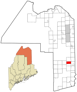
Location of Ludlow, Maine
|
|
| Country | United States |
| State | Maine |
| County | Aroostook |
| Area | |
| • Total | 22.02 sq mi (57.03 km2) |
| • Land | 22.01 sq mi (57.01 km2) |
| • Water | 0.01 sq mi (0.03 km2) |
| Elevation | 830 ft (253 m) |
| Population
(2020)
|
|
| • Total | 434 |
| • Density | 20/sq mi (7.6/km2) |
| Time zone | UTC-5 (Eastern (EST)) |
| • Summer (DST) | UTC-4 (EDT) |
| ZIP Code |
04730
|
| Area code(s) | 207 |
| FIPS code | 23-41715 |
| GNIS feature ID | 0582571 |
Ludlow is a small town in Aroostook County, Maine, United States. It is located in the northeastern part of Maine. In 2020, the town had a population of 434 people.
Geography of Ludlow
Ludlow covers a total area of about 22 square miles (57 square kilometers). Most of this area is land. Only a tiny part, about 0.01 square miles, is water.
One interesting fact about Ludlow is its connection to Interstate 95. The very northernmost point of Interstate 95 is found just inside Ludlow. This point is near Exit 291 for southbound traffic.
Population and People
The population of Ludlow has changed over many years. Records show how many people lived there during different times.
| Historical population | |||
|---|---|---|---|
| Census | Pop. | %± | |
| 1860 | 287 | — | |
| 1870 | 371 | 29.3% | |
| 1880 | 468 | 26.1% | |
| 1890 | 375 | −19.9% | |
| 1900 | 394 | 5.1% | |
| 1910 | 412 | 4.6% | |
| 1920 | 375 | −9.0% | |
| 1930 | 361 | −3.7% | |
| 1940 | 343 | −5.0% | |
| 1950 | 361 | 5.2% | |
| 1960 | 274 | −24.1% | |
| 1970 | 259 | −5.5% | |
| 1980 | 403 | 55.6% | |
| 1990 | 430 | 6.7% | |
| 2000 | 402 | −6.5% | |
| 2010 | 404 | 0.5% | |
| 2020 | 434 | 7.4% | |
| U.S. Decennial Census | |||
According to the 2010 census, there were 404 people living in Ludlow. These people lived in 177 different homes. About 118 of these homes were families.
The average age of people in Ludlow in 2010 was about 47.5 years old. Almost 20% of the residents were under 18 years old. About 19% were 65 years or older. The town had a nearly equal number of males and females.
See also
 In Spanish: Ludlow (Maine) para niños
 | Ernest Everett Just |
 | Mary Jackson |
 | Emmett Chappelle |
 | Marie Maynard Daly |

