Mars Hill, Maine facts for kids
Quick facts for kids
Mars Hill, Maine
|
|
|---|---|
|
|
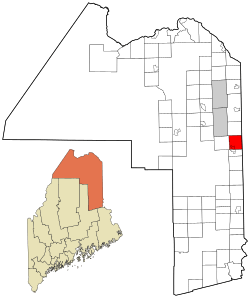
Location of Mars Hill, Maine
|
|
| Country | United States |
| State | Maine |
| County | Aroostook |
| Incorporated | 1867 |
| Village | Mars Hill |
| Area | |
| • Total | 35.20 sq mi (91.17 km2) |
| • Land | 35.13 sq mi (90.99 km2) |
| • Water | 0.07 sq mi (0.18 km2) |
| Elevation | 607 ft (185 m) |
| Population
(2020)
|
|
| • Total | 1,360 |
| • Density | 39/sq mi (14.9/km2) |
| Time zone | UTC-5 (Eastern) |
| • Summer (DST) | UTC-4 (Eastern) |
| ZIP code |
04758
|
| Area code(s) | 207 |
| FIPS code | 23-43710 |
| GNIS feature ID | 0582582 |
Mars Hill is a town located in Aroostook County, Maine, United States. It sits right at the base of Mars Hill Mountain. The town shares a border with Wicklow Parish in New Brunswick, Canada. The area is mostly known for its farms. In 2020, about 1,360 people lived in Mars Hill.
Contents
History of Mars Hill
Key Moments in Mars Hill History
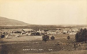
The town of Mars Hill gets its name from Hezekiah Mars. He camped for three years at the bottom of Mars Hill Mountain. In 1834, the first main business was cutting timber. They especially cut large trees to make masts for ships. Later, farming became very important.
After the Aroostook War ended in 1839, a clear border line was made between Maine and New Brunswick. Iron markers were put in place three years later to show the exact boundary. The first mill opened in 1856 at Rocky Brook. In 1860, the first school for the Mars Hill community was started. The town grew more quickly after the American Civil War. The Bangor and Aroostook Railroad arrived in 1892. This allowed farmers to send their crops to markets far away.
In 1906, the White Mountain Telephone Company opened a new office in Mars Hill. This company later became Aroostook Telephone & Telegraph. A small hospital with six beds was built in 1912. In 1922, a big fire destroyed many businesses in the town center. But the businesses were quickly rebuilt. The Walter T.A. Hansen Memorial Library opened in 1937. In the 1960s, the Big Rock Ski Area was built on Mars Hill Mountain.
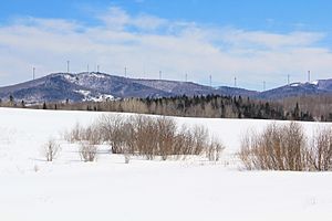
In 2006, Maine's first wind farm was built on top and along the northern side of Mars Hill Mountain.
Military Presence in Aroostook County
During and after World War II, military spending greatly affected Mars Hill and nearby towns. In 1947, the Limestone Army Air Field was built in Limestone. It opened in 1953 and was later called the Loring Air Force Base. Aroostook County was chosen because it was the closest part of the United States to Europe. This made it a good place for military operations. In 1991, it was decided that Loring Air Force Base would close, and it did in 1994.
Big Rock Ski Area Fun
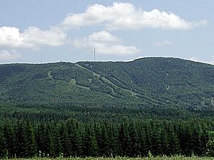
In the late 1950s, a large piece of land was bought to create a local fun area. By 1960, the Big Rock Ski Area was open for skiing. In 2000, the Maine Winter Sports Center (MWSC) bought the Big Rock Ski Center. They did this with help from grants from the Libra Foundation.
Wind Power on Mars Hill Mountain
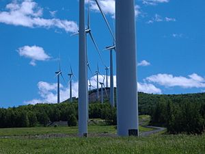
On March 27, 2007, a wind farm project started on Mars Hill Mountain. This project was built by First Wind, a company focused on clean energy. The Mars Hill Wind Farm cost about $85 million. A total of 28 General Electric 1.5 megawatt wind turbines were put up. They stand along the mountain's ridge and northern part.
The wind farm creates about 130 million kilowatt hours (kW·h) of electricity each year. This is enough power for about 20,000 homes. The Mars Hill Wind Farm was the first large-scale wind power plant in Maine. It sends electricity to New Brunswick Power and is an important part of the local economy.
People of Mars Hill
| Historical population | |||
|---|---|---|---|
| Census | Pop. | %± | |
| 1860 | 201 | — | |
| 1870 | 399 | 98.5% | |
| 1880 | 716 | 79.4% | |
| 1890 | 837 | 16.9% | |
| 1900 | 1,183 | 41.3% | |
| 1910 | 1,511 | 27.7% | |
| 1920 | 1,783 | 18.0% | |
| 1930 | 1,837 | 3.0% | |
| 1940 | 1,886 | 2.7% | |
| 1950 | 2,060 | 9.2% | |
| 1960 | 2,062 | 0.1% | |
| 1970 | 1,875 | −9.1% | |
| 1980 | 1,892 | 0.9% | |
| 1990 | 1,760 | −7.0% | |
| 2000 | 1,480 | −15.9% | |
| 2010 | 1,493 | 0.9% | |
| 2020 | 1,360 | −8.9% | |
| U.S. Decennial Census | |||
Mars Hill Population in 2010
According to the census from 2010, there were 1,493 people living in Mars Hill. These people lived in 614 households, with 413 of them being families. The town had about 42.5 people per square mile. Most of the people living in Mars Hill were White (97.3%).
About 28% of households had children under 18 living there. More than half (52.8%) were married couples. The average age of people in Mars Hill was 44 years old. About 21% of residents were under 18 years old.
Geography and Climate
The town of Mars Hill covers about 35.20 square miles (91.17 square kilometers). Most of this area is land, with a small amount of water. The Prestile Stream flows through Mars Hill, dividing parts of the town.
Mars Hill has a humid continental climate. This means it has warm, humid summers and cold, snowy winters. In July, daytime temperatures are usually between 75 and 80 degrees Fahrenheit (24-27 degrees Celsius). January temperatures are often around 32 degrees Fahrenheit (0 degrees Celsius) during the day, dropping below 0 degrees Fahrenheit (-18 degrees Celsius) at night.
| Climate data for Mars Hill, Maine | |||||||||||||
|---|---|---|---|---|---|---|---|---|---|---|---|---|---|
| Month | Jan | Feb | Mar | Apr | May | Jun | Jul | Aug | Sep | Oct | Nov | Dec | Year |
| Record high °F (°C) | 55 (13) |
59 (15) |
74 (23) |
84 (29) |
94 (34) |
95 (35) |
96 (36) |
99 (37) |
90 (32) |
84 (29) |
70 (21) |
57 (14) |
99 (37) |
| Mean daily maximum °F (°C) | 20.7 (−6.3) |
25 (−4) |
35.6 (2.0) |
48.3 (9.1) |
64.3 (17.9) |
73.2 (22.9) |
77.2 (25.1) |
75.6 (24.2) |
65.9 (18.8) |
52.9 (11.6) |
38.3 (3.5) |
25.9 (−3.4) |
50.2 (10.1) |
| Mean daily minimum °F (°C) | 1.2 (−17.1) |
4.7 (−15.2) |
16.2 (−8.8) |
29 (−2) |
40.6 (4.8) |
49.8 (9.9) |
55.1 (12.8) |
53.1 (11.7) |
44.6 (7.0) |
34.9 (1.6) |
24.7 (−4.1) |
9.3 (−12.6) |
30.3 (−0.9) |
| Record low °F (°C) | −35 (−37) |
−37 (−38) |
−30 (−34) |
−3 (−19) |
16 (−9) |
26 (−3) |
35 (2) |
29 (−2) |
21 (−6) |
15 (−9) |
−15 (−26) |
−33 (−36) |
−37 (−38) |
| Average precipitation inches (mm) | 2.55 (65) |
1.68 (43) |
2.12 (54) |
2.35 (60) |
3.44 (87) |
3.43 (87) |
3.71 (94) |
3.94 (100) |
3.44 (87) |
3.28 (83) |
2.77 (70) |
2.56 (65) |
35.27 (896) |
| Average snowfall inches (cm) | 18.9 (48) |
17.8 (45) |
17.3 (44) |
7.3 (19) |
0.2 (0.51) |
0 (0) |
0 (0) |
0 (0) |
0.1 (0.25) |
0.6 (1.5) |
8.8 (22) |
17.7 (45) |
88.7 (225) |
| Average precipitation days (≥ 0.01 in) | 11.0 | 7.8 | 9.7 | 10.8 | 12.6 | 12.2 | 12.9 | 11.8 | 11.4 | 12.2 | 11.8 | 11.3 | 135.5 |
| Average snowy days (≥ 0.1 in) | 7.6 | 5.6 | 5.0 | 2.3 | 0.2 | 0 | 0 | 0 | 0 | 0.4 | 3.0 | 6.4 | 30.5 |
| Source: NOAA | |||||||||||||
Mars Hill Mountain
Mars Hill Mountain is a very important part of the Mars Hill community. It creates a beautiful background for photos and offers amazing views from its top. From the mountain, you can look out over the Saint John Valley, where Mars Hill is located. You can even see Mount Katahdin, Maine's tallest mountain, from the top of Mars Hill Mountain, even though it's over 85 miles away!
A wind power project started on Mars Hill Mountain in the fall of 2006. A total of 28 large GE wind turbines were put up. They are located along the mountain's ridge and northern part. These windmills are built in several pieces. The towers are made of three sections stacked together. They weigh 20,000 pounds and stand 80 meters (262 feet) tall. Each turbine has three blades, which together form a rotor. Each blade is about 37 meters (121 feet) long. The total size of the rotor is about 75 meters (246 feet) across. This is similar to the wingspan of a Boeing 747 airplane!
Mars Hill Mountain also has a ski area called Big Rock Ski Area.
See also
 In Spanish: Mars Hill (Maine) para niños
 | Janet Taylor Pickett |
 | Synthia Saint James |
 | Howardena Pindell |
 | Faith Ringgold |


