Cary, Maine facts for kids
Quick facts for kids
Cary, Maine
|
|
|---|---|
|
Township
|
|

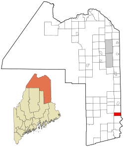
Location of Cary, Maine
|
|
| Country | United States |
| State | Maine |
| County | Aroostook |
| Area | |
| • Total | 18.8 sq mi (48.6 km2) |
| • Land | 18.8 sq mi (48.6 km2) |
| • Water | 0 sq mi (0 km2) |
| Elevation | 449 ft (137 m) |
| Population
(2010)
|
|
| • Total | 218 |
| • Density | 11.60/sq mi (4.486/km2) |
| Time zone | UTC-5 (Eastern (EST)) |
| • Summer (DST) | UTC-4 (EDT) |
| ZIP code |
04471
|
| Area code(s) | 207 |
| FIPS code | 23-11020 |
| GNIS feature ID | 582394 |
Cary is a small place in Aroostook County, Maine, in the United States. It used to be a "plantation," which is a type of small town in Maine that manages its own local services. Now, it's part of an area called the Unorganized Territory of South Aroostook. This means the state helps manage things like roads and schools. In 2010, about 218 people lived there.
History of Cary
Cary was first settled in 1824. It was officially set up as a "plantation" on January 27, 1883. This allowed the people living there to have their own local government.
In 2015, the people of Cary started thinking about becoming part of Maine's Unorganized Territory. This process is called "deorganization." They wanted to do this to lower their taxes. However, the state government said no at first. They worried it would cost other towns too much money.
But the residents of Cary tried again. On October 3, 2017, they voted to deorganize, with most people agreeing. They felt their taxes were getting too high. The state legislature then approved their plan. On November 6, 2018, the people of Cary voted again to confirm the change. Finally, on July 1, 2019, Cary officially became part of Maine's Unorganized Territory.
Geography of Cary
Cary is located in Maine. The total area of Cary is about 48.6 square kilometers (or 18.8 square miles). All of this area is land, meaning there are no large lakes or rivers within its borders.
People of Cary
| Historical population | |||
|---|---|---|---|
| Census | Pop. | %± | |
| 1890 | 390 | — | |
| 1900 | 400 | 2.6% | |
| 1910 | 340 | −15.0% | |
| 1920 | 327 | −3.8% | |
| 1930 | 241 | −26.3% | |
| 1940 | 287 | 19.1% | |
| 1950 | 278 | −3.1% | |
| 1960 | 208 | −25.2% | |
| 1970 | 184 | −11.5% | |
| 1980 | 229 | 24.5% | |
| 1990 | 235 | 2.6% | |
| 2000 | 217 | −7.7% | |
| 2010 | 218 | 0.5% | |
| 2019 (est.) | 291 | 33.5% | |
| U.S. Decennial Census | |||
In 2000, there were 217 people living in Cary. These people lived in 90 different homes, and 66 of these were families. The population density was about 11.4 people per square mile.
About 96.77% of the people in Cary were White. A small number were African American, Native American, or Asian. About 1.38% of the population identified as Hispanic or Latino.
In terms of age, about 19.8% of the people were under 18 years old. About 15.2% were 65 years or older. The average age in Cary was 43 years.
The average income for a household in Cary was $29,500 per year. For families, the average income was $40,000 per year. About 14.1% of all people in Cary lived below the poverty line. This included 20% of those under 18 and 17.5% of those 65 or older.
See also
 In Spanish: Cary Plantation para niños
 | Anna J. Cooper |
 | Mary McLeod Bethune |
 | Lillie Mae Bradford |

