Somerset County, Maine facts for kids
Quick facts for kids
Somerset County
|
|
|---|---|

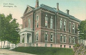
Somerset County Courthouse
|
|

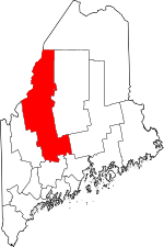
Location within the U.S. state of Maine
|
|
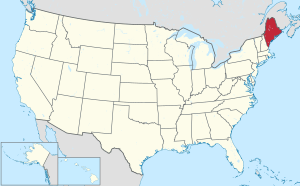
 Maine's location within the U.S. |
|
| Country | |
| State | |
| Founded | 1809 |
| Named for | Somerset County, England |
| Seat | Skowhegan |
| Largest town | Skowhegan |
| Area | |
| • Total | 4,094 sq mi (10,600 km2) |
| • Land | 3,924 sq mi (10,160 km2) |
| • Water | 169 sq mi (440 km2) 4.1%% |
| Population
(2020)
|
|
| • Total | 50,477 |
| • Density | 12.3295/sq mi (4.7604/km2) |
| Time zone | UTC−5 (Eastern) |
| • Summer (DST) | UTC−4 (EDT) |
| Congressional district | 2nd |
Somerset County is a county located in the state of Maine, United States. In 2020, about 50,477 people lived there. The main town and county seat is Skowhegan.
Contents
History of Somerset County
Somerset County was created on March 1, 1809. It was formed from parts of Kennebec County. The county was named after Somerset County in England.
Geography of Somerset County
Somerset County is a large area. It covers about 4,094 square miles (10,600 km²). Most of this area, 3,924 square miles (10,160 km²), is land. The rest, about 169 square miles (438 km²), is water. Water makes up about 4.1% of the county's total area. It is the third biggest county in Maine by size.
Mountains to Explore
Somerset County has several notable mountains. These include:
Rivers and Lakes
Many beautiful bodies of water are found here. Some important ones are:
- Carrabassett River
- Flagstaff Lake
- Kennebec River
- Moose River
- Moxie Falls
Main Roads and Highways
Several important roads run through Somerset County. They help people travel around and connect to other places.
- Interstate 95
- Maine State Route 6
- Maine State Route 8
- Maine State Route 11
- Maine State Route 15
- Maine State Route 16
- Maine State Route 27
- Maine State Route 100
- Maine State Route 104
- Maine State Route 137
- Maine State Route 139
- U.S. Route 2
- U.S. Route 201
- Armstrong–Jackman Border Crossing
- U.S. Route 201A
Neighboring Areas
Somerset County shares its borders with many other counties and regions. It is one of the few counties in the United States that borders ten other areas.
- Aroostook County – to the north
- Penobscot County – to the east
- Piscataquis County – to the east
- Waldo County – to the southeast
- Kennebec County – to the south
- Franklin County – to the southwest
- Le Granit Regional County Municipality, Quebec – to the west (in Canada)
- Beauce-Sartigan Regional County Municipality, Quebec – to the west (in Canada)
- Les Etchemins Regional County Municipality, Quebec – to the northwest (in Canada)
- Montmagny Regional County Municipality, Quebec – to the northwest (in Canada)
Population Information
| Historical population | |||
|---|---|---|---|
| Census | Pop. | %± | |
| 1810 | 12,910 | — | |
| 1820 | 21,787 | 68.8% | |
| 1830 | 35,787 | 64.3% | |
| 1840 | 33,912 | −5.2% | |
| 1850 | 35,581 | 4.9% | |
| 1860 | 36,753 | 3.3% | |
| 1870 | 34,611 | −5.8% | |
| 1880 | 32,333 | −6.6% | |
| 1890 | 32,627 | 0.9% | |
| 1900 | 33,849 | 3.7% | |
| 1910 | 36,301 | 7.2% | |
| 1920 | 37,171 | 2.4% | |
| 1930 | 39,111 | 5.2% | |
| 1940 | 38,245 | −2.2% | |
| 1950 | 39,785 | 4.0% | |
| 1960 | 39,749 | −0.1% | |
| 1970 | 40,597 | 2.1% | |
| 1980 | 45,028 | 10.9% | |
| 1990 | 49,767 | 10.5% | |
| 2000 | 50,888 | 2.3% | |
| 2010 | 52,228 | 2.6% | |
| 2020 | 50,477 | −3.4% | |
| 2023 (est.) | 51,302 | −1.8% | |
| U.S. Decennial Census 1790–1960 1900–1990 1990–2000 2010–2016 |
|||
In 2010, there were 52,228 people living in Somerset County. Most people, about 97.1%, were white. About 0.8% of the population was of Hispanic or Latino background. The average age of people living in the county was 43.6 years old.
Towns and Communities
Somerset County has many towns and other types of communities.
Towns
Census-Designated Places
These are areas that are like towns but are counted separately for census data.
Plantations
Plantations are small, rural communities.
Unorganized Territories
These are areas that do not have their own local government.
Villages
Villages are smaller communities within towns or other areas.
Education in Somerset County
Somerset County has many schools for students of all ages.
School Districts
These districts manage the public schools in different areas.
- MSAD 4
- MSAD 12
- MSAD 13
- MSAD 49
- MSAD 53
- MSAD 54
- MSAD 59
- MSAD 74
High Schools
Here are some of the high schools in the county:
- Carrabec High School – in North Anson
- Faith Baptist Christian School – in Skowhegan (serves many grades)
- Forest Hills Consolidated School (Kindergarten to 12th grade) – in Jackman
- Lawrence High School – in Fairfield
- Madison Area Memorial High School – in Madison
- Maine Academy of Natural Sciences – in Hinckley
- Maine Central Institute – in Pittsfield
- Skowhegan Area High School – in Skowhegan
- Upper Kennebec Valley Memorial High School – in Bingham
Colleges and Higher Learning
For students who want to continue their education after high school:
- Kennebec Valley Community College
Other Educational Places
- Skowhegan School of Painting and Sculpture
- L.C. Bates Museum
See also
 In Spanish: Condado de Somerset (Maine) para niños
 | Jackie Robinson |
 | Jack Johnson |
 | Althea Gibson |
 | Arthur Ashe |
 | Muhammad Ali |

