Carrabassett River facts for kids
Quick facts for kids Carrabassett River |
|
|---|---|

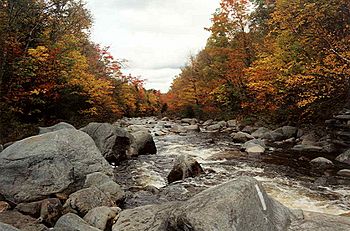
South Branch Carrabassett River at the AT crossing
|
|
| Country | United States |
| Physical characteristics | |
| Main source | Maine 2,720 feet (830 m) |
| River mouth | Kennebec River 245 feet (75 m) 44°50′56″N 69°52′37″W / 44.849°N 69.877°W |
| Length | 33.8 miles (54.4 km) |
The Carrabassett River is a cool river in Maine, United States. It's like a smaller stream that flows into a bigger river called the Kennebec River. The Carrabassett River starts near a famous place called Sugarloaf Mountain. It flows for about 33.8 miles (54.4 km) through Franklin County and Somerset County. The river passes by towns like Kingfield before it joins the Kennebec River in Anson.
Exploring the Carrabassett River's Path
The Carrabassett River has different parts, including a "South Branch" and its main section. Let's follow its journey!
The South Branch: Where the River Begins
The South Branch Carrabassett River is about 11.9 miles (19.2 km) long. It starts in Franklin County from a place called Caribou Pond. This pond gets its water from small streams and wet areas between two mountains: Spaulding Mountain and Mount Redington.
From Caribou Pond, the South Branch flows north through a valley called Caribou Valley. It runs between Crocker Mountain and Sugarloaf Mountain. If you're hiking the Appalachian Trail, you'll cross this part of the river in Caribou Valley!
Near a small village called Bigelow, the river turns east. Here, it collects water from streams flowing down from Sugarloaf Mountain, which is famous for its ski resort. At Bigelow, a road called State Route 16 & 27 goes over the river. An old narrow gauge train track, the Sandy River and Rangeley Lakes Railroad, used to follow the river from Bigelow all the way to Kingfield.
The Main River: Flowing Through Towns
Near the villages of Records and Carrabassett, in the town of Carrabassett Valley, the South Branch joins another stream called Huston Brook. After this meeting, the river is simply called the Carrabassett River.
A long time ago, around 1885, trains helped move logs from the forests near the river. A big sawmill was built in 1899 to turn these logs into lumber. Later, in the 1920s, special vehicles were used to move logs out of the woods. The old train tracks were removed between 1926 and 1936.
The Carrabassett River flows south from where the South Branch and Huston Brook meet. It passes between Poplar Mountain and Owls Head. It picks up more water from streams like Poplar Stream and Hammond Field Brook before reaching the town of Kingfield. In Kingfield, it collects even more streams, including Clay Brook and Reed Brook. This part of the river has many fast-moving sections called rapids.
Just before the village of Kingfield, the West Branch Carrabassett River joins the main river. In Kingfield, State Route 16 crosses the river, and there's a small concrete dam. Below the dam, the river gets water from Stanley Stream, then it enters Somerset County and the town of New Portland.
After crossing into New Portland, the Carrabassett River receives water from Indian Stream and other small brooks. In New Portland, there's a cool old suspension bridge called the "Wire Bridge" that crosses the river. The river then collects more water from streams like Lemon Stream and Dyer Brook. In East New Portland, another bridge crosses the river. Finally, the Carrabassett River gets water from one of its main helpers, Gilman Stream, and other smaller streams.
The Carrabassett River then flows through a narrow section called the North Anson Gorge in the town of Anson. It collects Mill Stream and Gilbert Brook before reaching the village of North Anson. About a mile (1.6 km) downstream from North Anson, the Carrabassett River finally joins the Kennebec River near an island called Savage Island. A major road, U.S. Route 201, crosses the Carrabassett River near where it meets the Kennebec.
 | Claudette Colvin |
 | Myrlie Evers-Williams |
 | Alberta Odell Jones |

