Somerset facts for kids
Quick facts for kids
Somerset
|
|||||||||||||||||||||||||||||||||||||||||||||||||||||||
|---|---|---|---|---|---|---|---|---|---|---|---|---|---|---|---|---|---|---|---|---|---|---|---|---|---|---|---|---|---|---|---|---|---|---|---|---|---|---|---|---|---|---|---|---|---|---|---|---|---|---|---|---|---|---|---|
|
|
|||||||||||||||||||||||||||||||||||||||||||||||||||||||
 |
|||||||||||||||||||||||||||||||||||||||||||||||||||||||
| Sovereign state | United Kingdom | ||||||||||||||||||||||||||||||||||||||||||||||||||||||
| Constituent country | England | ||||||||||||||||||||||||||||||||||||||||||||||||||||||
| Region | South West England | ||||||||||||||||||||||||||||||||||||||||||||||||||||||
| Established | Ancient | ||||||||||||||||||||||||||||||||||||||||||||||||||||||
| Time zone | UTC±00:00 (Greenwich Mean Time) | ||||||||||||||||||||||||||||||||||||||||||||||||||||||
| • Summer (DST) | UTC+01:00 (British Summer Time) | ||||||||||||||||||||||||||||||||||||||||||||||||||||||
| Members of Parliament | 9 MPs | ||||||||||||||||||||||||||||||||||||||||||||||||||||||
| Police | Avon and Somerset Police | ||||||||||||||||||||||||||||||||||||||||||||||||||||||
|
|||||||||||||||||||||||||||||||||||||||||||||||||||||||
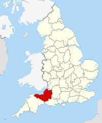
Somerset is a county in South West England. It is known for its beautiful countryside and rich history. The county is bordered by the Bristol Channel, Bristol, and Gloucestershire to the north. To the east is Wiltshire, to the south-east is Dorset, and to the south-west is Devon.
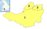
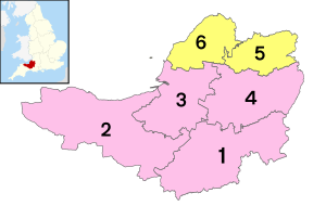
The largest city in Somerset is Bath. The main county town is Taunton. Somerset is mostly a rural area, meaning it has many farms and open spaces. It covers about 4,171 square kilometers (1,610 square miles). The population is around 965,424 people. Besides Bath (with over 101,000 people), other large towns include Weston-super-Mare (82,000), Taunton (60,000), and Yeovil (49,000). Wells is a small city, one of the smallest in England. For local government, Somerset is divided into three main areas: Bath and North East Somerset, North Somerset, and Somerset.
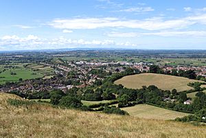
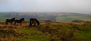
The middle of Somerset features the Somerset Levels, a flat, wet area. In the north-east, you'll find parts of the Cotswolds and all of the Mendip Hills. These are both special protected landscapes. To the west are the Quantock Hills and part of the Blackdown Hills, also protected. Most of Exmoor, a national park, is also in Somerset. Important rivers include the Avon, Axe, Brue, and River Parrett.
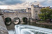
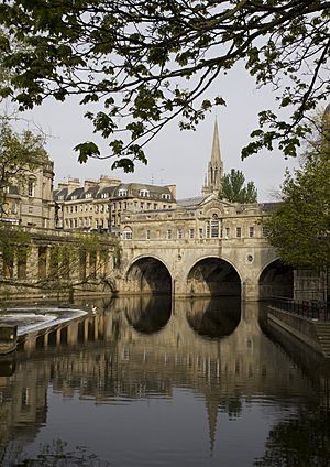
People have lived in Somerset since the Stone Age. Later, Celts, Romans, and Anglo-Saxons settled here. The county played a big role in Alfred the Great's story. It was also important during the English Civil War and the Monmouth Rebellion. In medieval times, many grand churches and monasteries were built. Glastonbury Abbey was very famous, even claiming to be the burial place of King Arthur. The city of Bath is famous for its Georgian buildings and is a UNESCO World Heritage Site. Somerset is also home to the Glastonbury Festival, a huge music event.
Contents
What's in a Name?
The name Somerset likely comes from Old English. It means "the people living at or dependent on Sumortūn" (now Somerton). Another idea is that it means "settlers by the sea lakes." The name Somersæte was first used in the laws of King Ine. He was a Saxon King from 688 to 726 CE. This makes Somerset one of the oldest local government areas in the world.
The county's motto, Sumorsǣte ealle, means "all the people of Somerset." This phrase comes from the Anglo-Saxon Chronicle. It shows how much the people of Somerset supported King Alfred. They helped him fight against Viking invaders.
Most place names in Somerset are Anglo-Saxon. Examples include Bath, Somerton, and Wells. However, some names have older Celtic parts. Rivers like Frome and Avon are examples. Some modern names, like Tarnock and Priddy, are fully Celtic. Others, like Pen Hill, mix Saxon and Celtic words.
A Look Back in Time
Ancient Times
People lived in the caves of the Mendip Hills during the Stone Age. Important sites like Cheddar Gorge show this. Bones from Gough's Cave are 14,000 years old. A full skeleton, called Cheddar Man, dates back to 7150 BCE. Cave art has also been found. Some caves, like Wookey Hole, were used until recent times.
The Somerset Levels also have a long history of people living there. Early hunters settled on dry spots like Glastonbury and Brent Knoll. One of the world's oldest known engineered roads, the Sweet Track, was built here around 3807 BCE. This helped people travel across the wet lands.
The age of the stone circle monument at Stanton Drew stone circles is not fully known. But it is thought to be from the New Stone Age. There are many Iron Age hill forts in Somerset. Some, like Cadbury Castle and Ham Hill, were used again in the early Middle Ages.
Roman Rule
The Second Legion Augusta of the Roman army invaded Somerset in 47 CE. This was part of the Roman expansion in Britain. The county remained part of the Roman Empire until about 409 CE. That's when the Romans left Britain.
Many Roman remains have been found in Somerset. These include the Pagans Hill Roman temple in Chew Stoke. There's also the Low Ham Roman Villa. The famous Roman Baths in Bath gave the city its name.
Saxons and Normans
After the Romans left, Anglo-Saxon people invaded Britain. By 600 CE, they controlled much of England. But Somerset was still held by native Britons. The Britons fought off the Saxons for some time. By the early 700s, King Ine of Wessex had expanded his kingdom to include Somerset. The Saxon royal palace in Cheddar was used often in the 10th century for important meetings.
It's not fully clear how Britons and Saxons got along in Somerset. King Ine's laws show that Britons were a big part of the population. But the laws also suggest Britons couldn't reach the same social status as Saxons. Many were even slaves. Because of this, many Britons may have moved to places like Brittany. Those who stayed likely adopted Anglo-Saxon culture.
After the Norman Conquest in 1066, Somerset was divided into about 700 areas called fiefs. Large parts were owned by the king. Forts like Dunster Castle were used to control and defend the land. During the Middle Ages, different powerful nobles influenced Somerset.
From the 1600s to the 1800s
Somerset is home to HM Prison Shepton Mallet. It was England's oldest prison until it closed in 2013, having opened in 1610. During the English Civil War (1642-1651), Somerset mostly supported Parliament. Key battles included the Sieges of Taunton and the Battle of Langport.
In 1685, the Monmouth Rebellion happened in Somerset and nearby Dorset. Rebels landed at Lyme Regis and marched north. They hoped to capture Bristol and Bath. But they were defeated at the Battle of Sedgemoor in Westonzoyland. This was the last big battle fought in England. Arthur Wellesley later became the Duke of Wellington. His title came from the town of Wellington. A large monument on a nearby hill, the Wellington Monument, remembers him.
The Industrial Revolution in other parts of England ended most of Somerset's small home-based industries. But farming continued to do well. The Royal Bath and West of England Society was started in 1777 to improve farming methods.
Coal mining was important in north Somerset in the 1700s and 1800s. By 1800, it was big in Radstock. The Somerset Coalfield produced the most coal by the 1920s. All the mines are now closed, the last one in 1973. Most of the old mine buildings are gone. Only a winding wheel outside Radstock Museum remains. Further west, iron ore was mined in the Brendon Hills in the late 1800s. This ore was taken by the West Somerset Mineral Railway to Watchet Harbour. From there, it was shipped to furnaces.
The 1900s
Many Somerset soldiers died in the First World War. The Somerset Light Infantry had nearly 5,000 casualties. War memorials were built in most towns and villages. Only nine villages, called Thankful Villages, had no residents killed. During the Second World War, Somerset was a base for troops getting ready for the D-Day landings. Some hospitals built for war casualties are still used today. The Taunton Stop Line was built to stop a possible German invasion. You can still see its pill boxes along the coast and south through Ilminster and Chard.
Several fake towns were built in Somerset during World War II. They were designed to protect Bristol and other towns. These "decoy towns" looked like blacked-out streets and railway lines at night. This was to trick German bombers into dropping bombs on empty land. One decoy town was built on Beacon Batch. It was designed by Shepperton Studios using aerial photos of Bristol's railway yards. The decoys had dim red lights to look like steam locomotives. Burning straw bales soaked in creosote mimicked incendiary bombs. Oil drums were also lit to look like a burning city. This aimed to fool later waves of bombers.
The Chew Magna decoy town was bombed several times in late 1940 and early 1941. The Uphill decoy town, protecting the Weston-super-Mare airfield, was also bombed. A herd of dairy cows was hit, killing some.
Somerset's Landscape
Borders and Towns
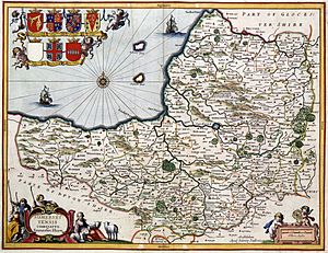
Somerset's borders are mostly the same as they were in medieval times. The biggest change is in the north. The River Avon used to be the border with Gloucestershire. But the area around Bath, which crosses the Avon, was part of Somerset. Bristol started on the Gloucestershire side of the Avon. As it grew, it spread into Somerset. In 1373, King Edward III declared Bristol a "county by itself."
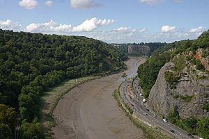
Today, Somerset's northern border follows the southern bank of the Avon from the Bristol Channel. It then goes around the southern edge of Bristol. It continues upstream along the Avon, then moves away from the river to include Bath. It meets Wiltshire at the Three Shire Stones on the Fosse Way at Batheaston.
Somerton was the county town in the late 1200s. But it became less important. So, Taunton became the county town around 1366. Somerset has two cities: Bath and Wells. It also has about 30 towns. The largest urban areas are Bath, Weston-super-Mare, Taunton, Yeovil, and Bridgwater.
Many towns grew because of their location near rivers or valleys. For example, Axbridge is on the River Axe. Castle Cary is on the River Cary. North Petherton is on the River Parrett. Ilminster was a crossing point on the River Isle. Midsomer Norton is on the River Somer. Chard is the southernmost town and one of the highest. Wiveliscombe is the highest town in the county, at 126 meters (413 feet) high.
Green Spaces
Somerset has parts of the Avon green belt area. This area helps stop cities like Bristol and Bath from spreading too much into the countryside. It protects the rural areas of North Somerset, Bath and North East Somerset, and Mendip. The green belt stretches from the coast near Portishead and Clevedon. It goes east past Nailsea, around Bristol, and through to Bath. It meets the Mendip Hills Area of Outstanding Natural Beauty (AONB) and the Cotswolds AONB. This creates a large area protected from too much building.
Rocks and Rivers
Somerset's landscape is shaped by its geology. The north has limestone hills. The center has clay valleys and wetlands. The east and south have oolite rocks. The west has Devonian sandstone.
North-east of the Somerset Levels are the Mendip Hills. These are moderate limestone hills. The central and western Mendips became an Area of Outstanding Natural Beauty in 1972. They cover 198 square kilometers (76 square miles). The main type of land here is grassy hills, with some farming. South-west of the Somerset Levels are the Quantock Hills. This was England's first Area of Outstanding Natural Beauty, named in 1956. It has heathland, oak woods, and old parklands. It covers 99 square kilometers (38 square miles). The Somerset Coalfield is part of a larger coalfield. North of the Mendip hills is the Chew Valley. To the south are wide valleys with clay soil, good for dairy farming. These valleys drain into the Somerset Levels.
Somerset has many caves. These include Wookey Hole, underground rivers, and gorges like Cheddar Gorge. The county has many rivers: the Axe, Brue, Cary, Parrett, Sheppey, Tone, and Yeo. These rivers feed and drain the flat levels and moors in central and west Somerset. In the north, the River Chew flows into the Bristol Avon. The Parrett River is tidal almost to Langport. Roman wharfs have been found there.
Levels and Moors
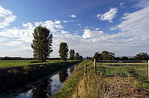
The Somerset Levels are a flat, wet area in central Somerset. They are between the Quantock and Mendip hills. They have marine clay near the coast and peat-based moors inland. The Polden Hills divide the Levels into two parts. The River Parrett drains the land to the south. The River Axe and River Brue drain the land to the north. The Levels cover about 647.5 square kilometers (160,000 acres). This area mostly matches the Sedgemoor district. About 70% of the area is grassland, and 30% is used for crops.
This flat land stretches about 32 kilometers (20 miles) inland. It is barely above sea level. Before it was drained, much of it was shallow, salty water in winter and marshland in summer. Drainage began with the Romans. It was restarted by the Anglo-Saxons and by Glastonbury Abbey in the Middle Ages. More drainage happened from 1400 to 1770 and during the Second World War. This included building the Huntspill River. Water levels are still managed today with pumps.
The North Somerset Levels basin is north of the Mendips. It is a smaller coastal area around Avonmouth. It was also reclaimed by draining.
In the far west of the county, extending into Devon, is Exmoor. This is a high moorland area. It became a national park in 1954. The highest point in Somerset is Dunkery Beacon on Exmoor. It is 519 meters (1,703 feet) high. Over 100 places in Somerset are special protected sites called Sites of Special Scientific Interest.
Coastline Views
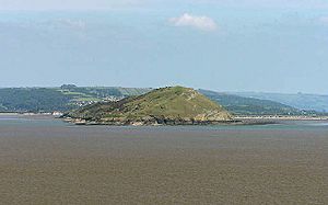
The 64-kilometer (40-mile) coastline of the Bristol Channel and Severn Estuary forms part of Somerset's northern border. The Bristol Channel has the second largest tidal range in the world. At Burnham-on-Sea, for example, the tide can rise and fall more than 12 meters (39 feet). There are plans to build a Severn Barrage to use this tidal energy. The island of Steep Holm in the Bristol Channel is part of Somerset.
The main coastal towns are Minehead, Watchet, Burnham-on-Sea, Weston-super-Mare, Clevedon, and Portishead. The coast between Minehead and Brean Down is called Bridgwater Bay. It is a National Nature Reserve. North of that, the coast forms Weston Bay and Sand Bay. Sand Point marks the start of the Severn Estuary. In the middle and north of the county, the coast is low and flat. In the west, the coastline is high and dramatic, with cliffs and waterfalls where Exmoor meets the sea.
Somerset's Weather
Somerset has a mild climate, generally wetter than the rest of the UK. The average yearly temperature is about 10°C (50°F). Temperatures don't change as much as in other parts of the UK because of the nearby sea. July and August are the warmest months, with average high temperatures around 21°C (70°F). In winter, average low temperatures are around 1°C or 2°C (34-36°F). The yearly sunshine is a bit less than the regional average of 1,600 hours.
Most rain in the south-west comes from Atlantic depressions or from warm air rising. In autumn and winter, Atlantic depressions cause most of the rain. In summer, much of the rain comes from the sun heating the ground, leading to showers and thunderstorms. Average rainfall is about 700 mm (28 inches). Snowfall is typical for 8–15 days a year. Wind speeds are highest from November to March and lightest from June to August. The wind usually blows from the south-west.
| Climate data for Yeovilton, England (1981–2010) data | |||||||||||||
|---|---|---|---|---|---|---|---|---|---|---|---|---|---|
| Month | Jan | Feb | Mar | Apr | May | Jun | Jul | Aug | Sep | Oct | Nov | Dec | Year |
| Mean daily maximum °C (°F) | 8.1 (46.6) |
8.3 (46.9) |
10.6 (51.1) |
12.9 (55.2) |
16.5 (61.7) |
19.3 (66.7) |
21.7 (71.1) |
21.5 (70.7) |
18.6 (65.5) |
14.8 (58.6) |
11.1 (52.0) |
9.0 (48.2) |
14.4 (57.9) |
| Daily mean °C (°F) | 4.8 (40.6) |
4.8 (40.6) |
6.7 (44.1) |
8.3 (46.9) |
11.7 (53.1) |
14.5 (58.1) |
16.8 (62.2) |
16.6 (61.9) |
14.1 (57.4) |
10.9 (51.6) |
7.4 (45.3) |
5.7 (42.3) |
10.2 (50.4) |
| Mean daily minimum °C (°F) | 1.4 (34.5) |
1.3 (34.3) |
2.7 (36.9) |
3.7 (38.7) |
6.8 (44.2) |
9.7 (49.5) |
11.9 (53.4) |
11.7 (53.1) |
9.6 (49.3) |
6.9 (44.4) |
3.6 (38.5) |
2.4 (36.3) |
6.0 (42.8) |
| Average precipitation mm (inches) | 72.0 (2.83) |
55.6 (2.19) |
56.5 (2.22) |
47.3 (1.86) |
48.9 (1.93) |
57.2 (2.25) |
48.9 (1.93) |
56.6 (2.23) |
64.5 (2.54) |
67.9 (2.67) |
65.8 (2.59) |
83.3 (3.28) |
724.5 (28.52) |
| Average rainy days | 12.5 | 10.2 | 10.9 | 9.2 | 8.8 | 8.5 | 6.9 | 8.6 | 10.1 | 11.3 | 11.6 | 12.6 | 121.2 |
| Mean monthly sunshine hours | 50.2 | 68.9 | 107.6 | 155.4 | 193.1 | 186.0 | 205.8 | 197.8 | 139.8 | 101.1 | 70.2 | 46.8 | 1,522.7 |
| Source: Met Office | |||||||||||||
How Somerset is Governed
The county of Somerset is currently managed by three main local councils. These are Bath and North East Somerset Council (B&NES), North Somerset Council, and Somerset Council. B&NES is also part of the West of England Combined Authority.
Local government in Somerset started in 1889. An administrative county was created, and Somerset County Council was set up. Bath was managed separately.
In 1974, the county and council were changed. They were replaced by two new types of counties: Somerset and Avon. Somerset was governed by a new county council and five districts. Avon had six districts, three of which used to be part of Somerset.
In 1996, Avon was removed. Its districts were renamed and became single-tier councils. Woodspring became 'North Somerset'. Wansdyke and Bath were combined into 'Bath and North East Somerset'. In 1997, these two areas became part of the ceremonial county of Somerset. On September 1, 2019, the districts of West Somerset and Taunton Deane merged to form Somerset West and Taunton.
In 2023, the non-metropolitan county was changed again. The four districts and their councils were removed. Somerset County Council became a single-tier council for the whole area, renamed Somerset Council. The two existing single-tier councils (Bath and North East Somerset, and North Somerset) were not changed.
Somerset's local government records go back to 1617. This is longer than any other county. A meeting in Wells that year decided to create a room to keep important records safe.
UK Parliament Members
As of 2024, Somerset is divided into 11 areas for the UK Parliament. Each area chooses one Member of Parliament (MP) to represent them in the House of Commons.
Conservative Labour Liberal Democrat
| Constituency | Member of Parliament | |
|---|---|---|
| Bath | Wera Hobhouse | |
| Bridgwater | Ashley Fox | |
| Frome and East Somerset | Anna Sabine | |
| Glastonbury and Somerton | Sarah Dyke | |
| North East Somerset and Hanham (partly in Gloucestershire) | Dan Norris | |
| North Somerset | Sadik Al-Hassan | |
| Taunton and Wellington | Gideon Amos | |
| Tiverton and Minehead (partly in Devon) | Rachel Gilmour | |
| Wells and Mendip Hills | Tessa Munt | |
| Weston-super-Mare | Dan Aldridge | |
| Yeovil | Adam Dance | |
Local Parishes
Almost all of Somerset has a local form of government called a civil parish. These have a town or parish council (or a city council in Wells). Some parishes group together. The city of Bath and much of Taunton do not have these parish councils.
People of Somerset
In the 2011 census, the population of the Somerset County Council area was 571,600. Bath and North East Somerset had 193,400 people. North Somerset had 216,700 people. This makes the total population for the ceremonial county 981,700.
The population is growing faster than the national average. It increased by 6.4% in the Somerset County Council area since 1991. The population density is 1.4 people per hectare. This is lower than the South West region's average of 2.07 people per hectare. Population density varies within the county.
Most of Somerset's population is white British (94.6%). About 2.0% belong to Black and ethnic minority (BME) groups. Over 25% of Somerset's people live in Taunton, Bridgwater, and Yeovil. The rest of the county is rural and has fewer people. Over 9 million tourists visit Somerset each year. This greatly increases the population during busy times.
| Year | 1801 | 1851 | 1901 | 1911 | 1921 | 1931 | 1941 | 1951 | 1961 | 1971 | 1981 | 1991 | 2001 | 2011 | 2021 |
|---|---|---|---|---|---|---|---|---|---|---|---|---|---|---|---|
| Somerset CC area | 187,266 | 276,684 | 277,563 | 280,215 | 282,411 | 284,740 | 305,244 | 327,505 | 355,292 | 385,698 | 417,450 | 468,395 | 498,093 | 529,972 | 571,600 |
| BANES | 57,188 | 96,992 | 107,637 | 113,732 | 113,351 | 112,972 | 123,185 | 134,346 | 144,950 | 156,421 | 154,083 | 164,737 | 169,045 | 176,015 | 193,400 |
| North Somerset | 16,670 | 33,774 | 60,066 | 68,410 | 75,276 | 82,833 | 91,967 | 102,119 | 119,509 | 139,924 | 160,353 | 179,865 | 188,556 | 202,566 | 216,700 |
| Total | 261,124 | 407,450 | 445,266 | 462,357 | 471,038 | 479,758 | 520,396 | 563,970 | 619,751 | 682,043 | 731,886 | 812,997 | 855,694 | 908,553 | 981,700 |
Somerset's Economy
Somerset doesn't have many large factories. But it has light industry, high-tech companies, and traditional farming. Tourism is also becoming very important. The unemployment rate is low, at 2.5%. In 2013, tourism supported about 26,000 jobs.
Bridgwater grew as a major port during the Industrial Revolution. Large ships could sail up the River Parrett to Bridgwater. Goods were then moved to smaller boats to go further upriver to Langport. Or they could go to Taunton via the River Tone. Today, the Parrett is only navigable to Dunball Wharf. In the 1800s and 1900s, Bridgwater made bricks, roof tiles, and later cellophane. These industries have now stopped.
Because of its good links to motorways, Bridgwater is now a hub for distribution companies. These include Argos and Morrisons. Leonardo Helicopters, previously AgustaWestland, makes helicopters in Yeovil. Normalair Garratt, which builds aircraft oxygen systems, is also in Yeovil.
Somerset is a key supplier of defense equipment and technology. A Royal Ordnance Factory, ROF Bridgwater, was built during World War II to make explosives. It closed in 2008. Templecombe has Thales Underwater Systems. Taunton has the United Kingdom Hydrographic Office and Avimo, which is now part of Thales Optics. Other high-tech companies include Gooch and Housego in Ilminster, which makes optics. There are Ministry of Defence offices in Bath. Norton Fitzwarren is home to 40 Commando Royal Marines. The Royal Naval Air Station in Yeovilton is one of Britain's two active naval air bases. It houses the Royal Navy's Wildcat and Merlin helicopters.
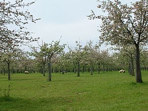
Farming and food production are still big industries. They employ over 15,000 people. Apple orchards were once common, and Somerset still makes a lot of cider. Taunton and Shepton Mallet are involved in cider production. There are also special producers like Burrow Hill Cider Farm. Gerber Products Company in Bridgwater is Europe's largest fruit juice maker. It produces brands like Sunny Delight. Dairy-based companies, like Ilchester Cheese Company and Yeo Valley Organic, make desserts, yoghurts, and cheeses.
Traditional willow growing and weaving is less common now. But it is still done on the Somerset Levels. You can learn about it at the Willows and Wetlands Visitor Centre. Willow was used in ancient times for baskets and causeways. In the 1930s, over 3,600 hectares (8,900 acres) of willow were grown. The industry declined after the 1950s because plastic bags and cardboard boxes replaced baskets. By the late 1900s, only about 140 hectares (350 acres) were grown commercially.
Towns like Castle Cary and Frome grew because of medieval weaving. Street became a center for making wool slippers and shoes. C&J Clark had its headquarters there. Now, Clark's shoes are made in other countries.
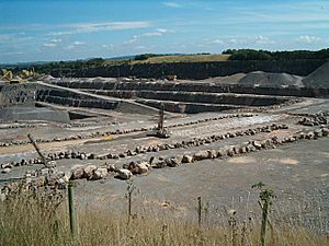
Somerset has a long history of providing freestone and building stone. Quarries at Doulting supplied stone for Wells Cathedral. Bath stone is also widely used. It was mined underground and is still used today, often as a cladding material. Further south, Hamstone comes from Ham Hill. Blue Lias stone was used locally for building and cement. Until the 1960s, Puriton had Blue Lias quarries. Since the 1920s, the county has supplied aggregates (materials like gravel). Foster Yeoman is Europe's largest supplier of limestone aggregates. Its quarries, like Merehead Quarry, use Mendip Rail to transport aggregates by train.
In November 2008, an organization called Into Somerset was launched. Its goal was to attract businesses to the county. This is now part of the Heart of the South West Growth Hub.
Nuclear Power
Hinkley Point C nuclear power station is a project to build a large nuclear power station. It will have two reactors and produce 3,200 MW of power. On October 18, 2010, the British government announced that Hinkley Point was suitable for new nuclear power stations. This site already had the disused Hinkley Point A and the then-operating Hinkley Point B power stations. Construction is underway and is expected to be finished in 2025.
Emergency Services
All of Somerset is covered by the Avon and Somerset Police. This police force also covers Bristol and South Gloucestershire. The Devon and Somerset Fire and Rescue Service covers the Somerset County Council area and Devon. North Somerset and Bath & North East Somerset are covered by the Avon Fire and Rescue Service. The South Western Ambulance Service covers all of South West England, including Somerset. The Dorset and Somerset Air Ambulance is a charity based in the county.
Culture and Fun
In Arthurian legend, Avalon is linked to Glastonbury Tor. Monks at Glastonbury Abbey claimed to find the bones of King Arthur there. Glastonbury was an important religious center by 700 CE. It claims to have the "oldest above-ground Christian church in the World." This claim is based on a legendary visit by Joseph of Arimathea in 63 AD. He was said to have brought the Holy Grail.
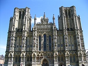
In the Middle Ages, other important religious sites were Woodspring Priory and Muchelney Abbey. The Diocese of Bath and Wells covers most of Somerset. The main church for the Bishop of Bath and Wells is in Wells Cathedral. Before the English Reformation, it was a Roman Catholic area. Now, the county is part of the Roman Catholic Diocese of Clifton. The Benedictine monastery Saint Gregory's Abbey, known as Downside Abbey, is in Stratton-on-the-Fosse. The ruins of the former Cistercian Cleeve Abbey are near Washford.
Somerset has strong traditions in art, music, and literature. Poets Wordsworth and Coleridge wrote while staying in Coleridge Cottage, Nether Stowey. The writer John Cowper Powys lived in Montacute and set his novels Wood and Stone and A Glastonbury Romance in Somerset. The writer Evelyn Waugh spent his last years in Combe Florey.
Traditional folk music and dance were important in farming communities. Cecil Sharp collected Somerset songs. These were used in works like Holst's A Somerset Rhapsody. Halsway Manor near Williton is an international center for folk music. The tradition continues with groups like The Wurzels, known for their Scrumpy and Western music.
The Glastonbury Festival of Contemporary Performing Arts happens most years in Pilton. It attracts over 170,000 people from around the world. The Big Green Gathering also takes place in the Mendip Hills. The annual Bath Literature Festival is one of many local festivals. Others include the Frome Festival. The West Country Carnivals are held in Somerset towns in autumn. They form a major regional festival and are the largest Festival of Lights in Europe.
Somerset has several museums. In Bath, there's the American Museum in Britain, the Museum of Bath Architecture, and the Roman Baths. Other attractions include Claverton Pumping Station, Dunster Working Watermill, the Fleet Air Arm Museum at Yeovilton, Nunney Castle, The Helicopter Museum in Weston-super-Mare, and the Museum of Somerset in Taunton.
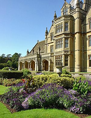
Somerset has 11,500 listed buildings. It also has 523 scheduled monuments and 192 conservation areas. There are 41 parks and gardens, including Barrington Court and Tintinhull Garden. There are 36 English Heritage sites and 19 National Trust sites. These include Montacute House and Tyntesfield. Stembridge Tower Mill is the last thatched windmill in England. A key feature of Somerset architecture is its medieval church towers. These towers are considered some of England's finest medieval art.
Bath Rugby plays at the Recreation Ground in Bath. The Somerset County Cricket Club is based in Taunton. The county's top football club is Yeovil Town. Horse racing courses are in Taunton, Bath, and Wincanton.
The county is served by the regional Western Daily Press newspaper. Local newspapers include the Weston & Somerset Mercury and the Bath Chronicle. Television is provided by BBC West and ITV West Country. Local radio stations are BBC Radio Somerset and Heart West.
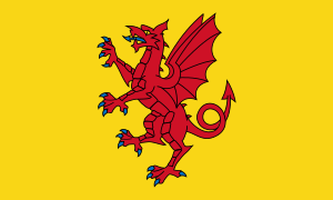
A flag representing the historic county of Somerset was chosen in 2013 after a competition.
Getting Around Somerset
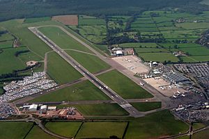
Somerset has 6,531 kilometers (4,058 miles) of roads. Major roads include the M5 motorway, A303, A37, A38, and A39. These provide good access across the county. But many areas can only be reached by narrow country lanes.
Train services are provided by the West of England Main Line and the Bristol to Exeter line. The main train operator is Great Western Railway. Other services are run by South Western Railway and CrossCountry.
Bristol Airport, located in North Somerset, offers national and international flights.
The Somerset Coal Canal was built in the early 1800s. It helped lower the cost of moving coal and other heavy goods. The first 16 kilometers (10 miles) were in use by 1805. This included several tramways.
The 1800s saw improvements to Somerset's roads with turnpikes. Canals and railways were also built. Canals included the Bridgwater & Taunton Canal and Glastonbury Canal. The Dorset & Somerset Canal was planned but mostly not built.
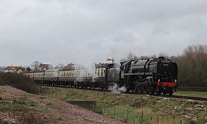
The canals were useful for a short time. Some have now been restored for fun. The 1800s also saw railways built in and through Somerset. The county was served by five railway companies. The main lines of the Great Western Railway (GWR) are still used today. But many of its smaller lines were removed. Other railway lines, like the Somerset & Dorset Joint Railway, have closed completely. Two branch lines, the West and East Somerset Railways, were saved. They are now "heritage" lines, run privately. The West Somerset Mineral Railway carried iron ore from the Brendon Hills to Watchet.
Until the 1960s, piers at Weston-super-Mare, Clevedon, Portishead, and Minehead had regular boat services. These boats went to places like Barry and Cardiff. The original stone pier at Burnham-on-Sea was used for goods. The newer concrete pier at Burnham-on-Sea is said to be the shortest pier in Britain. In the 1970s, the Royal Portbury Dock was built to add more capacity for the Port of Bristol.
For long-distance holiday traffic going through Somerset to Devon and Cornwall, the county is often seen as a stopping point. North-south traffic uses the M5 motorway. Traffic from the east uses either the A303 road or the M4 motorway. The M4 crosses the M5 just north of the county.
Learning in Somerset
State schools in Somerset are managed by three local education authorities. These are Bath and North East Somerset, North Somerset, and the larger Somerset County Council. All state schools are comprehensive, meaning they teach students of all abilities. In some areas, primary, infant, and junior schools teach children aged four to eleven. After that, students go to secondary schools. The Cheddar Valley and West Somerset use a three-tier system with first, middle, and upper schools. Most other schools in the county use a two-tier system. Somerset has 30 state and 17 independent secondary schools.
| % of pupils gaining 5 grades A-C including English and Maths in 2006 (average for England is 45.8%) | |
|---|---|
| Education Authority | % |
| Bath and North East Somerset (Unitary Authority) | 52.0% |
| West Somerset | 51.0% |
| Taunton Deane | 49.5% |
| Mendip | 47.7% |
| North Somerset (Unitary Authority) | 47.4% |
| South Somerset | 42.3% |
| Sedgemoor | 41.4% |
Some secondary schools in the county have specialist school status. Some schools have sixth forms for older students. Others send their sixth formers to colleges. Several schools have long histories, like The Blue School in Wells. Others have changed names, like Beechen Cliff School. Many schools were built after World War II. In 2006, 5,900 students in Somerset took GCSE exams. 44.5% achieved 5 grades A-C, including English and Maths.
Sexey's School in Bruton is a state boarding school that also takes day students. The Somerset local education authority also provides special schools. These include Newbury Manor School for children aged 10 to 17 with special educational needs. Mainstream schools also help students with special needs.
There are also many private or public schools. Many of these are for students aged 11 to 18, like King's College, Taunton and Wellington School, Somerset. King's School, Bruton, was founded in 1519. Millfield is the largest co-educational boarding school. There are also preparatory schools for younger children. Some schools teach children from age 3 or 4 up to 18, like King Edward's School, Bath and Wells Cathedral School. Wells Cathedral School is one of Britain's five established music schools for school-aged children.
Some schools have religious links. For example, Monkton Combe School and Downside School are Roman Catholic. Sidcot School is linked to the Religious Society of Friends. Kingswood School was founded by John Wesley in 1748 for the children of Methodist clergy.
Further and Higher Education
Somerset offers many adult education and further education courses. These are available in schools, colleges, and community centers. The colleges include Weston College and Bridgwater and Taunton College. The latter was formed in 2016 and includes the University Centre Somerset in Taunton. Other colleges are Bath College, Frome Community College, and Yeovil College. Somerset County Council runs Dillington House, a residential adult education college in Ilminster.
The University of Bath, Bath Spa University, and University Centre Weston are higher education places in the north of the county. The University of Bath started in 1966. It has a campus in Claverton with 15,000 students. Bath Spa University became a university in 2005. It is based at Newton St Loe and has 5,500 students.
|
See also
 In Spanish: Somerset para niños
 | Roy Wilkins |
 | John Lewis |
 | Linda Carol Brown |


