Mendip Hills facts for kids
Quick facts for kids Mendip Hills |
|
|---|---|
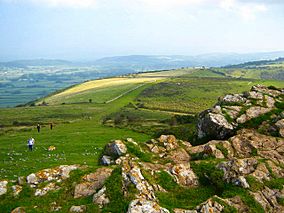
The Mendip Hills from Crook Peak, near Compton Bishop
|
|
| Location | Somerset, small part of west Wiltshire, England |
| Length | 30 km (19 mi) |
| Width | 10 km (6.2 mi) |
| Area | 200 km2 (77 sq mi) |
| Established | 1972 |
| Governing body | Mendip Hills AONB Partnership |
| Website | www.mendiphillsaonb.org.uk |
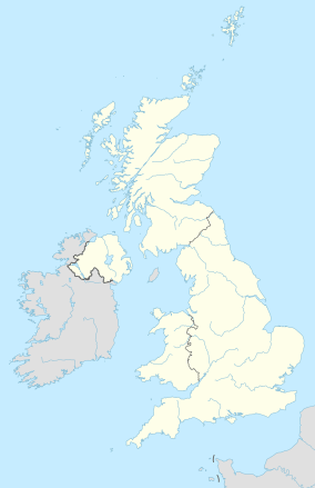
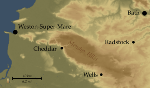
The Mendip Hills, often called the Mendips, are a range of limestone hills in Somerset, England. They are located south of the cities of Bristol and Bath. These hills stretch from Weston-super-Mare and the Bristol Channel in the west. They reach the Frome valley in the east.
The Mendips look over the Somerset Levels to the south. To the north, they overlook the Chew Valley and other rivers that flow into the Avon. The area is so important that the local government district is named Mendip. The western part of the hills, covering about 198 square kilometers (76 square miles), is a special protected area. It is called an Area of Outstanding Natural Beauty (AONB). This means it is protected almost like a national park.
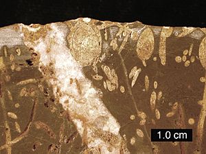
The hills are mostly made of Carboniferous Limestone. This rock is dug up in several places. The Mendips are home to important natural areas. These include ash–maple woodlands and different types of grasslands. These habitats support many plants and animals. You can find various birds, butterflies, and small mammals here. The dry stone walls that divide the fields are also special. They are home to a rare plant called wall whitlowgrass.
People have lived in the Mendips for a very long time. Evidence shows humans were here in the Stone Age. Many old items have been found in the caves. There are also over 200 ancient monuments like burial mounds. Mining for lead and silver started here in the Bronze Age. It became very important after the Romans arrived. Today, there are still several quarries in the Mendips.
The Mendips are a great place for outdoor activities. They are famous for caving and cave diving. People also enjoy climbing, hiking, and studying nature here. Some caves, like Wookey Hole Caves and parts of Cheddar Gorge, are open to visitors. Other caves are only for experienced cavers. Long walking paths like the Mendip Way also cross the hills.
Contents
What Does "Mendip" Mean?
The name "Mendip" has a few possible meanings. The earliest known spelling was Mendepe in 1185. Some people think it comes from a medieval term, Myne-deepes. This might refer to the deep mines in the area.
Another idea is that it comes from a Celtic word, monith. This word means mountain or hill. The second part of the name is less clear. It might come from an Old English word, yppe, meaning upland or plateau.
Some also suggest it's linked to the Welsh word mynydd, which means upland moorland. The end of the name might come from the Old English word hop, meaning a valley. Other ideas include "the stone pit" from Celtic words. This could refer to the collapsed caves in Cheddar. Or it might mean "mighty and awesome" from Old English words.
How the Mendips Were Formed
The rocks that make up the Mendips are called Carboniferous Limestone. They were formed about 320 to 350 million years ago. After that, a huge event called the Variscan orogeny happened. This was when continents collided about 300 million years ago. This collision created many mountains and hills across Europe, including the Mendips.
Because of this mountain-building, the Mendips now have several folded rock structures. These folds run from east to west. They have older sandstones and volcanic rocks at their core. These volcanic rocks are used to build roads and make concrete. Millions of years ago, the Mendips were much taller and steeper. Over time, erosion has shaped them into what we see today. This includes deep gorges, dry valleys, and sinkholes.
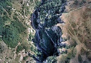
Underneath the southern slopes and plateau, there are many caves. You can also find areas of exposed limestone rock patterns. The dissolving of limestone created famous gorges like Cheddar Gorge and Burrington Combe. Many springs flow from the eastern part of the hills.
Black Down is a moorland area. Its steep sides are covered in bracken plants. The flatter top has heather and grasses. Most of the rest of the Mendip plateau is covered in pasture land. The main part of the hills is a wide, flat area. It is about 6–8 kilometers (4–5 miles) wide. It is generally about 240 meters (800 feet) above sea level.
In some places, lead and zinc ores have mixed with the limestone. From Roman times until 1908, the Mendips were a major source of lead. These mining areas left behind rough, contaminated ground. Locals call these areas "gruffy." This name comes from the grooves left where lead ore was dug up near the surface. Other minerals found here included zinc ore, manganese, iron, copper, and baryte. The eastern Mendips also reach into parts of the Somerset Coalfield.
Weather in the Mendips
The Mendip Hills have a temperate climate. This means it's generally wetter and milder than other parts of England. The average yearly temperature is about 10°C (50°F). January is the coldest month, and July and August are the warmest.
December is usually the cloudiest month, and June is the sunniest. The southwest of England often gets good weather in summer. This is because of a high-pressure system from the Azores.
Clouds often form over the hills, which can reduce sunshine. The area gets about 1,600 hours of sunshine each year. Rain usually comes from Atlantic storms or from local thunderstorms in summer. The average rainfall is about 800–900 mm (31–35 inches). It typically snows for 8–15 days a year. The wind is usually strongest from November to March.
The rain and geology create a lot of water runoff from springs. About 330,000 cubic meters (72 million imperial gallons) flow out each day. The Bristol Waterworks Company realized how valuable this water was. Between 1846 and 1853, they built tunnels and pipes. This system still carries about 18,200 cubic meters (4 million imperial gallons) of water daily. This water goes to Barrow Gurney Reservoirs for cleaning. Then it is sent to Bristol and nearby areas. Water from the Mendips is also collected in Cheddar Reservoir. This reservoir was built in the 1930s. It collects water from the springs in Cheddar Gorge.
Wildlife in the Mendips
The Mendips have three very important natural habitats. These are ash–maple woodlands, and two types of grasslands. These areas are home to a wide variety of plants and animals. Much of the Mendips is open grassland. This supports many flowering plants and insects. Some parts are ancient woodlands with trees that lose their leaves in autumn.
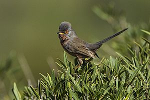
Many bird species live in the Mendips. The peregrine falcon is very important. It has returned to the area since the 1980s. These falcons nest on cliffs and in old quarries. The high moorlands in the west Mendips are now home to the Dartford warbler. This bird is usually found in lowland heath. The woodlands at Stock Hill are where nightjars and long-eared owls breed.
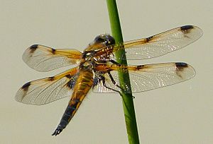
Waldegrave Pool, near Priddy Mineries, is a key spot for dragonflies. You can find downy emerald and four-spotted chaser dragonflies here. Waldegrave Pool is the only place in the Mendips where downy emerald dragonflies breed. In 2007, a red kite was seen for the first time in Charterhouse.
Important small mammals live here too. These include the hazel dormouse and various bats. Hazel dormice prefer woodlands and thick bushes. Bats, like the rare lesser and greater horseshoe bats, live in buildings, caves, and mines. The greater horseshoe bat is a protected species. Amphibians like the great crested newt are also common. They are often found in old, flooded quarries.
Several rare butterflies live in the Mendips. These include the pearl-bordered fritillary and Duke of Burgundy. The large blue butterfly used to live here but died out in the late 1970s. The white-clawed crayfish is also rare. Small groups live in the Mells River and River Chew.
The dry stone walls are a famous feature of the Mendips. They are built from local limestone without any mortar. Many of these walls have fallen apart over the years. They are important for plants, as they support the rare wall whitlowgrass. Other special plants in the area include the Cheddar pink and purple gromwell.
A Look at Mendip History
People have lived in the Mendips for a very long time. Over 20 Stone Age sites have been found. These sites contain animal bones and stone tools from caves. More tools have been found on the surface. Many items have been found near Neolithic, Iron Age, and Bronze Age sites. These include burial mounds and forts around Priddy and Dolebury Warren.
The caves in Cheddar Gorge have many old remains. Floodwaters washed items and bones into the caves. This helped to preserve them in the silt. The Cheddar Man, Britain's oldest complete skeleton, was found in Gough's Cave. This cave is part of the Cheddar Complex.
There are 286 clear examples of round burial mounds in the Mendip Hills. These include the Priddy Nine Barrows and Ashen Hill Barrow Cemeteries. The area has over 1,200 historical records. There are also over 600 listed buildings and 200 ancient monuments. These protected sites range from prehistoric mounds to a World War II bombing decoy.
Mining for lead started in the late Bronze Age. This was when new metal-working skills appeared. The Roman invasion was partly due to the Mendips' rich minerals. Lead mining grew a lot after the Romans arrived.
In 1789, William Wilberforce visited Cheddar. He saw how poor the local people were. This inspired Hannah More to help the Mendip miners and farm workers. She helped build schools. Children were taught to read and learn Christian teachings. Between 1770 and 1813, about 7,300 hectares (18,000 acres) of common land were fenced off. This was mostly done with dry stone walls. These walls are now a key part of the landscape. In 2006, money was raised to fix and improve these walls.
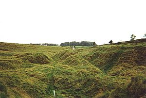
In the early 1900s, over 300 "Mendip Motor Cars" were built in Chewton Mendip. During World War II, a fake bombing target was built on top of Black Down. This was to confuse bombers trying to hit Bristol. Piles of stones were also made to stop enemy planes from landing.
In the 1960s, the tallest mast in the region was built. This was the Mendip transmitting station on Pen Hill near Wells. It is one of the highest points in the Mendips. The antenna reaches almost 589 meters (1,932 feet) above sea level. Since 2003, there have been discussions about building a wind turbine near Chewton Mendip. In 2006, permission was given to build a 102-meter (335-foot) turbine.
The Mendip Power Group is installing small hydroelectric turbines in old watermills. The first one started making electricity in 2006. It produces 50–55 kW of power.
Protecting the Mendip Hills
Since 1972, the western Mendip Hills have been an Area of Outstanding Natural Beauty (AONB). This means the area is specially protected. The Mendip Society was formed in 1965. It helps people learn about and protect the area. The society has 700 members. They offer guided walks and educational talks. They also give small grants to help local communities. These grants help to protect the landscape and encourage people to enjoy it.
AONBs are similar to national parks in England and Wales. They are created under the same law. However, national parks have their own authorities. These authorities have legal power to stop harmful building. AONBs have fewer official duties for local authorities. But new rules were added in 2000 to protect AONBs even more.
In 2009, there were plans to make the Mendips a Geopark. A Geopark is a special area recognized by UNESCO. It has important scientific sites. These sites are valuable for geology, archaeology, nature, or culture.
The Mendip Hills Partnership helps manage the AONB. It includes five local councils and other groups. These groups care about protecting the area. The AONB staff unit is based at the Charterhouse Centre. They have a manager, project officer, support officer, and planning officer. They also have 20 volunteer rangers. In 2005, a plan was made to make the AONB even bigger. This would include Steep Holm and Brean Down in the west. It would also extend towards Frome in the east.
Many villages in the Mendips have their own parish councils. These councils handle local issues. People also vote for councillors in larger districts. The AONB covers about 198 square kilometers (76 square miles). This area is split across four districts. These are Mendip District Council, Sedgemoor District Council, Bath and North East Somerset Council, and North Somerset Council. Each village is also part of a larger voting area for Parliament. The police services are provided by Avon and Somerset Constabulary.
People of the Mendips
The people living on the higher parts of the Mendips are spread out. They live in small farms and tiny villages. Most people now travel to nearby cities and towns for work. They don't usually work in farming or forestry. The largest village on the western Mendips plateau is Priddy. In 2011, it had 624 people. The smaller village of Charterhouse is also nearby.
Larger villages and towns are on the lower slopes of the western hills. They are often in river valleys. Axbridge has 2,057 people, and Cheddar has 5,755. Both are in the Sedgemoor district. The Mendip town of Shepton Mallet has 10,369 people. The city of Wells has 10,636. These are along the southern edge of the hills. On the northern edge are villages like Blagdon (1,116 people), Compton Martin (508), East Harptree (644), and West Harptree (439).
Further east are the towns of Midsomer Norton and Radstock. The village of Paulton has 5,302 people. These are in the Bath and North East Somerset area.
Getting Around the Mendips
Around the middle of the 1st century, the Romans built the Fosse Way. This road went from Bath to Ilchester. A branch of this road went to the Charterhouse lead mines. Two Mendip villages, Stratton-on-the-Fosse and Lydford-on-Fosse, are named after this Roman road. Much of the high plateau was not farmed or fenced until the 1700s. Because of this, many roads are still narrow, winding lanes. They run between high banks and stone walls. Some tracks were originally for moving livestock. These often became open roads with wide grassy edges. Roads tend to follow gorges and valleys, like in Cheddar Gorge.
Today's main roads often started as toll roads in the 1500s. These roads avoid the highest parts of the hills. To the north, the A368 separates the hills from the Chew Valley. On the south side, the A371 runs along the bottom of the hills. The western end of the hills is crossed by the M5 motorway. You can get on or off at junctions 21 and 22. The A38 also crosses here. Further east, the A37, A39, A36, and A361 run north to south.
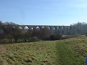
In the late 1800s and early 1900s, railways ran through the Mendips. These included the Bristol and North Somerset Railway. Other lines served towns like Cheddar and Wells. These railways have all closed now. However, Mendip Rail still uses freight lines. These lines carry limestone from the quarries of the Mendip Hills. There is also the East Somerset Railway, which is a working heritage railway. The Somerset Coal Canal reached some of the coal mines in the eastern Mendips.
Quarrying in the Mendips
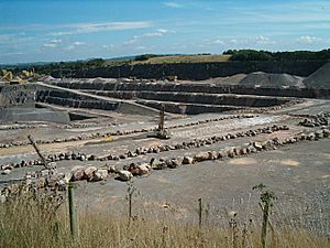
For centuries, the Mendips have been a source of stone. This stone was used to build cities like Bath and Bristol. Today, the quarries are major suppliers of road stone for southern England. They produce about twelve million tonnes of limestone every year. This industry employs over two thousand people. It also generates about £150 million each year.
There are two main types of rock in the Mendips. These are the Devonian sandstones and the Carboniferous Limestones. The limestone is the most common rock. There are nine active quarries and many old, unused sites. Several of these old sites are protected as important geological areas. Quarrying affects the environment and local communities. Because of this, there is a campaign to stop new quarries. It also aims to limit the growth of existing ones.
Fun Activities in the Mendips
The Mendips offer many outdoor sports and activities. These include caving, climbing, and abseiling. The rich variety of plants and animals also makes it great for hiking. People who love nature enjoy exploring here.
Caving and Cave Diving
Large areas of limestone in the Mendips have been worn away by water. This makes the hills a national center for caving. Some caves have been known since Roman times. This was when lead mining started. However, many caves were only found or explored in the 1900s. You need special gear and training to visit most caves. But Cheddar Gorge and Wookey Hole Caves are show caves. They are easy for the public to visit. Local caving clubs organize trips. They continue to find new caverns.
The Mendips hide Britain's largest underground river system. Trying to move between caves through these rivers led to cave diving. The first cave dive was attempted in 1934. This was at Swildon's Hole. The first successful dive was in 1935 at Wookey Hole Caves. This cave has the deepest underwater passage in Britain. It is 76 meters (250 feet) deep. Several cave systems are protected as important scientific sites. The deepest cave in the Mendip Hills is Charterhouse Cave. It goes down 220 meters (720 feet).
Many Mendip caves were explored for archaeology and nature studies. Pioneer explorer Herbert E. Balch did a lot of this work. Caver Harry Savory took amazing photos in the early 1900s. He used huge cameras and flash powder.
Walking and Hiking
Several places in the Mendips are open access land. This means you can walk freely there. There are also many footpaths and bridleways. These are usually clearly marked.
The Limestone Link is a 58-kilometer (36-mile) long-distance footpath. It goes from the Mendips to the Cotswolds. The Mendip Way covers 80 kilometers (50 miles). It runs from Weston-super-Mare to Frome. The western part starts at Uphill Cliff. It offers views over the Somerset Levels. It then crosses the central Mendip plateau. It goes down to Cheddar Gorge. Then it continues to Wells and Frome.
The much longer Monarch's Way is 990 kilometers (615 miles) long. It goes from Worcester to Shoreham-by-Sea. It follows the path taken by King Charles II. He took this route after losing a battle in 1651. The route enters Somerset near Chewton Mendip. It crosses the Mendip Hills on its way to Wells. A shorter local path is the Mendip Pub Trail. It is 45 kilometers (28 miles) long. It connects six pubs owned by Butcombe Brewery. The trail goes through Hinton Blewett, Priddy, Axbridge, Bleadon, Rowberrow, and Compton Martin.
Motor Sports
Different types of oval short-track racing happen at Mendips Raceway. This includes F1 and F2 stock cars. Races have been held here since 1969. The track is on Warrens Hill Road. It is on the edge of Batts Combe quarry. This is between Shipham and Charterhouse.
Mendips in Art
Thomas Hardy described the Mendips as "a range of limestone rocks stretching from the shores of the Bristol Channel into the middle of Somersetshire." Several of his books mention the Mendips or places on the hills. Legend says that Augustus Montague Toplady wrote the hymn "Rock of Ages" here. He was sheltering under a rock in Burrington Combe during a thunderstorm in 1763. There is a metal plaque marking the spot.
|
 | William M. Jackson |
 | Juan E. Gilbert |
 | Neil deGrasse Tyson |


