
North Somerset facts for kids
Quick facts for kids
North Somerset
|
||
|---|---|---|
|
Unitary authority
|
||
|
||

North Somerset within Somerset
|
||
| Sovereign state | United Kingdom | |
| Constituent country | England | |
| Region | South West England | |
| Ceremonial county | Somerset | |
| Admin HQ | Weston-super-Mare | |
| Area first created | 1 April 1974 | |
| Unitary status | 1 April 1996 | |
| Government | ||
| • Type | Unitary authority | |
| Area | ||
| • Total | 144.66 sq mi (374.68 km2) | |
| Population
(2005 est.)
|
||
| • Total | 215,052 (Ranked 82nd) | |
| Ethnicity (2021) | ||
| • Ethnic groups |
List
|
|
| Religion (2021) | ||
| • Religion |
List
46.6% Christianity
45.3% no religion 7.5% other 0.6% Islam |
|
| Time zone | UTC0 (GMT) | |
| • Summer (DST) | UTC+1 (BST) | |
| ISO 3166 code | GB-NSM | |

North Somerset is a special area in England that handles its own local government. It's like a mini-county within the larger Somerset area. The main office for North Somerset is in Weston-super-Mare, which is the biggest town there. You'll also find other towns like Clevedon, Nailsea, and Portishead, plus many smaller villages and countryside. Some parts of North Somerset are even in the Mendip Hills, which is a beautiful area known for its natural beauty.
This area was first created in 1974 and was called Woodspring. It was part of a county called Avon. But in 1996, Avon was removed, and Woodspring became North Somerset. This new name meant its local council took on more responsibilities, acting like a county council too.
North Somerset is located on the coast, facing the Bristol Channel to the west. Its neighbours are the cities of Bristol and Bath and North East Somerset, and the district of Somerset.
Contents
History of North Somerset
North Somerset was formed on 1 April 1974. Before that, it was made up of several smaller areas that were combined. These included parts of the Axbridge Rural District, and all of the Clevedon Urban District, Long Ashton Rural District, Portishead Urban District, and Weston-super-Mare Municipal Borough.

Before 1974, all these areas were part of Somerset. But then they became part of a new county called Avon. The new district was named Woodspring after Woodspring Priory, an old church located near the coast.
In 1996, the county of Avon was removed. The Woodspring area then became a "unitary authority." This means its local council became responsible for both district-level and county-level services. At this time, the government wanted to rename it "North West Somerset."
However, in July 1995, the local council decided to change the name to "North Somerset" instead. This change officially happened on 1 April 1996. A few years later, there was a small question about whether the council's decision was fully legal. So, in 2005, the council made another official decision to confirm the name "North Somerset" to make sure there were no doubts.
How North Somerset is Governed
North Somerset Council is the main governing body for the area. It provides many important services, like education, social care, and waste collection. This council handles both the services usually managed by a county and those managed by a smaller district.
The entire area of North Somerset is also divided into smaller local areas called civil parishes. These parishes have their own local councils that deal with very local issues, like parks or community halls.
The people of North Somerset also vote for their representatives in the national Parliament. The area is covered by two parliamentary constituencies: Weston-super-Mare and North Somerset.
Towns and Villages in North Somerset
.svg)
The main towns in North Somerset are coastal towns. These include Weston-super-Mare, Portishead, Clevedon, and Nailsea.
North Somerset is also home to many smaller villages, including:
- Abbots Leigh
- Backwell, Banwell, Barrow Gurney, Blagdon, Bleadon, Brockley, Burrington, Butcombe
- Churchill, Clapton in Gordano, Cleeve, Congresbury
- Dundry
- Easton in Gordano
- Failand, Felton, Flax Bourton
- Hutton
- Kenn, Kewstoke, Kingston Seymour
- Leigh Woods, Locking, Long Ashton, Loxton, Lulsgate Bottom
- Pill, Portbury, Puxton
- Redhill, Rickford
- Sandford, St Georges
- Tickenham
- Uphill
- Walton in Gordano, Weston in Gordano, Wick St. Lawrence, Winford, Winscombe, Worle, Wraxall, Wrington
- Yatton
Places to Visit in North Somerset
North Somerset has beautiful natural areas and coastal towns that attract many visitors. Some notable places to see include:
- Gordano Valley: A unique valley with special plants and wildlife.
- Mendip Hills: A range of hills perfect for walking and exploring. Part of the district's border runs along these hills.
- Sand Bay and Sand Point: A lovely sandy beach and a headland that offers great views.
- Worlebury Hill: A hill with an ancient hill fort.
- Burrington Combe, Goblin Combe, Brockley Combe: These are deep, narrow valleys, great for hiking and exploring nature.
- North Somerset Levels: Flat, low-lying areas, often used for farming.
A significant historical religious site is Woodspring Priory.
Economy and Jobs in North Somerset
Historically, North Somerset's economy was based on farming. This included raising sheep for wool in the Mendip Hills and dairy farming in the valleys. The annual North Somerset Show celebrates this farming heritage.
During the 1700s, tourism became very important, especially in coastal towns like Weston-super-Mare. This town grew from a small village into a popular holiday resort. While tourism became less popular in the mid-to-late 1900s, it has now become stable again.
In the 1800s, the big port city of Bristol needed new docks for larger ships. So, new docks were built on the coast of North Somerset. Portishead Dock was one of the first, used for shipping coal. Today, the newer Royal Portbury Dock is famous for importing many cars.
The table below shows how the economy of North Somerset has grown over the years. It looks at the total value of goods and services produced in the area.
| Year | Total Value | Farming | Industry | Services |
|---|---|---|---|---|
| 1995 | 5,916 | 125 | 1,919 | 3,872 |
| 2000 | 8,788 | 86 | 2,373 | 6,330 |
| 2003 | 10,854 | 67 | 2,873 | 7,914 |
Note: All figures are in millions of British Pounds Sterling. Numbers might not add up exactly due to rounding.
Population and People in North Somerset
North Somerset covers about 375 square kilometres (145 square miles). Around 193,000 people live here in about 85,000 homes.
The population of North Somerset has doubled since the 1950s. It is expected to keep growing, especially among young adults aged 20-34. However, North Somerset also has a higher percentage of older people (aged 60 and above) compared to the rest of England and Wales. This means it has a relatively older population overall.
In 2001, about 134,132 people in North Somerset were of working age. Out of these, 91,767 had jobs, which is about 68.4%. This is very similar to the employment rate in the wider West of England area.
Education in North Somerset
North Somerset has many schools for young people. As of 2023, the North Somerset Council works with 72 primary schools and 18 secondary schools. There are also four private schools in the area.
For students who want to continue their studies after secondary school, Weston College is the main place for further education. If you're looking for university-level courses, University Centre Weston offers these in partnership with Bath Spa University and the University of the West of England.
Images for kids
-
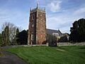
Holy Trinity Church in Abbots Leigh.
-
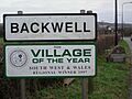
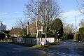
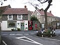
A sign welcoming visitors to Backwell.
-
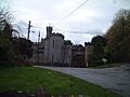
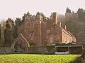
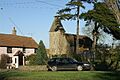
Banwell Castle, a historic building.
-
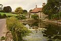
The millpond at Lower Barrow Mill in Barrow Gurney.
-
Blagdon church with a lake in the background.
-
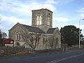
The church in Bleadon.
-
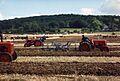
A ploughing match in Brockley in 1991.
-
The church in Burrington.
-
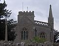
The church in Butcombe.
-
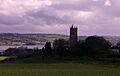
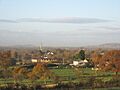
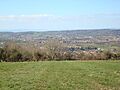
Houses and hills in Churchill, Somerset.
-
Clapton Court in Clapton in Gordano.
-
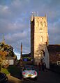
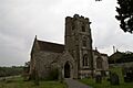
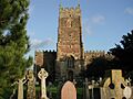
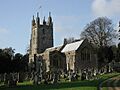
Holy Trinity Church in Cleeve.
-
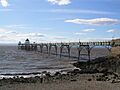
Clevedon Pier, stretching out into the sea.
-
The village of Congresbury with its church.
-
Dundry church and surrounding buildings.
-
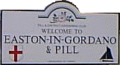
A street sign welcoming visitors to Easton in Gordano & Pill.
-
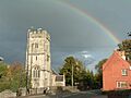
Flax Bourton church with a rainbow.
-
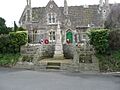
The War Memorial in Hutton.
-
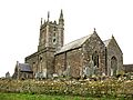
The church in Kenn.
-
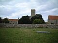
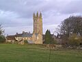
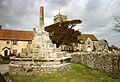
Woodspring Priory, a historic site.
-
The Triangle in Kingston Seymour.
-
Locking village hall.
-
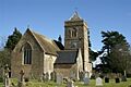
Long Ashton Church.
-
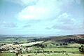
The village of Loxton surrounded by fields.
-
Houses and green spaces in Nailsea.
-
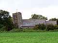
Portbury church.
-
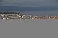
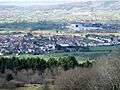
Views of Portishead with its many buildings.
-
Puxton church.
-
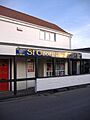
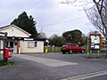
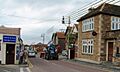
A local shop in St Georges, North Somerset.
-
Tickenham church.
-
A road junction in Walton in Gordano.
-
Weston in Gordano church.
-
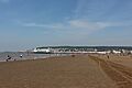
Weston-super-Mare with its famous Grand Pier.
-
Wick St Lawrence village scene.
-
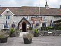
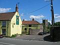
The Prince of Waterloo pub in Winford.
-
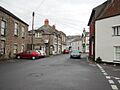
A street scene in Winscombe.
-
All Saints Church in Wraxall.
-
The high street in Wrington.
-
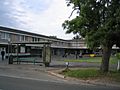
A pedestrian precinct in Yatton.


See also
 In Spanish: North Somerset para niños
