
River Tone facts for kids
Quick facts for kids River Tone |
|
|---|---|

The River Tone near Burrowbridge
|
|
| Country | England |
| County | Somerset |
| Settlements | Taunton, Creech St Michael |
| Physical characteristics | |
| Main source | Brendon Hills Huish Champflower, West Somerset, Somerset, England 51°06′05″N 3°24′29″W / 51.10139°N 3.40806°W |
| River mouth | River Parrett Burrowbridge, Taunton Deane, Somerset, England 51°04′02″N 2°55′02″W / 51.06722°N 2.91722°W |
| Length | 33 km (21 mi) |
| Basin features | |
| Basin size | 414 km2 (160 sq mi) |
The River Tone is a river in the English county of Somerset. It is about 33 kilometers (21 miles) long. The river starts at Beverton Pond near Huish Champflower in the Brendon Hills. Part of its water is held back by the Clatworthy Reservoir.
After the reservoir, the River Tone flows through the town of Taunton. It then passes through Curry and Hay Moors. These areas are very important for nature and are called a Site of Special Scientific Interest. Finally, the river joins the River Parrett at Burrowbridge.
Contents
Making the River Usable for Boats
For many years, people wanted to use the River Tone to move goods by boat. This would help trade in towns like Taunton.
In 1699, a special law was passed by the government. This law allowed work to be done to make the river deep enough for boats. The goal was to make it possible for boats to travel all the way to Taunton. The law also said that any money made from using the river should help the poor people of Taunton.
At first, the people in charge of the river didn't follow this rule. But by 1843, they used money from selling the river's navigation rights. This money helped build a part of the Taunton and Somerset Hospital. It also helped the Taunton Market Trust, which looked after the town's market.
The Canal and River Changes
In 1827, the Bridgwater and Taunton Canal opened. This new canal offered a much easier way to move goods than the river. Because of this, there were many disagreements about who owned the river and its water. These problems were finally sorted out in 1832. The company that owned the canal officially took over the river navigation.
Over time, it became harder to use the river for boats. The nearby River Parrett was also no longer used for navigation after 1878.
Flooding and Modern Changes
In 1960, there was a big flood in Taunton. After this, parts of the River Tone were straightened. This helped the water flow better and reduced flooding. The old locks, which were like water elevators for boats, were removed. One lock at a place called Ham was even blown up by the Territorial Army! By 1967, the right to use the river for boats was officially ended.
Images for kids
-
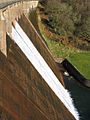
Clatworthy Dam
-
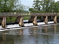
A footbridge crosses the top of French Weir at Taunton
-
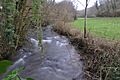
The River Tone at Tracebridge
-
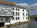
Dellers Wharf at Taunton.
-
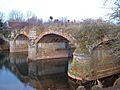
The Aqueduct over the river near Creech St Michael
-
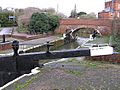
Firepool lock where the Bridgwater and Taunton Canal meets the River Tone
-
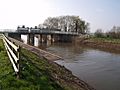
The sluice at Newbridge, which is the tidal limit for the river.
-
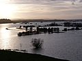
The River Tone in flood, Between Curry Moor and Hay Moor in 2013
-
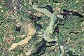
Satellite image showing the extent of flooding on 19 February 2014


.jpg)


.jpg)

