Brendon Hills facts for kids
Quick facts for kids Brendon Hills |
|
|---|---|

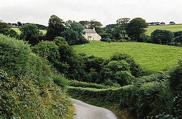
Brendon, towards Cranscombe Farm, Scob Hill
|
|
| Highest point | |
| Elevation | 1,388 ft (423 m) |
| Geography | |
| Location | Somerset, England |
| OS grid | SS950371 |
The Brendon Hills are a group of hills in west Somerset, England. They are found right next to the eastern part of Exmoor and are actually inside the Exmoor National Park. The highest point is Lype Hill, which stands about 1,388 feet (423 meters) above sea level. The name "Brendon" comes from an old word meaning "brown hill."
Contents
What are the Brendon Hills?
The Brendon Hills are a range of hills in the western part of Somerset, England. They are located right next to the eastern side of Exmoor. In fact, they are part of the beautiful Exmoor National Park.
Highest Points
The tallest point in the Brendon Hills is called Lype Hill. It reaches about 1,388 feet (423 meters) above the sea. There is also another high point nearby, which is about 1,350 feet (411 meters) tall. Both of these spots have special markers used by mapmakers.
What's in a Name?
The name "Brendon" comes from old words like Brunedun and Brundon. These words mean "brown one" or "brown hill." The word Dun was a common Old English word for a fairly flat and wide hill. It's interesting to know that these hills are not named after the village of Brendon in Devon, as that name has a different history.
How Were the Brendon Hills Formed?
The Brendon Hills are made mostly of a type of rock called "Morte Slates." These are very old sedimentary rocks from a time called the Devonian period. This means they formed from layers of mud and sand that hardened over millions of years.
Rock Formations
Over time, these rocks were pushed and folded by powerful forces deep within the Earth. This created big bends in the rock layers, like a giant wavy blanket. These folds are known as the Brendon Anticline and Brendon Syncline. The rocks were also shifted by large cracks in the Earth's crust called faults.
Rivers and Streams
Many deep streams and rivers cut through the hills. These waterways flow generally southwards. They eventually join the River Haddeo, which is a smaller river that flows into the larger River Exe.
A History of Mining
For many centuries, people mined the Brendon Hills for valuable minerals. The most important mineral found here was ironstone. Ironstone is a rock that contains iron, which is used to make steel.
The Mining Boom
Mining became very busy in the 1800s. To help move the ironstone, a special train line was built. It was called the West Somerset Mineral Railway. This railway even had a very steep section, like a ramp, that was about 800 feet (244 meters) long! The trains would carry the ironstone from the mines to Watchet. From there, it was shipped to Ebbw Vale to be melted down and turned into iron.
End of an Era
Most of the mining stopped towards the end of the 19th century. This was because the mines had run out of ironstone.
Exploring the Hills
Today, the Brendon Hills are a great place for outdoor activities. They are crossed by two well-known walking paths:
- The Coleridge Way
- The Samaritans Way
These paths allow people to explore the beautiful countryside and enjoy the views. Unlike some other hilly areas nearby, the Brendon Hills are quite farmed.
 | Dorothy Vaughan |
 | Charles Henry Turner |
 | Hildrus Poindexter |
 | Henry Cecil McBay |

