River Brue facts for kids
Quick facts for kids River Brue |
|
|---|---|
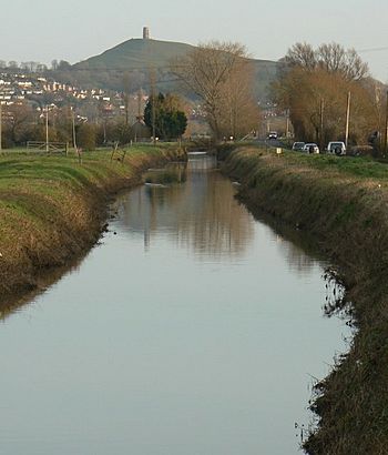
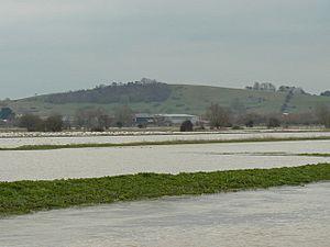
River Brue and Glastonbury Tor
|
|
| Country | England |
| County | Somerset |
| District | Somerset Levels |
| Towns | Bruton, Glastonbury, Highbridge |
| Physical characteristics | |
| Main source | Brewham, South Somerset, Somerset, England 51°07′49″N 2°22′43″W / 51.13028°N 2.37861°W |
| River mouth | Bristol Channel Highbridge, Somerset, Somerset, England 51°13′32″N 3°00′13″W / 51.22556°N 3.00361°W |
| Length | 61 km (38 mi) |
| Basin features | |
| Tributaries |
|
The River Brue starts in a place called Brewham in Somerset, England. It flows about 50 kilometres (31 mi) west until it reaches the sea at Burnham-on-Sea. A long time ago, in the 1100s, the river's path from Glastonbury to the sea was changed by Glastonbury Abbey.
The River Brue is super important for draining water from a very flat area. This area often floods, so people have worked for centuries to control the water. They use special ditches called rhynes, canals, and gates called sluices to manage the flow.
The Brue Valley Living Landscape is a special project. It helps protect nature in the Somerset Levels and Moors. The Somerset Wildlife Trust manages this project. This area has several important nature spots called Sites of Special Scientific Interest (SSSIs). These include Westhay Moor and Shapwick Heath. For a long time, people dug up peat (a type of soil made from old plants) in this area. The Brue Valley project started in 2009. It aims to bring back and connect natural areas for wildlife. The goal is for nature to survive even with climate change. It also helps farmers and landowners keep using their land for profit.
Contents
Journey of the River Brue
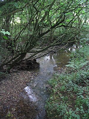
The River Brue begins in the hills near the border with Dorset. These same hills are also where the River Wylye and the Dorset Stour start. Those rivers flow south towards the English Channel. The Brue quickly flows down a narrow valley. Just past Bruton, it meets the River Pitt.
After this, the Brue winds its way through a wide, flat valley. This valley is between Castle Cary and Alhampton. By the time it reaches Baltonsborough, the river is only about 10 metres (33 ft) above sea level. Many small ditches, called rhynes, drain the surrounding land into the river.
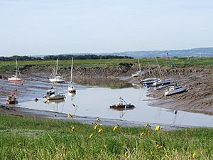
The river then passes Glastonbury, forming a natural border with the nearby village of Street. From there, it flows through a mostly man-made channel across the Somerset Levels. It joins the River Parrett at Burnham-on-Sea. Other waterways join the Brue, like the North Drain and White's River. White's River carries water from the River Sheppey. The Cripps River is another man-made channel that connects the Brue to the River Huntspill. Many drainage rhynes also feed into it. The Brue is connected to the River Axe by several of these channels. These connections are controlled by sluices. Below the sluices at New Clyce Bridge in Highbridge, the river is affected by the tide.
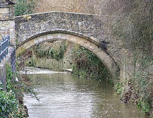
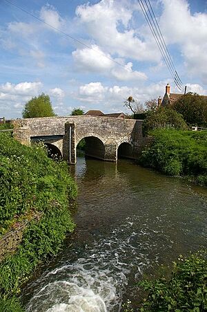
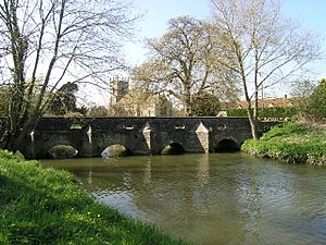
Bow Bridge is a very old bridge over the River Brue in Bruton. It was built in the 1400s. It is a Packhorse bridge, meaning it was made for packhorses to cross. This bridge is a Grade I listed building, which means it's very important historically. It might have connected the old Bruton Abbey to its courthouse. The bridge was fixed after floods in 1982.
The River Brue has often flooded over the years. The parts of the river closer to the sea are almost at sea level. The river above Bruton drains a large area of 31 square kilometres (12 sq mi) into a steep, narrow valley. In 1984, a dam was built about 1 kilometre (0.62 mi) upstream from Bruton to help protect the town.
River Brue's Past
People have lived in the Brue Valley since the Neolithic period (New Stone Age). They used the marshy areas for resources. They also built wooden paths called trackways. The Sweet Track and Post Tracks are examples. The Sweet Track was found in 1970. It dates back to the 3800s BC. It is the world's oldest wooden path. It connected an island at Westhay to higher ground at Shapwick. This was close to the River Brue. Other similar paths have been found nearby.
The Glastonbury Lake Village is the best-preserved prehistoric village in the UK. It is in the Levels. There are also two other villages at Meare Lake Village. The Glastonbury village was found in 1892. About 200 people lived there in 14 roundhouses. It was built on a marshy area. The houses stood on a base of timber, brushwood, and clay.
The valley was used during the Romano-British period. People extracted salt there. At that time, the Brue formed a lake south of Glastonbury. Legend says this lake might be where the Lady of the Lake lived in the King Arthur stories. Pomparles Bridge was at the west end of this lake. It guarded Glastonbury from the south. Some say this is where Sir Bedivere threw Excalibur after King Arthur's last battle. The current concrete bridge was built in 1911. It carries the A39 road over the Brue.
How the River's Path Changed
Before the 1200s, the direct path to the sea at Highbridge was blocked. There were gravel banks and peat near Westhay. The river used to flow around Glastonbury. It went through Beckery and then north to join the River Axe. This route made it hard for Glastonbury Abbey to move goods. When the Axe valley flooded, it would also flood Glastonbury.
So, between 1230 and 1250, a new channel was dug. It went west into Meare Pool and then further west to Mark Moor. From there, it split into two channels. One, the Pilrow cut, went north to join the Axe. The other went directly west to the sea at Highbridge. In the past, there were many fish weirs on the lower river. These were used to catch fish with nets or baskets.
Controlling Floods
Between 1774 and 1797, laws were passed to enclose land in the Brue valley. In 1794, huge floods covered the entire Brue valley. People worked to improve drainage. In 1801, a new law allowed parts of the river to be straightened. New channels like the North and South Drains were built. In 1803, the clyse (a type of sluice gate) at Highbridge was replaced and moved.
The area around Bruton has often suffered from floods. In 1768, a stone bridge was destroyed when the river rose very fast. On June 28, 1917, 242.8 millimetres (9.56 in) of rain fell in 24 hours in Bruton. The water level in one pub was 20 feet (6.1 m) higher than normal! In 1982, there was a lot of flooding in the town. Because of this, a protective dam was built in 1984. It is about 1 kilometre (0.62 mi) upstream from Bruton.
Recent Times
The mouth of the River Brue was a busy harbour in Roman and Saxon times. It later filled with silt. It was used again as a small harbour in the 1600s and 1700s. In 1833, the port of Highbridge officially opened on the river. A new wharf was built by 1904. It was used to bring in coal and send out bricks, tiles, and farm products. The port closed in 1949.
Canals like Galton's Canal and Brown's Canal were built in the early 1800s. They connected to the river. The Glastonbury Canal used part of the River Brue's path. It ran for over 14 miles (23 km) with two locks. It connected Glastonbury to Highbridge. The canal opened in 1834. Most of it stopped being used for boats in 1854. A railway was built along its path instead.
During the Second World War, the Brue was part of a defense line. Many pillboxes (small concrete bunkers) were built along the river. Gants Mill near Bruton is a watermill. It still grinds cattle feed today. A 12 kilowatts (16 hp) hydroelectric turbine was recently put in there. There has been a mill here since the 1200s. The current building was built in 1810.
After floods in 1997 and 1999-2000, a project called the Parrett Catchment Project started. Many groups worked together to reduce flooding. They tried different methods. These included changing farmland, using new drainage systems, dredging (clearing out) rivers, raising riverbanks, and improving pumps. They also studied how woodlands could help reduce floods.
In the winter flooding of 2013–14 on the Somerset Levels, the River Brue overflowed around New Year. This was due to heavy rain and storms. Many people asked for the river to be dredged again. On January 24, 2014, with continued flooding, local councils declared a "major incident." About 17,000 acres (6,900 ha) of farmland had been underwater for over a month. The village of Thorney was left empty, and Muchelney was cut off for almost a month. Northmoor Green (also known as Moorland) was also badly affected. By the end of January, much farmland was still flooded. Bridgwater also flooded partly in February 2014. Over 600 houses were flooded. Flooding also stopped trains. More work to prevent floods has caused some debate about dredging the river.
River Health and Water Quality
At Bruton Dam, the river's normal level is between 0.6 metres (2 ft 0 in) and 2.08 metres (6 ft 10 in). The highest level ever was 10.7 metres (35 ft) in 2007. Further downstream at Lovington, the normal level is between 0.08 metres (3.1 in) and 0.56 metres (1 ft 10 in).
When checking water quality, the Brue and Axe rivers are looked at together. In 2013, most of the water in this area was of "moderate" quality. Some parts were "poor," and a few were "good." Farming and land management are the biggest reasons for water quality issues. The water industry and transportation also play a part.
Wildlife and Nature
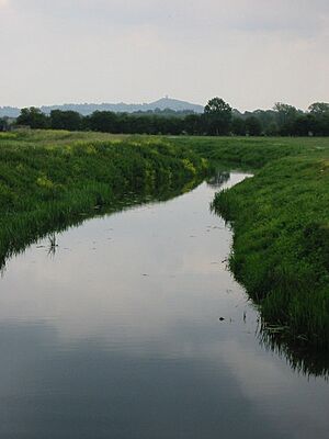
The Brue Valley Living Landscape is a big nature project in the UK. The Somerset Wildlife Trust runs it. It started in 2009. The goal is to bring back and protect natural areas for wildlife. It helps nature survive climate change. It also makes sure farmers can still use their land. This project is one of many across the UK that protects large areas of land.
The project covers about 12,500 hectares (31,000 acres) (about 30,000 acres). This includes the flat area around the River Brue. It stretches from east of Glastonbury to the Catcott, Edington and Chilton Moors SSSI in the west. Almost a quarter of this area is protected. It's a Site of Special Scientific Interest (SSSI), a Special Protection Area (SPA), and a Ramsar site. The project area makes up almost half of the Somerset Levels and Moors Special Protection Area.
Many groups already manage land for nature here. These include Somerset Wildlife Trust and the Royal Society for the Protection of Birds. Some of these special places are Shapwick Heath national nature reserve and Westhay Moor. There are also many historical sites in the area. These include the Glastonbury Lake Village and Sweet Track. Studying the Somerset Levels has taught us a lot about wetlands and human history. This project focuses only on the peat soils of the Somerset Moors.
The project has clear goals. They want to map and research the Brue Valley. They also want to work with local government, farmers, and other groups. This helps create a shared plan for the area. They hope to create bigger and better-connected areas of important habitats. This will also help the local economy and people. The project gets money from different sources, including the European Regional Development Fund.
One main goal is to protect and create different types of habitats. These include reedbeds, grazing marshes, and wet woodlands. Many special plant species will benefit. These include divided sedge and greater water parsnip. These plants provide homes for many insects. These include moths like the argent and sable moth. Butterfly species like the small heath will also benefit. Beetles like the lesser silver water beetle are found here. There are also shining ram's-horn snails and shrill carder bees.
The River Brue and its smaller rivers are home to European eels. Reptiles found here include the European adder and grass snake. Many bird species live in the area. These include Bewick's swan, Eurasian bittern, Eurasian bullfinch, Eurasian wigeon, European starling, gadwall, grasshopper warbler, hen harrier, house sparrow, linnet, marsh harrier, marsh tit, merlin, northern lapwing, peregrine, reed bunting, short-eared owl, skylark, song thrush, teal, willow tit, and yellowhammer.
Interesting mammals in the area include the brown hare, Eurasian harvest mouse, European otter, and water vole.
Fun Things to Do
If you like fishing, you can find big pike (over 20 pounds (9.1 kg)). There are also lots of chub, dace, roach, bream, tench, perch, rudd, and gudgeon. You can find trout in the upper parts of the river.
There are several places to get into the river for canoeing. You can canoe as far up as Bruton. But above West Lydford, you need recent rain for enough water. There are public footpaths along many parts of the river. Some areas are also great for wild swimming.
Getting There by Train
You can reach the area by train at Highbridge and Burnham railway station. From there, it's about a 2 miles (3.2 km) walk or bike ride west. You can follow the old path of the S&DJR extension route. This path goes mainly alongside the River Brue and takes you into Burnham-on-Sea.
 | Precious Adams |
 | Lauren Anderson |
 | Janet Collins |


