River Wylye facts for kids
Quick facts for kids River Wylye |
|
|---|---|

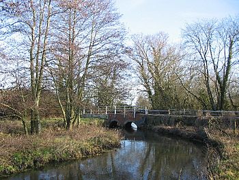
River Wylye at Norton Bavant
|
|
| Country | England |
| Cities | Maiden Bradley, Warminster, Codford St Peter, Wilton |
| Physical characteristics | |
| Main source | Rodmead Farm Maiden Bradley, Wiltshire, England 148 m (486 ft) 51°07′25″N 2°18′11″W / 51.12361°N 2.30306°W |
| River mouth | Confluence with River Nadder Wilton, Wiltshire, England 69 m (226 ft) 51°04′45″N 1°51′45″W / 51.07917°N 1.86250°W |
| Length | 45 km (28 mi) |
| Basin features | |
| Basin size | 470 km2 (180 sq mi) |
| Tributaries |
|
The River Wylye (pronounced WY-lee) is a beautiful river in southern England. It is known as a chalk stream, which means its water is very clear. This clear water flows over a bed of gravel.
The River Wylye is a popular spot for anglers, especially for fly fishing. A special part of the river, along with three lakes in Warminster, is protected as a local nature reserve. This helps keep the area safe for wildlife.
Contents
The River's Journey
The Wylye River starts in the west of Wiltshire, near a place called Maiden Bradley. It begins below the White Sheet Downs. From there, it flows north through the Deverill valley.
- A small stream joins the Wylye near Crockerton. This stream also feeds the man-made Shearwater lake.
- As the river reaches the southern edge of Warminster, it turns and flows generally east-southeast.
- This part of the river creates the Wylye Valley. The A36 road and the Wessex Main Line railway also run through this narrow valley.
The river passes through many villages. These include Norton Bavant, Heytesbury, Knook, Upton Lovell, Boyton, Codford, Wylye, and Wilton. These villages are close to the southern edge of Salisbury Plain.
Water Flow and Connections
The Wylye River gets water from special streams called winterbournes. These streams only flow during the wetter parts of the year, usually in winter. Because of this, the amount of water in the Wylye can change a lot.
The river is part of the larger River Avon catchment area. This means all the water from the Wylye eventually flows into the River Avon. At Wilton, the Wylye joins the River Nadder. Finally, all this water reaches the sea at Christchurch.
Nature and Scenery
The River Wylye and its surrounding areas are home to important natural sites. Two areas near the river are called SSSIs. These are Steeple Langford Down and Wylye and Church Dean Downs. SSSIs are special places protected for their wildlife, plants, or geology.
Near where the river starts, there is even a vineyard. This is a place where grapes are grown to make wine.
The Wylye valley is famous for its charming villages. These villages often have traditional chocolate box cottages. These cottages usually have thatched roofs and are built from local stone. Many also have old stone pubs.
The River's Name
The town of Wilton is named after the River Wylye. The county of Wiltshire was originally called Wiltonshire, also taking its name from the river. There is also a village called Wylye that shares the river's name.
Villages Along the Wylye
Many villages are located right on or very close to the River Wylye. Here is a list of some of them, starting from where the river begins (its source) and going downstream to where it joins another river (its confluence):
- Kingston Deverill
- Monkton Deverill
- Brixton Deverill
- Longbridge Deverill
- Crockerton
- Norton Bavant
- Heytesbury
- Sutton Veny
- Upton Lovell
- Boyton
- Sherrington
- Codford
- Stockton
- Bapton
- Wylye
- Hanging Langford
- Steeple Langford
- Great Wishford
- Stoford
- South Newton
- Wilton
 | Jewel Prestage |
 | Ella Baker |
 | Fannie Lou Hamer |

