Bridgwater Bay facts for kids
| Site of Special Scientific Interest | |
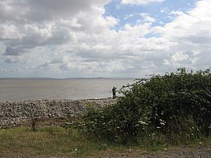
Bridgwater Bay near the mouth of the River Parrett
|
|
| Area of Search | Somerset |
|---|---|
| Coordinates | 51°13′00″N 3°17′00″W / 51.2166°N 3.2833°W |
| Interest | Biological |
| Area | 3,574.1 hectares (35.741 km2; 13.800 sq mi) |
| Notification | 1989 |
Bridgwater Bay is a special coastal area in Somerset, England. It's located on the Bristol Channel, about 5 kilometres (3.1 mi) north of the town of Bridgwater. This bay stretches from Minehead in the southwest all the way to Brean Down in the north.
The bay is made up of huge areas of mudflats, salty marshes, sandy areas, and shingle beaches. Some of these areas have plants growing on them. Bridgwater Bay is so important for nature that it has been named a Site of Special Scientific Interest (SSSI) since 1989. It covers a large area of 3,574.1 hectares (35.741 km2; 13.800 sq mi). It's also recognized as a wetland of international importance under the Ramsar Convention, which means it's super important for wildlife around the world.
Many rivers flow into Bridgwater Bay, like the River Parrett, Brue, and Washford. There are also man-made drainage channels from the Somerset Levels, such as the River Huntspill, that empty into the bay. The mudflats here are home to many different plants and animals, including some rare ones like certain plants, beetles, and snails.
The bay is especially important for birds that spend the winter there, like waders (shorebirds) and wildfowl. About 190 different bird species have been seen here, including the Eurasian whimbrel, black-tailed godwit, dunlin, and wigeon. People have been fishing in the bay for hundreds of years, using special shallow boats called flatners. It was also the last place in England where 'mudhorse fishing' was done.
Because the land around the bay is low, it has flooded many times. One big flood was in 1607, and there have been others since, especially around the Steart Peninsula. To protect the area, sea walls have been built in places like Burnham-on-Sea, Berrow, and along the coast from Blue Anchor to Lilstock. The wide mudflats and very high tides can be dangerous, so rescue services like the Burnham Area Rescue Boat are there to help if needed.
Contents
Exploring Bridgwater Bay's Geography
Bridgwater Bay is a big part of the Somerset coastline on the southern side of the Bristol Channel. It stretches from the Quantock Hills in the southwest to Brean Down in the north. The coastline here has a special type of rock called Jurassic Blue Lias, which has been shaped by waves.
Several rivers flow into the bay, including the River Parrett, Brue, and Washford. There's also the man-made River Huntspill. Important places and towns along the coast include Brean, Berrow, Burnham on Sea, the mouth of the River Parrett, the Steart Peninsula, Lilstock, East Quantoxhead, and Watchet.
Winds blowing from the west have created sand dunes at Berrow and a shingle ridge at Steart. On the beach near Stogursey, you can find the remains of an ancient forest that was submerged by the sea thousands of years ago.
Brean Down: A Natural Landmark
Brean Down is a rocky headland that marks the eastern end of the bay. It's made of Carboniferous Limestone and is connected to the Mendip Hills. Two small islands, Steep Holm and Flat Holm, are also part of this same rock formation. The National Trust owns Brean Down, and it's full of wildlife, history, and archaeology. It's also a Site of Special Scientific Interest on its own.
Brean Down has steep cliffs. At its tip, you can see Brean Down Fort, which was built in 1865 and used again in World War II. There's also evidence of an Iron Age hill fort, ancient burial mounds called barrows, old field systems, and a pagan shrine. In 1897, Guglielmo Marconi used Brean Down to set a new record for wireless transmission.
Tides and Safety
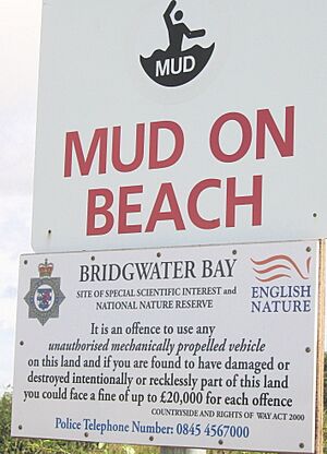
When the tide is low, huge areas of mud flats, up to 4 kilometres (2.5 mi) wide, are exposed. This is because the Bristol Channel has a very large tidal range of 15 metres (49 ft), which is one of the biggest in the world! These mudflats can be very dangerous. It's common for emergency services to rescue people who get stuck in the mud. After a sad event in 2002, local people raised money to buy a special rescue hovercraft. This hovercraft is operated by the Burnham Area Rescue Boat (BARB) in Burnham-on-Sea.
You can explore much of the coastline in the western part of the bay using public footpaths. The South West Coast Path even starts at Minehead at the western end of the bay. The huge tidal range here also means there's a lot of potential for generating energy, and plans for a tidal barrage have been considered.
Hinkley Point and Coastal Defenses
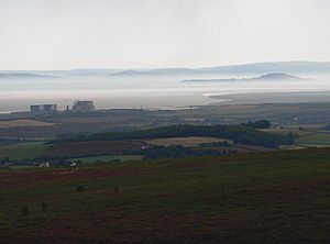
Hinkley Point is a headland that sticks out into Bridgwater Bay, about 5 miles (8.0 km) west of Burnham-on-Sea. This area is known for its two nuclear power stations: Hinkley Point A (which is now closed) and Hinkley Point B. A third power station, Hinkley Point C, is also planned.
To protect the coast from the sea, people have built sea defenses. These include a sea wall at Burnham-on-Sea and a 3 kilometres (1.9 mi) section south of Brean Down. There are also sand dune belts that are managed to protect the land and provide homes for wildlife. The Steart Peninsula has flooded many times over the centuries. In response to these threats, studies have been done to plan for future coastal protection.
Other Coastal Areas
Watchet is a town located at the mouth of the Washford River, on the edge of Exmoor National Park. Its foreshore is rocky, but it has a small harbour. The cliffs between Watchet and Blue Anchor have a unique pale, greenish-blue colour from the alabaster found there. This colour was even called "Watchet Blue" in the 16th century.
East Quantoxhead used to have a small harbour. It was used to bring in limestone for local limekilns and to export alabaster. It's also thought that it was used for smuggling!
At Kilve, you can see the remains of an old brick building called a retort. It was built in 1924 because people discovered that the shale in the cliffs was rich in oil. The beach here is part of the Blue Anchor to Lilstock Coast SSSI. Along this coast, the cliffs have layers of oil-bearing shale and blue, yellow, and brown lias rocks, which are full of fossils.
Fishing in the Bay
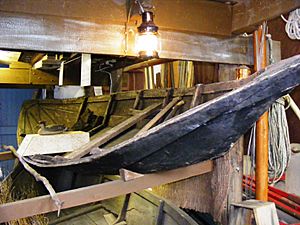
The wide mudflats of Bridgwater Bay have been used for fishing for a very long time. Some old fishing structures found on Stert Flats date back to between 932 and 966! It's also the last place in England where 'mudhorse fishing' was practiced. This involves using a wooden sledge to slide across the mudflats to collect fish from nets.
Fish caught here include Thinlip mullet, plaice, dogfish, cuttlefish, skate, shrimp, prawns, sea bass, and sole. The Watchet Boat Museum has displays about the unique local flatner boats that were used for fishing in the bay, along with other related items.
Wildlife and Nature
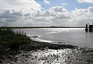
When the tide is low, the huge mudflats (like the Steart and Berrow Flats) are uncovered. These areas are very important feeding and wintering grounds for waders (shorebirds). The ditches and ponds around the bay's shores are home to many small creatures called invertebrates, including six species that are nationally rare and eighteen that are nationally scarce.
Because of its amazing wildlife, Bridgwater Bay is a national nature reserve. It is managed by Natural England to protect its natural environment. There's also a local Oil Spill Contingency Plan to help protect the wildlife if there's an oil spill.
Bridgwater Bay also includes other important nature sites like Brean Down, Berrow Dunes, and the Blue Anchor to Lilstock Coast SSSI. The entire reserve is recognized as a wetland of international importance under the Ramsar Convention. It's also considered a top-tier site for nature conservation in Great Britain.
Plants of Bridgwater Bay
A type of grass called common cord-grass was planted in the area in the 1990s. It has now spread to the surrounding marshes and mudflats. The Spartina here is usually shorter than in other places because of the high tides and cloudy water.
On higher ground, you can find common saltmarsh-grass and sea aster. Where the land isn't grazed by animals, common reed often grows above the sea aster. If cattle graze the upper marsh, you'll find red fescue and creeping bent. The marsh areas furthest from the sea support Sea couch and sea club-rush.
Some nationally rare plants found on the marshes, grazed by sheep, include bulbous foxtail, slender hare's-ear, and sea barley. Around Stert Island, you might spot the nationally rare compact brome and the nationally scarce Ray's knotgrass.
The ditches are full of water plants and plants that grow along the banks. These include the nationally rare rootless duckweed. Other uncommon species like frogbit and water fern can also be found. The presence of brackish water-crowfoot and sea clubrush shows that the water is a little bit salty.
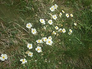
Brean Down is home to the nationally rare white rock-rose, which grows in large numbers on the sunny, grassy slopes. Other plants on the southern slopes include Somerset hair grass, wild thyme, horseshoe vetch, and birds-foot-trefoil. The northern side of Brean Down is covered by bracken, bramble, privet, hawthorn, cowslips, and bell heather.
Animals of Bridgwater Bay
Five rare Red Data Book invertebrate species have been found here. These include two types of soldier flies (Odontomyia ornata and Stratiomys singularior), a hover fly called Lejops vittata, the great silver water beetle, and the water beetle Hydrovatus clypealis. Nationally scarce species include the aquatic snail Gyraulus laevis, the hairy dragonfly, and the ladybird Coccidula scutellata.
More than 190 species of birds have been seen near the bay. Many of these birds use the bay as a feeding ground during their long migrations. Waders and wildfowl often spend the winter here. The numbers of Eurasian whimbrel and black-tailed godwit are so high that they are considered internationally important. There are also many dunlin and wigeon in the bay. In recent years, Avocets have become regular visitors in autumn and winter, and for the first time in over 50 years, they even bred on the reserve in 2012!
Rare birds that have wandered into the area include lesser yellowlegs, white-rumped sandpiper, Pallid Harrier, and Richard's pipit. Birds seen on Brean Down include peregrine falcon, jackdaw, kestrel, collared and stock doves, whitethroat, linnet, stonechat, dunnock, and rock pipit.
There are also several species of butterfly found here, such as chalkhill blue, dark green fritillary, meadow brown, marbled white, small heath, and common blue.
 | William M. Jackson |
 | Juan E. Gilbert |
 | Neil deGrasse Tyson |


