Flat Holm facts for kids
|
Native name:
(Welsh) Ynys Echni
|
|
|---|---|
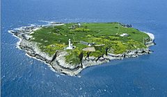
Flat Holm in April 2008
|
|
 |
|
| Geography | |
| Location | Bristol Channel |
| Coordinates | 51°22′37″N 3°07′19″W / 51.37687°N 3.12207°W |
| Area | 0.35 km2 (0.14 sq mi) |
| Length | 0.63 km (0.391 mi) |
| Width | 0.61 km (0.379 mi) |
| Highest elevation | 32 m (105 ft) |
| Administration | |
|
Wales
|
|
| City and County | Cardiff |
| Community | Butetown |
| Capital city | Cardiff |
| Demographics | |
| Population | 1 |
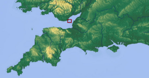
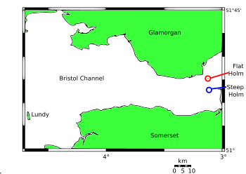
Flat Holm (Welsh: Ynys Echni) is a small Welsh island. It sits in the Bristol Channel, about 6 kilometers (4 miles) from Lavernock Point in the Vale of Glamorgan. This island is the most southerly point of Wales.
Flat Holm has a long and interesting history. People have lived there since at least the Bronze Age. It was a place for religious visits and later became home to a mission helping sailors. In 1896, a special hospital was built there for people with serious illnesses like cholera.
A very important event happened on Flat Holm in 1897. Guglielmo Marconi sent the first ever wireless signals across open water from the island. Because many ships crashed nearby, a lighthouse was built. Later, in the 1860s, gun forts were added to protect the area. These forts were used again during World War II.
Today, Flat Holm is part of Cardiff and is looked after by Cardiff Council. It is a special Local Nature Reserve and Site of Special Scientific Interest. This is because of its unique plants and important bird colonies.
Contents
Flat Holm's Past: A Look at Its History
Early Life on Flat Holm: Bronze Age to Roman Times
The first signs of people living on Flat Holm are from the late Bronze Age, around 900 to 700 BC. In 1988, a bronze axe head was found near the island's farmhouse. This shows that people were using tools and living here a very long time ago.
Later, around 500-600 AD, the island became a quiet place for religious figures. Saint Cadoc lived there as a hermit, meaning he lived alone for religious reasons, for seven years. His friend, Saint Gildas, lived on the nearby island of Steep Holm. They would sometimes meet to pray together.
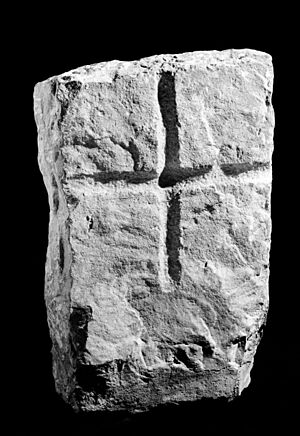
In 1815, a doctor found two old graves near the farmhouse. One had a broken headstone with a Celtic cross. Another grave held two skeletons that had been covered in lime. This suggests the people likely died from a contagious disease.
Flat Holm in the Middle Ages: Vikings and Normans
The Anglo-Saxons called the island Bradanreolice. This name came from an Irish word for churchyard, suggesting the island was a burial place. The island's current name, "Holm," comes from the Old Norse word for "island in an estuary."
Records show that Vikings once took shelter on Flat Holm. This was after they were defeated by the Saxons. In 1067, Gytha Thorkelsdóttir, the mother of the last Anglo-Saxon king of England, stayed on the island. She was on her way to France after the Norman conquest of England.
After the Normans took over, Flat Holm became part of Glamorgan. It was owned by the Norman Lords of Glamorgan. Archaeologists have found old pottery and animal bones on the island. This shows that people lived there continuously. They also found pieces of roofing tiles, suggesting a large medieval building, possibly a chapel, once stood there.
Smugglers' Hideout: The 18th Century
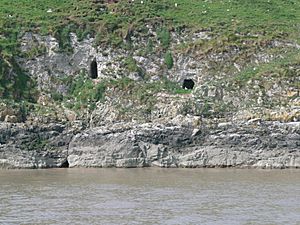
In the 1700s, Flat Holm was a perfect spot for smuggling. Smugglers would hide illegal goods like tea and brandy there. Even though the island was visible from both the Welsh and English coasts, customs officers couldn't stop them. They didn't have a boat to reach the island. It's believed that a cave on the east side of Flat Holm was used to store these hidden goods.
Making History: The 19th Century and Marconi
In 1835, a clergyman named John Ashley started helping the people on the island. He then created the Bristol Channel Mission to support sailors. This mission later became the Mission to Seafarers, which still helps sailors worldwide today.
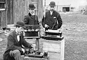
A huge moment in communication happened on Flat Holm. On May 13, 1897, a 22-year-old Italian inventor, Guglielmo Marconi, made history. With help from George Kemp, he sent the first wireless signals over open sea. The signals traveled from Flat Holm to Lavernock Point in Wales.
Marconi had tried to get his home country, Italy, interested in his invention, but they weren't. So, he came to Britain. He met William Preece, a chief engineer. They set up a 34-meter (112-foot) tall transmitting mast on Flat Holm. A 50-meter (164-foot) receiving mast was at Lavernock Point. The message sent in Morse code was "Are you ready." The original paper slip with this message is now in the National Museum of Wales.
Flat Holm made communication history again in 2002. It became one of the first places in South Wales to get an internet connection through wireless technology. This connection helps with internet access and phone calls for the island.
Shipwrecks Around Flat Holm
The waters around Flat Holm can be very dangerous for ships. Many vessels have been wrecked there over the years.
In January 1773, the ship Tapley got stuck on Flat Holm. Seven passengers lost their lives. In 1817, the ship William and Mary sank after hitting rocks near the island. Fifty-four passengers were lost, and their bodies were buried on Flat Holm. Later, in 1938, the Norman Queen ran aground but was saved. In 1941, the Middlesex steamship was lost.
Flat Holm's Landscape: Geography and Geology
Island Shape and Location
Flat Holm is a small, almost round island in the Bristol Channel. It is about 620 meters (2,030 feet) across and covers 35 hectares (86 acres). The island slopes gently from its rocky western shore to cliffs on the east. The lighthouse stands proudly at the top of these eastern cliffs. At its highest point, Flat Holm is 32 meters (105 feet) above sea level. Flat Holm is part of Wales, while its neighbor, Steep Holm, is part of England.
The Bristol Channel has the second-largest tidal range in the world, reaching up to 15 meters (49 feet). This means the water level changes a lot between high and low tide.
How Flat Holm Was Formed: Geology
Millions of years ago, during the ice ages, the sea level was much lower. Flat Holm was actually connected to the coast of Somerset, England. As the ice melted, the sea level rose, flooding the flat lands. The hilltops became islands, including Flat Holm and Steep Holm.
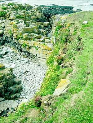
Flat Holm is made of Carboniferous Limestone. This type of rock is also found in Bristol and South Wales. Part of the island's shoreline is special because it shows large fossil "ripple marks" in the limestone. These marks were made by ancient waves.
The island also has deposits of galena, which is a mineral that contains silver. You can see old pits and mounds on the island from where people tried to mine for lead. However, it wasn't profitable, so they stopped. There are also caves on the island that were used by smugglers in the past.
Buildings of Flat Holm
The Lighthouse and Foghorn
The Flat Holm Lighthouse is a key feature of the island. It helps guide ships safely through the channel. There is also a foghorn station to warn ships during foggy weather.
The Farmhouse: From Monks to Hotel
Records show that monks from St Augustine's Abbey in Bristol started a dairy farm on Flat Holm in 1150. In 1815, a visitor noted that the farm was doing well, with cows, bulls, sheep, and other animals.
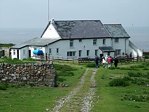
In 1897, the farmhouse was turned into The Flat Holm Hotel, with a bar and a skittle alley. But it closed after only a few years. Today, the farmhouse has been fixed up and is used as a place for visitors to stay.
Forts and Barracks: Protecting the Coast
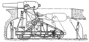
Flat Holm was made stronger with forts in the 1860s. This happened after Queen Victoria and Prince Albert visited France and worried about the French Navy. The forts on the island were finished in 1869. They were part of a line of defenses called the Palmerston Forts.
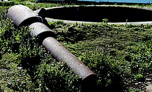
Flat Holm Battery is the name for the gun positions on the island. They were built to protect Bristol and Cardiff. There are four main battery sites:
- Castle Rock Battery
- Farm House Battery
- Well Battery
- Lighthouse Battery
These batteries had nine large guns that could "disappear" into pits. This made them hard for enemy ships to see and protected the gun crews. The guns were never actually used in battle, only for testing.
In 1869, stone barracks were built to house up to 50 soldiers. These soldiers kept the guns ready. The barracks are now restored and used for educational purposes.
Radar Station: World War II Defenses
When World War II started, over 350 soldiers were stationed on Flat Holm. The island was re-armed with new guns and searchlights to protect against aircraft and ships. A radar station was also placed in the middle of the island. These defenses helped protect the ships traveling between Cardiff, Barry, and Flat Holm. After the war, these military structures were abandoned. The island still has a helipad in the center.
Isolation Hospital: A Place for Healing
In 1883, three sailors who might have had cholera were left on the island. One of them sadly died. Because of this, a permanent hospital was built on Flat Holm in 1896 for patients with infectious diseases. It was described as having two wards with six beds each and a nurse's room.
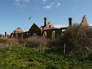
This hospital was unique because it was the only Victorian isolation hospital on a British offshore island. The last patient to die there, from bubonic plague, was cremated on the island in the late 1800s. The hospital closed in 1935 and is now in ruins. The main hospital building and laundry building are protected as listed buildings.
The Flat Holm Project
In 1975, the local council leased Flat Holm for 99 years. In 1995, Cardiff Council took over the lease. Flat Holm is now a Local Nature Reserve, managed by the Cardiff Council's Flat Holm Project.
The project uses a special boat called the Lewis Alexander. This boat was built to carry up to 45 passengers and supplies to the island. The Flat Holm Society, a charity, also helps support the work on the island.
Flat Holm's Nature: Plants and Animals
Special Plants of Flat Holm
Flat Holm was named a Site of Special Scientific Interest (SSSI) in 1972. This is because of its special maritime grassland and rare plants.
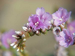
While there are no plants found only on Flat Holm, its isolation helps certain tough species grow well. These include bird's-foot trefoil and biting stonecrop. There are also rare plants like rock sea-lavender and wild leek. The wild leek can grow up to 6 feet (1.8 meters) tall. It smells like garlic and is found in only a few places in the UK.
Some plants may have been brought to the island by monks for their medicinal uses. These include dove's-foot crane's-bill. The wild peony was also brought to the island, possibly by monks, and now grows naturally there.
Birds and Other Animals
Flat Holm is home to many breeding birds. There are over 4,000 pairs of lesser black-backed gulls and 400 pairs of herring gulls. You can also find great black-backed gulls, common shelducks, and Eurasian oystercatchers.
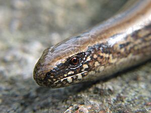
The island also has slowworms. These are legless lizards that look like snakes. The slowworms on Flat Holm are special because they have unusually large blue markings.
Rabbits were brought to the island for farming in the 1100s. Their numbers are controlled by a disease called myxomatosis. Since 1989, the island has been grazed by animals. Goats were first used, and then sheep were added in 1992. Today, there are Soay sheep grazing wild on the island.
Flat Holm's Future: Sustainable Energy
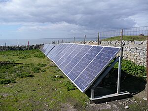
The Flat Holm Project wants to make the island a model for using sustainable energy. In 2006, underground cables were installed to create a "mini-grid" for power. This connected the farmhouse, workshops, and foghorn keeper's cottage.
In 2007, the system was improved. It now includes a battery bank charged by solar arrays and a wind turbine. This helps the island use clean, renewable energy.
Severn Barrage Study
There have been discussions about building a large barrier, called a Severn Barrage, across the Bristol Channel. This barrier would generate electricity from the tides. If built, it could affect Flat Holm, depending on its design and location.
Studies are being done to see if this project is possible. The proposed barrage would be about 3 kilometers (2 miles) west of Flat Holm. Some environmental groups are against it. The studies will look at all the issues before a final decision is made.
|
See also
 In Spanish: Flat Holm para niños
 | Laphonza Butler |
 | Daisy Bates |
 | Elizabeth Piper Ensley |


