Low-pressure area facts for kids
A low-pressure area is a place where the air pressure is lower than the air around it. These areas are often called a "low." Low-pressure areas usually bring cloudy, windy, and rainy weather, or even storms. On the other hand, high-pressure areas typically mean clear skies and light winds.
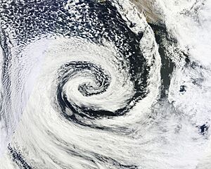
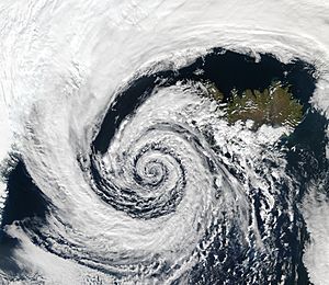
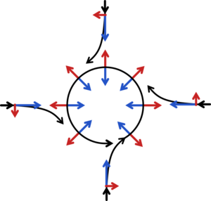
Winds spin differently around lows depending on where you are on Earth. In the Northern Hemisphere, winds circle counter-clockwise (anti-clockwise) around a low. In the Southern Hemisphere, they spin clockwise. This happens because of something called the Coriolis force, which is caused by the Earth's rotation.
Low-pressure systems form when air moves upwards in the upper parts of the atmosphere. This upward movement of air is called "atmospheric lift." When air rises, it lowers the air pressure closer to the ground. The process of a low-pressure area forming is known as cyclogenesis.
Sometimes, low-pressure areas called thermal lows form over deserts or other land areas that get very hot. This happens because warm air is lighter than cooler air, so it rises, lowering the pressure. Large thermal lows over continents can even help create monsoon weather patterns. Lows can also form over warm ocean water, especially when there are many thunderstorms. If a low over the tropics gets very organized, it can become a tropical cyclone.
When air rises in a low-pressure area, it cools down. This cooling causes water vapor in the air to turn into tiny water droplets, forming clouds. That's why low-pressure areas are often cloudy. Clouds reflect sunlight, which can make daytime temperatures cooler. But at night, clouds trap heat, making the nights warmer. The stronger a low-pressure area is, the stronger the winds will be around it.
Contents
How Lows Form
The creation and strengthening of low-pressure areas is called cyclogenesis. This is the opposite of cyclolysis, which is when a low-pressure area weakens. There are different ways lows can form, but they all involve air moving upwards in the atmosphere. When air rises, it reduces the amount of air pushing down on the surface, which lowers the pressure.
Large low-pressure systems, like extratropical cyclones, form along weather fronts. These are big systems that affect weather over large areas. Polar lows are smaller, short-lived low-pressure systems that form over cold ocean areas near the poles. They can bring strong winds and are important for ships and oil platforms to know about.
Tropical cyclones (like hurricanes and typhoons) form over warm ocean waters. They need several things to develop:
- Warm ocean water (at least 26.5°C or 80°F) that is deep enough.
- Air that cools quickly as it rises.
- Lots of moisture in the air.
- Low wind shear, which means winds don't change much with height.
- An existing area of disturbed weather.
Mesocyclones are smaller low-pressure areas that form over land and can lead to tornadoes.
In deserts, the ground gets very hot from the sun. This heats the air above it, making it lighter. This rising hot air creates a thermal low. Monsoons are like giant sea breezes. They happen when large land areas heat up much faster than the ocean. This creates a big thermal low over the land, pulling moist air from the ocean towards the land, which often brings a lot of rain. In winter, the land cools faster than the ocean, reversing the wind direction.
Where Lows Are Found
Large low-pressure systems near the poles help guide weather patterns in the middle parts of the Earth. Extratropical cyclones often form east of continents or west of oceans. Studies show that there are many of these cyclones active at any given time. In places like the United Kingdom and the Netherlands, these recurring low-pressure systems are simply called "depressions" and often bring wet weather.
Thermal lows also appear during summer over large land areas in warmer regions, like the Sonoran Desert or the Sahara. The Tibetan Plateau and the area east of the Rocky mountains are also common places for lows to form.
Monsoon Troughs
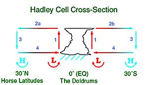
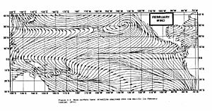
Long areas of low pressure, called monsoon troughs or the intertropical convergence zone, form as part of a global air circulation pattern called the Hadley cell. These troughs move north and south with the seasons. They reach their northernmost point in East Asia in August and their southernmost point in Australia in February. Many of the world's rainforests are found in areas affected by these low-pressure systems.
Tropical Cyclones
Tropical cyclones usually form more than 555 kilometers (345 miles) away from the equator. This distance allows the Coriolis effect to be strong enough to make the winds spin around the low-pressure center.
Tropical cyclone activity is highest in late summer, when the ocean water is warmest. However, different parts of the world have their own peak seasons. Globally, May is the quietest month for tropical cyclones, while September is the busiest. November is the only month when tropical cyclones can form in all parts of the world. The western Pacific Ocean is the most active area for tropical cyclones, with almost one-third of all global tropical cyclones forming there.
Weather with Lows
Wind always starts by moving from areas of high pressure to areas of low pressure. This happens because air in high-pressure areas is usually cooler or drier, making it heavier. So, it flows towards warmer, moister air found near low-pressure areas. The bigger the difference in pressure between a high and a low, the stronger the wind will be. This means strong low-pressure areas bring strong winds.
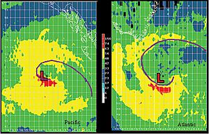
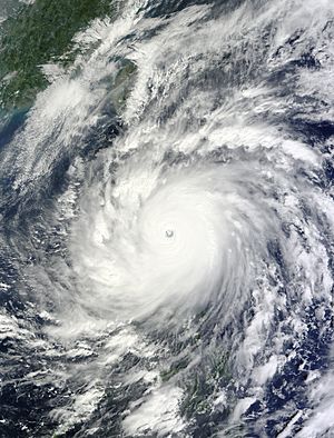
The Coriolis force, caused by the Earth spinning, makes winds around low-pressure areas (like hurricanes, cyclones, and typhoons) curve. In the Northern Hemisphere, they spin counter-clockwise. In the Southern Hemisphere, they spin clockwise. A tropical cyclone is called a hurricane if it's in the Atlantic or northeastern Pacific Ocean. It's called a typhoon if it's in the northwestern Pacific Ocean. And it's called a tropical cyclone if it's in the South Pacific or Indian Ocean.
When wind blows over land, friction slows it down and makes it flow more directly into the center of the low. Tornadoes are usually too small and short-lived to be affected by the Coriolis force, but they can be part of a larger low-pressure system.
See also
 In Spanish: Borrasca para niños
- East Asian Monsoon
- High-pressure area
- Intertropical Convergence Zone
- North American Monsoon
- Surface weather analysis
- Tropical wave
- Trough (meteorology)
- Weather map


