
Weather map facts for kids

A weather map is a special kind of map. It helps us see and understand weather information very quickly. People have used weather maps since the mid-1800s. They are great for studying weather and for predicting what the weather will be like. Some maps show things like temperature differences or where weather fronts are moving.
Contents
Understanding Weather Symbols

A station model is a small picture made of symbols. It shows the weather conditions at a specific weather station. Meteorologists created these models. They help fit lots of weather details into a small space on a map.
Even though maps can look crowded with these symbols, they are very helpful. They allow meteorologists, pilots, and sailors to quickly spot important weather patterns. Computers now draw these models for every observation point.
Station models are mostly used for maps that show surface weather. But they can also show weather conditions higher up in the sky. A full map with station models helps people study patterns in air pressure, temperature, wind, cloud cover, and precipitation.
The Start of Weather Mapping
People began using modern weather charts in the mid-1800s. They wanted to understand how storm systems worked. A telegraph network started around 1845. This made it possible to collect weather information quickly from many different places. This speed was important for the information to be useful.
In the 1840s, Joseph Henry led an effort. He helped the Smithsonian Institution gather weather observations. Most of their observers were in the central and eastern United States. The U.S. Army Signal Corps continued this network from 1870 to 1874. Later, it grew to include the Western United States.
Standardizing Weather Observations
At first, it was hard to put all the weather data on a map. This was because there was no standard time for observations. People first tried to make time standard in Great Britain in 1855. The whole United States did not use time zones until 1906. This was when Detroit finally adopted standard time. Around the world, other countries started taking weather observations at the same time in 1873.
Images for kids
-
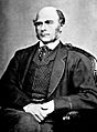
Sir Francis Galton, who helped invent the weather map
-
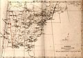
US weather map from 1843
-
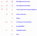
Present weather symbols used on weather maps
-
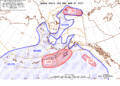
Alaskan aviation weather map
-
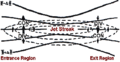
An upper level jet streak. DIV areas are regions of divergence aloft, which usually leads to surface convergence and cyclogenesis

_(cropped).jpg)


See also
 In Spanish: Mapa meteorológico para niños
