Westonzoyland facts for kids
Quick facts for kids Westonzoyland |
|
|---|---|
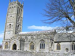 St Mary's Church |
|
| Population | 1,801 (2011) |
| OS grid reference | ST352348 |
| Unitary authority |
|
| Ceremonial county | |
| Region | |
| Country | England |
| Sovereign state | United Kingdom |
| Post town | BRIDGWATER |
| Postcode district | TA7 |
| Dialling code | 01278 |
| Police | Avon and Somerset |
| Fire | Devon and Somerset |
| Ambulance | South Western |
| EU Parliament | South West England |
| UK Parliament |
|
Westonzoyland is a village and civil parish in Somerset, England. It is located on the Somerset Levels, about 4 kilometers (2.5 miles) south-east of Bridgwater.
Contents
Village History and Famous Battle
The name Westonzoyland comes from its location on the "island" of Sowy. This was a slightly higher area of land within the Somerset Levels. The parish of Westonzoyland was created in 1515. Its name means "the westernmost settlement on Sowy."
For a long time, the land around Westonzoyland was common land. It was owned by the Abbey at Glastonbury. In the 12th and 13th centuries, the Abbey encouraged people to drain the marshland. About 292 hectares (722 acres) were fenced off in 1234. After the Abbey was closed in 1539, the land was divided.
Later, in the 17th century, a Dutch engineer named Cornelius Vermuyden tried to drain parts of the area. Even after a huge flood in 1607, people in Sedgemoor worried that draining the land would take away their common rights. But between 1777 and 1801, new laws were passed. These laws allowed for the building of drainage systems in the Somerset moors and levels.
The Battle of Sedgemoor
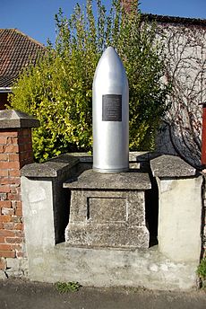
Westonzoyland is famous for being the site of the Battle of Sedgemoor. This battle happened on July 6, 1685. It was the last major battle fought in England. It was part of the Monmouth Rebellion.
The rebellion was led by James Scott, 1st Duke of Monmouth. He was trying to take the throne from his uncle, the Catholic King James II. Monmouth's army was mostly made up of farmers and peasants. They tried a surprise night attack against the King's soldiers.
However, a shot was fired by a Royalist patrol, and the surprise was lost. Monmouth's 3,600 rebel forces were no match for the King's smaller but well-trained army. The rebel army was completely defeated. Monmouth was captured and later executed. Many of his supporters faced harsh punishments. A painting of the battle can be seen at the Sedgemoor services on the M5 motorway.
Cool Places to Visit
Westonzoyland Pumping Station Museum
Westonzoyland is home to Somerset's oldest steam-powered pumping station. It was built in 1830. This station used to pump water off the Somerset Levels. Now, it's a museum. You can see old steam engines and learn about land drainage history.
The most important engine is the Easton and Amos. It's still in the main engine house, built in 1861. People started fixing up the site in 1976. In 1990, it was bought by a group working to preserve it. The pump house is a special historic building.
Aviation History and Flying Clubs
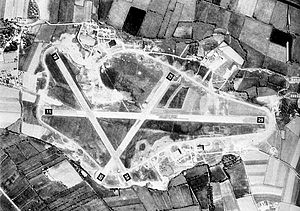
East of the village is the old RAF Weston Zoyland airfield. It was used from 1926 to 1968. During World War II, it helped with air combat and moving troops to France.
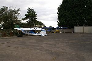
Today, part of the airfield is an airstrip for the Westonzoyland Microlight Aircraft Club. These small aircraft fly for fun. They also help with "Sky Watch," a group that looks for people in trouble on land or at sea.
Middlezoy Aerodrome opened in 2018 on the south side of the old airfield. They have a hangar and an original Nissen hut. The Somerset Aeroplane Company is restoring old planes there. You can see a Meteor T.7 plane from the A372 road. Middlezoy Aerodrome also holds a show every summer called The Somerset Aerofest.
The Sedgemoor Radio Control Flying Club flies model planes on the east side of the airfield. The airfield is also home to the local football club, Middlezoy Rovers F.C..
Westonzoyland Carnival Club
In the middle of the village, you'll find the workshops of the Westonzoyland Carnival Club. Members call it "The Shed." This club started in 1960. It is one of the oldest village clubs that takes part in the Somerset Carnival.
How Westonzoyland is Governed
The parish council helps manage local issues. They set a local tax to cover costs and check planning applications. They also work with the police and local groups on crime, safety, and traffic. The council helps with maintaining roads, drainage, footpaths, and public transport. They also look after historic buildings and environmental matters.
Since April 1, 2023, Westonzoyland is part of the Somerset Council. This is a "unitary authority," meaning it handles all local government services for the area. Before this, it was part of the Sedgemoor district.
The village is in the 'King's Isle' electoral ward. This area also includes Othery and Bawdrip. In 2011, the total population of this ward was 4,506 people.
Westonzoyland is also part of the Bridgwater and West Somerset area. This area elects one MP to the House of Commons in the Parliament of the United Kingdom.
Geography and Nature
The parish includes the small village of Andersea, about 2 kilometers (1.2 miles) to the south-west. Westonzoyland has about 1,600 people. It is the largest of the three 'Zoys'. The other two are Middlezoy and Chedzoy.
There is one public house (pub) in the village, called the Sedgemoor Inn. It is a very old building, dating back to medieval times. It has been the village pub since the Battle of Sedgemoor in 1685.
The northern edge of the village has the King's Sedgemoor Drain. This is an artificial channel finished in 1795. It helps drain King's Sedgemoor by moving water from the River Cary. The drain was improved during Second World War. Another channel, the Sowy River, was built in 1972. It helps prevent flooding from the River Parrett.
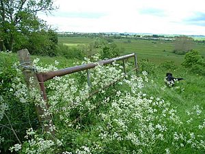
South of the village is Langmead and Weston Level. This is a special area of 168.8 hectares (417.1 acres). It is important for its grasslands and ditches. Many fields here are wet for parts of the year. This area is home to rare insects. These include the Great Silver Diving Beetle and the soldier fly (Odontomyia ornata).
Climate in Westonzoyland
Westonzoyland has a mild climate, like the rest of South West England. It is usually wetter and milder than other parts of the UK. The average yearly temperature is about 10°C (50°F). Summers are warmest in July and August, with highs around 21°C (70°F). Winters are colder, with lows around 1°C or 2°C (34°F or 36°F).
The area gets about 700 millimeters (28 inches) of rain each year. Most rain in autumn and winter comes from storms over the Atlantic Ocean. In summer, rain often comes from thunderstorms. Snowfall is typical for about 8 to 15 days a year. Winds are strongest from November to March, usually from the south-west.
Local Economy
People on the Levels have used Willow for a very long time. Pieces of willow baskets have been found near the Glastonbury Lake Village. Willow was also used to build ancient causeways. Willow was harvested by cutting the tree back to its main stem. New shoots, called "withies," would grow. These were then cut for use.
In the 1930s, over 9,000 acres (36 square kilometers) of willow were grown for business. But the industry has declined since the 1950s. This is because plastic bags and cardboard boxes replaced baskets. By the end of the 20th century, only about 350 acres (1.4 square kilometers) were grown. This was mainly near Burrowbridge, Westonzoyland, and North Curry.
Getting Around
The A372 road runs through Westonzoyland. This road connects Podimore and Bridgwater. The closest train station is Bridgwater railway station.
Religious Sites
St Mary's Parish Church has a beautiful 15th-century carved timber roof. This church has a link to history. About 500 soldiers were held prisoner here after the Battle of Sedgemoor. Today, a part of the church remembers local airmen. They lost their lives in 1918, 1919, and in the early 1950s after World War II.
The church tower has four levels. It has a decorated top with fancy stone patterns. The tower also has strong supports that end in tall, pointed decorations.
 | Jackie Robinson |
 | Jack Johnson |
 | Althea Gibson |
 | Arthur Ashe |
 | Muhammad Ali |


