Weston, Maine facts for kids
Quick facts for kids
Weston, Maine
|
|
|---|---|

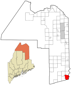
Location in Aroostook County and the state of Maine
|
|
| Country | United States |
| State | Maine |
| County | Aroostook |
| Villages | Weston Butterfield Landing |
| Area | |
| • Total | 40.55 sq mi (105.02 km2) |
| • Land | 30.61 sq mi (79.28 km2) |
| • Water | 9.94 sq mi (25.74 km2) |
| Elevation | 509 ft (155 m) |
| Population
(2020)
|
|
| • Total | 245 |
| • Density | 8/sq mi (3.1/km2) |
| Time zone | UTC-5 (Eastern (EST)) |
| • Summer (DST) | UTC-4 (EDT) |
| ZIP Code |
04424
|
| Area code(s) | 207 |
| FIPS code | 23-83785 |
| GNIS feature ID | 0582808 |
Weston is a small and peaceful town located in Aroostook County, Maine, United States. It's a great place to learn about life in a quiet community. In 2020, about 245 people called Weston home.
Contents
What is Weston Like?
Weston is nestled in the beautiful state of Maine. It's part of Aroostook County, which is known for its forests and natural beauty. The town was officially created in 1835. It is believed to be named after the person who surveyed the town that same year, though their full name is not known.
How Big is Weston?
Weston covers a total area of about 40.55 square miles (105.02 square kilometers). Most of this area, about 30.61 square miles (79.28 square kilometers), is land. The rest, about 9.94 square miles (25.74 square kilometers), is water. This means Weston has lakes, rivers, or other water bodies within its borders.
Who Lives in Weston?
Learning about the people who live in a town is called demographics. This section tells us about the population of Weston over the years and what the community looked like in 2010.
How Has Weston's Population Changed?
The number of people living in Weston has changed quite a bit over time. Here's a quick look at the population from 1840 to 2020:
| Historical population | |||
|---|---|---|---|
| Census | Pop. | %± | |
| 1840 | 249 | — | |
| 1850 | 293 | 17.7% | |
| 1860 | 394 | 34.5% | |
| 1870 | 394 | 0.0% | |
| 1880 | 417 | 5.8% | |
| 1890 | 404 | −3.1% | |
| 1900 | 367 | −9.2% | |
| 1910 | 390 | 6.3% | |
| 1920 | 433 | 11.0% | |
| 1930 | 323 | −25.4% | |
| 1940 | 328 | 1.5% | |
| 1950 | 248 | −24.4% | |
| 1960 | 202 | −18.5% | |
| 1970 | 162 | −19.8% | |
| 1980 | 155 | −4.3% | |
| 1990 | 207 | 33.5% | |
| 2000 | 203 | −1.9% | |
| 2010 | 228 | 12.3% | |
| 2020 | 245 | 7.5% | |
| U.S. Decennial Census | |||
What Was Weston Like in 2010?
In 2010, there were 228 people living in Weston. These people lived in 112 different homes, and 68 of these were families. The town had about 7.4 people per square mile of land. There were also 369 housing units, which means there were many places for people to live.
Most of the people in Weston in 2010 were White (95.2%). There were also small numbers of African American, Native American, and Asian residents. About 1.8% of the population identified as Hispanic or Latino.
Families and Households
Out of the 112 homes, about 14.3% had children under 18 living there. More than half (52.7%) were married couples living together. Some homes had a single parent, and nearly 40% were non-family households. About 16.1% of homes had someone aged 65 or older living alone.
The average number of people in each home was 2.04. For families, the average was 2.56 people.
Age and Gender
The average age of people in Weston in 2010 was 51.6 years old. This means it was a town with many adults. About 12.3% of residents were under 18. About 25.9% were 65 years or older.
When it came to gender, 54.4% of the population was male, and 45.6% was female.
See also
 In Spanish: Weston (Maine) para niños
 | Kyle Baker |
 | Joseph Yoakum |
 | Laura Wheeler Waring |
 | Henry Ossawa Tanner |

