Washburn (CDP), Maine facts for kids
Quick facts for kids
Washburn, Maine
|
|
|---|---|

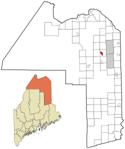
Location of Washburn, Maine
|
|
| Country | United States |
| State | Maine |
| County | Aroostook |
| Town | Washburn |
| Area | |
| • Total | 4.53 sq mi (11.73 km2) |
| • Land | 4.47 sq mi (11.57 km2) |
| • Water | 0.06 sq mi (0.16 km2) |
| Elevation | 500 ft (200 m) |
| Population
(2020)
|
|
| • Total | 937 |
| • Density | 209.71/sq mi (80.97/km2) |
| Time zone | UTC-5 (Eastern (EST)) |
| • Summer (DST) | UTC-4 (EDT) |
| ZIP code |
04786
|
| Area code(s) | 207 |
| FIPS code | 23-80250 |
| GNIS feature ID | 577855 |
Washburn is a small community located in the state of Maine, United States. It is known as a census-designated place (CDP). This means it is a specific area that the government counts for population.
Washburn is part of a larger area called Aroostook County. In 2010, about 997 people lived in the Washburn CDP. The entire town of Washburn had a population of 1,687 people.
Where is Washburn Located?
Washburn CDP is found in the western part of the town of Washburn. It is at a spot where two main roads meet. These roads are Maine State Route 164 and Maine State Route 228.
The community is about 10 miles (16 km) northeast of Caribou. You can get there by following Route 164.
Land and Water Areas
The United States Census Bureau measures the size of places like Washburn. The Washburn CDP covers a total area of about 4.5 square miles (11.7 square kilometers).
Most of this area is land, about 4.47 square miles (11.6 square kilometers). A small part is water, which is about 0.06 square miles (0.2 square kilometers).
People Living in Washburn
| Historical population | |||
|---|---|---|---|
| Census | Pop. | %± | |
| 2020 | 937 | — | |
| U.S. Decennial Census | |||
The number of people living in Washburn changes over time. The 2020 Census counted 937 people living in the Washburn CDP. This information helps us understand how communities grow or shrink.
See also
 In Spanish: Washburn (condado de Aroostook) para niños
 | Valerie Thomas |
 | Frederick McKinley Jones |
 | George Edward Alcorn Jr. |
 | Thomas Mensah |

