
Androscoggin River facts for kids
Quick facts for kids Androscoggin River |
|
|---|---|

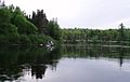
Drift boat fly fishing on the Androscoggin near Errol, New Hampshire
|
|

Map of the Androscoggin River watershed
|
|
| Country | United States |
| State | Maine, New Hampshire |
| Cities | Auburn, Lewiston, Berlin |
| Physical characteristics | |
| Main source | Umbagog Lake Coos County, New Hampshire 1,243 ft (379 m) 44°46′59″N 71°3′41″W / 44.78306°N 71.06139°W |
| River mouth | Kennebec River Merrymeeting Bay, Sagadahoc County, Maine 0 ft (0 m) 43°57′2″N 69°52′39″W / 43.95056°N 69.87750°W |
| Length | 164 mi (264 km) |
| Discharge (location 2) |
|
| Basin features | |
| Basin size | 3,450 sq mi (8,900 km2) |
| Tributaries |
|
The Androscoggin River is a river in the U.S. states of Maine and New Hampshire. It's about 178 miles (286 km) long. The river flows into the Kennebec River at Merrymeeting Bay in Maine. From there, its water goes into the Gulf of Maine and then the Atlantic Ocean. The area of land that drains into the river, called its drainage basin, is about 3,530 square miles (9,100 km2).
The name "Androscoggin" comes from the Abenaki people. It means "river of cliff rock shelters." It might also mean "river of rock shelters" from the Penobscot language.
Contents
Where Does the Androscoggin River Flow?

The Androscoggin River starts in Errol, New Hampshire. This is where the Magalloway River meets the water flowing out of Umbagog Lake. The river generally flows south, but it has many twists and turns. It passes through towns like Errol and Milan, and the city of Berlin.
Then, it turns east near Gorham, New Hampshire. It cuts through the northern part of the White Mountains and enters Maine. In Maine, the river continues east past towns such as Bethel, Rumford, and Dixfield.
It then turns south at Livermore Falls, leaving the mountains behind. The river flows through the cities of Lewiston and Auburn. It then turns southeast, passing Lisbon Falls.
The river reaches the ocean's tide just below the last waterfalls in Brunswick. Merrymeeting Bay is a large freshwater area where the Androscoggin meets the Kennebec River. This bay is about 10-mile-long (16 km) and is nearly 20 miles (32 km) from the Atlantic Ocean.
How Clean is the River's Water?
The Androscoggin River used to be very polluted. Many factories, like textile mills and paper mills, released their waste into it. This pollution was so bad that it helped lead to the creation of the Clean Water Act.
Thanks to environmental efforts and some factories leaving the area, the river is much cleaner now. Less dirty water is released into it. However, some mills still release chemicals, but in much smaller amounts.
From the 1940s to the 2000s, the Androscoggin was one of the most polluted rivers in the U.S. The pollution was so severe that for a 14-mile (23 km) section, special machines had to add oxygen to the water. This was done to stop fish from suffocating.
In 2020, there was a big explosion at a paper mill on the river. It's not yet fully known how this event will affect the river's water quality.
Fun Activities on the Androscoggin River
Fishing Opportunities
The Androscoggin River is a great spot for anglers (people who fish). The upper part of the river is good for fly fishing. You can catch brook, rainbow, and brown trout there.
Landlocked salmon can also be found in the northern parts of the river near Errol, New Hampshire. As the river flows south and east, the water becomes more acidic. Because of this, trout and salmon are harder to find in the middle and lower parts of the river.
However, these sections are known for large smallmouth bass. You might also find Northern pike here. Other fish in the lower river include redbreast sunfish, yellow perch, and white suckers.
Paddling and Boating

A local group called the Androscoggin River Watershed Council is creating a water trail. This trail will run along the entire river. It will make it easier to access the river for paddling, fishing, and boating.
There are already over 40 public places mapped where you can get to the river. The Androscoggin Riverlands State Park in Maine is a popular place for paddling. It covers about 12 miles (19 km) along the western side of the river near Turner.
A Look at the River's Past

The old name for the river was Pescedona. This is an Abenaki word meaning "a branch." The U.S. Geological Survey (USGS) lists many other names the river has been called over time.
The Androscoggin River drops about eight feet for every mile it flows. This made it an excellent source of water power. This power helped cities like Berlin, New Hampshire, Lewiston, and Auburn, Maine grow. It also helped towns like Brunswick, Topsham, Lisbon Falls, Livermore Falls, Chisholm, Mexico, Rumford, and Bethel develop.
Major Rivers Joining the Androscoggin
Here are some of the main rivers that flow into the Androscoggin, listed from its start to its end:
- Magalloway River, joins at Errol, New Hampshire
- Clear Stream, joins at Errol, New Hampshire
- Mollidgewock Brook, joins at Errol, New Hampshire
- Chickwolnepy Stream, joins at Milan, New Hampshire
- Dead River, joins at Berlin, New Hampshire
- Moose Brook, joins at Gorham, New Hampshire
- Moose River, joins at Gorham, New Hampshire
- Peabody River, joins at Gorham, New Hampshire
- Wild River, joins at Gilead, Maine
- Pleasant River, joins at Bethel, Maine
- Alder River, joins at Bethel, Maine
- Sunday River, joins at Bethel, Maine
- Bear River, joins at Newry, Maine
- Ellis River, joins at Rumford, Maine
- Concord River, joins at Rumford, Maine
- Swift River, joins between Rumford and Mexico, Maine
- Webb River, joins at Dixfield, Maine
- Dead River, joins at Leeds, Maine
- Nezinscot River, joins at Turner, Maine
- Little Androscoggin River, joins at Auburn, Maine
- Sabattus River, joins at Lisbon, Maine
- Little River, joins at Lisbon Falls, Maine
Images for kids
-
Drift boat fly-fishing in Errol, New Hampshire
See also
 In Spanish: Río Androscoggin para niños
