
Gulf of Maine facts for kids
Quick facts for kids Gulf of Maine |
|
|---|---|
| French: Golfe du Maine | |

Gulf of Maine
Location in North Atlantic
|
|

Major features of the Gulf of Maine
|
|
| Location | Northeast coast of the United States and southeast coast of Canada |
| Coordinates | 43°N 68°W / 43°N 68°W |
| Type | Gulf |
| Part of | North Atlantic Ocean |
| River sources | Saint John River, Penobscot River |
| Catchment area | 69,000 square miles (180,000 km2) |
| Basin countries | Canada and the United States |
| Surface area | 36,000 square miles (93,000 km2) |
| Islands | Mount Desert Island, Fox Islands (North Haven and Vinalhaven), Isle au Haut, Grand Manan |
| Settlements | Boston, Portsmouth, Portland, Saint John |
The Gulf of Maine is a large gulf found on the east coast of North America. It is part of the Atlantic Ocean. This gulf stretches from Cape Cod in Massachusetts in the southwest to Cape Sable Island in Nova Scotia, Canada, in the northeast.
The Gulf of Maine includes the entire coastlines of the U.S. states of New Hampshire and Maine. It also covers the part of Massachusetts north of Cape Cod. In Canada, it touches the southern and western coasts of New Brunswick and Nova Scotia. The gulf was likely named after the old French province of Maine by early explorers. Inside the Gulf of Maine, you'll find other bays like Massachusetts Bay, Penobscot Bay, Passamaquoddy Bay, and the Bay of Fundy. The Bay of Fundy is famous for having the highest tides in the world!
Contents
Geography of the Gulf of Maine
The Gulf of Maine is shaped a bit like a rectangle. It covers an area of about 36,000 square miles (93,000 km2). The land surrounds it to the west and north. To the southeast, it opens up to the Atlantic Ocean.
Coastline and Underwater Features
Long ago, huge sheets of ice called the Laurentide Ice Sheet covered this area. As they moved, they scraped away the soil from the coastline. This left behind a shore that is mostly rocky and very beautiful. You won't find many sandy beaches here, unlike areas further south along the Eastern Seaboard. The main cities along the coast are Boston, Portsmouth, Portland, and Saint John.
Under the water, the seabed was also shaped by the ice ages. It has many underwater hills and valleys. These features make the gulf a bit like a semi-enclosed sea. Large underwater hills, called banks, protect it from the south and east. Georges Bank, for example, helps block the warmer Gulf Stream from entering the gulf. Because of this, the waters in the Gulf of Maine are colder and have more nutrients. They are more affected by the Labrador Current, which brings cold water from the north.
Some underwater valleys in the middle of the gulf can be very deep, reaching about 1,500 feet (457 meters). There are also underwater mountains that rise almost to the surface, sometimes even forming islands!
Major Basins and Channels
The Gulf of Maine has three main deep areas, called basins:
- Wilkinson Basin in the west.
- Jordan Basin in the northeast.
- Georges Basin in the south.
These basins are separated from each other by underwater ridges. Georges Basin is the deepest, going down over 1,200 feet (366 meters). It's located just north of Georges Bank.
The main way water flows into and out of the Gulf of Maine is through the Northeast Channel. This is a deep crack between Georges Bank and Browns Bank. There's also a shallower connection called the Great South Channel. It's located between Georges Bank and the Nantucket Shoals.
Marine Life and Ecology
The Gulf of Maine is a very special place for marine life. Its cold waters, strong tides that mix everything up, and varied seabed create a perfect home for many different species. It's one of the most productive ocean environments in the North Atlantic.
Animals of the Gulf
Many important fish and other sea creatures live here, including:
- Haddock
- Acadian redfish
- Atlantic herring
- American lobster, which are known to grow very large in these waters.
The gulf is also a summer home for many different kinds of birds and whales. The highly endangered North Atlantic right whale is a notable visitor. Sadly, the sea mink, a type of mammal, used to live here but became extinct in the late 1800s.
Changing Temperatures and Cod Fish
Recently, the water temperatures in the Gulf of Maine have been rising very quickly. This has made it too warm for cod fish. Along with too much fishing in the past, this warming has caused cod numbers to drop a lot. Even with fewer fish being caught, their numbers are struggling to recover. Scientists have found that traditional ways of counting cod often guessed there were more fish than there actually were. Since 2004, temperatures have gone up by more than 0.4°F (0.2°C) each year. There was even a big ocean heat wave in this area in 2012-2013.
Rivers and Watershed

The land area that drains water into the Gulf of Maine is called its watershed. This watershed covers about 69,000 square miles (179,000 km2). It includes:
- All of Maine
- 70% of New Hampshire
- 56% of New Brunswick (Canada)
- 41% of Massachusetts
- 36% of Nova Scotia (Canada)
- A small part of Quebec (Canada)
Many important rivers flow into the Gulf of Maine. Some of the largest include the Saint John River and the Penobscot River. These two rivers bring the most water into the gulf. Other rivers include the Annapolis, Shubenacadie, Salmon, Petitcodiac, Magaguadavic, St. Croix, Kennebec, Saco, Piscataqua, Merrimack, and Charles rivers.
History and Importance

Because the Gulf of Maine is relatively close to Europe, it was one of the first places where Europeans settled in North America.
- In 1604, French settlers built a community on St. Croix Island.
- In 1607, English settlers started the Popham Colony on an island in the Kennebec River. This was the same year as the Jamestown settlement further south.
- In 1620, the Plymouth Colony was founded on the shores of Massachusetts Bay.
Border Disputes
In the 1960s and 1970s, Canada and the United States had a disagreement over fishing and other resources in the Gulf of Maine, especially around the Georges Bank. This argument went to the International Court of Justice, which is like a world court. In 1984, they drew a maritime boundary (a border in the sea) through the gulf.
However, the two countries still don't agree on who owns Machias Seal Island and the waters around it in the northeastern part of the gulf. Both Canada and the United States understand how important the gulf is for marine life. Because of this, they both have rules against looking for oil and gas on Georges Bank.
Images for kids
-
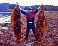
S. latissima, a type of seaweed common in the Gulf of Maine.

See also
 In Spanish: Golfo de Maine para niños
